Map of Winona, Minnesota
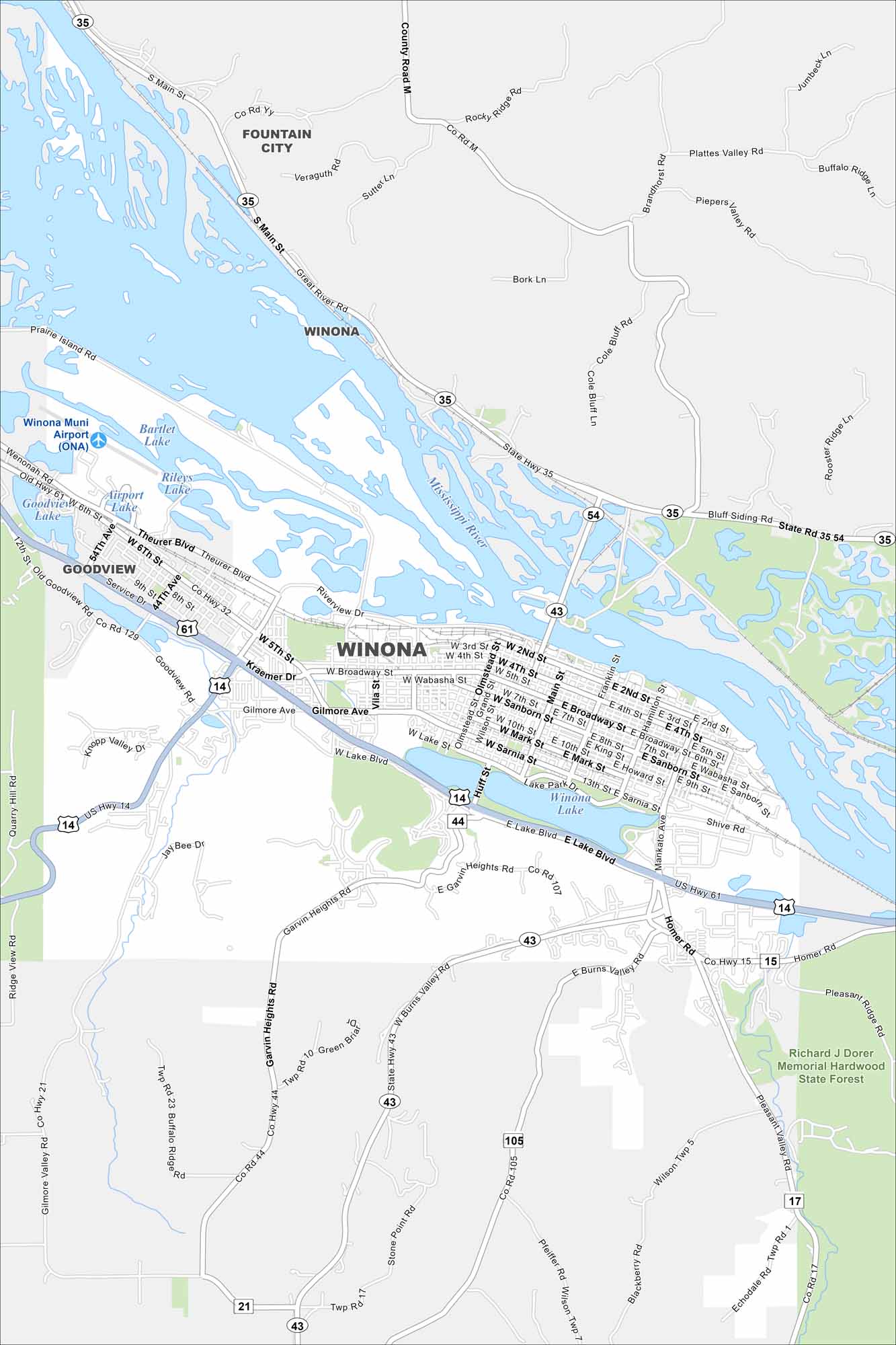
Our map of Winona shows its prime spot along the Mississippi River. Surrounded by bluffs, it’s one of Minnesota’s most scenic river towns.
Map Information
On the Map
Interstates/Highways: US Hwy 61, US Hwy 14, State Rte 43, State Rte 35, State Rte 54 Major Roads: Broadway St, Sarnia St, Main St, Huff St, Homer Rd, Mankato Ave, 5th St, 6th St, Theurer Blvd, Service Dr, Gilmore Ave, Lake Blvd, Pelzer St, Garvin Heights Rd, Burns Valley Rd, Wilson Twp Rd, Pleasant Valley Rd, Riverview Dr, Franklin St, Hamilton St Airports: Winona Muni Airport (ONA) Lakes and Reservoirs: Winona Lake, Bartlet Lake, Rileys Lake, Airport Lake Major Rivers: Mississippi River Parks and Preserves: Richard J Dorer Memorial Hardwood State Forest Nearby Communities: Fountain City, GoodviewMinnesota State Maps
Explore every lake in our state maps of Minnesota


Minnesota City Maps
Browse through our city maps of Minnesota


