Map of Wichita Falls, Texas
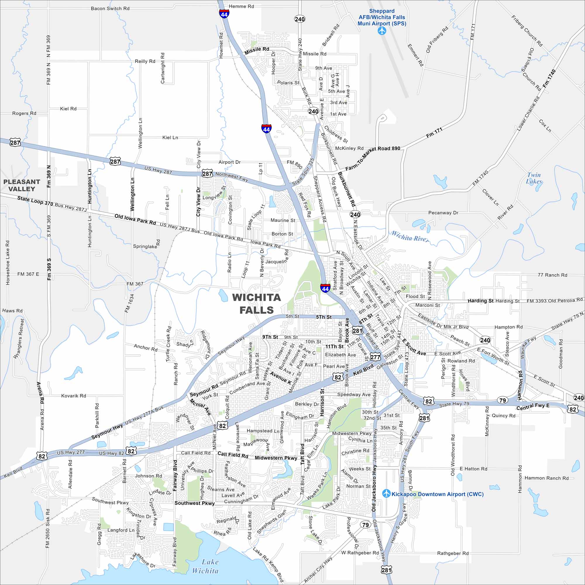
Check out our map of Wichita Falls, Texas, located north of Lake Wichita. The city is named after its waterfalls and has a lively downtown.
Map Information
On the Map
Interstates/Highways: I-44, US Hwy 287, US Hwy 82, US Hwy 277, US Hwy 281, State Rte 79, State Rte 240 Major Roads: Kemp Blvd, Southwest Pkwy, Midwestern Pkwy, Lawrence Rd, Call Field Rd, McNiel Ave, Seymour Rd, Old Iowa Park Rd, Northwest Fwy, Burkburnett Rd, Central Fwy, Jacksboro Hwy, Scott Ave, Holliday St, Broad St, Brook Ave, Taft Blvd, Harrison St, Hampstead Ln, University Ave Airports: Sheppard AFB/Wichita Falls Muni Airport (SPS), Kickapoo Downtown Airport (CWC) Lakes and Reservoirs: Lake Wichita, Twin Lakes Major Rivers: Wichita River Nearby Communities: Pleasant ValleyTexas State Maps
Scan our maps of the massive southern state of Texas.


City Maps of Texas
Explore our map collection of Texas cities.


