Map of Weymouth, Massachusetts
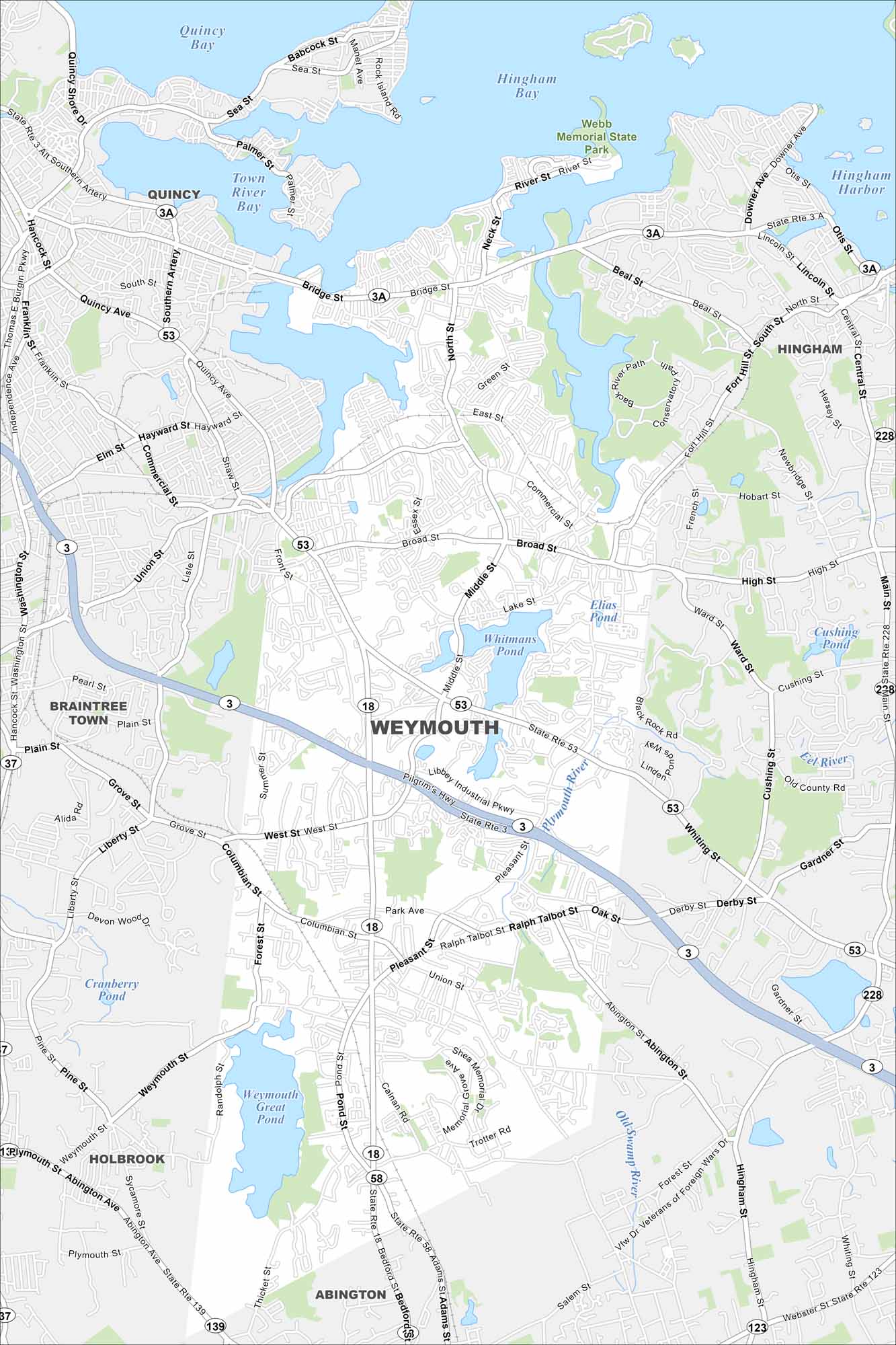
We’ve mapped out every major road in Weymouth on Boston’s South Shore. It’s one of the oldest towns in Massachusetts with a busy harbor.
Map Information
On the Map
Interstates/Highways: State Rte 3, State Rte 3A, State Rte 18, State Rte 53, State Rte 58, State Rte 123, State Rte 139 Major Roads: Main St, Broad St, Washington St, Pleasant St, Bridge St, Middle St, Union St, West St, Columbian St, Ralph Talbot St, Commercial St, Park Ave, Libbey Industrial Pkwy, Pilgrim’s Hwy, Abington St, Weymouth St, Pine St, Derby St, Whiting St, High St Airports: Lakes and Reservoirs: Hingham Bay, Quincy Bay, Town River Bay, Hingham Harbor, Whitmans Pond, Weymouth Great Pond, Cranberry Pond Major Rivers: Plymouth River, Eel River, Old Swamp River Parks and Preserves: Webb Memorial State Park Nearby Communities: Quincy, Braintree Town, Hingham, Holbrook, AbingtonMassachusetts State Maps
Here’s our state maps of Massachusetts


City Maps of Massachusetts
Explore Boston and other urban areas in Massachusetts


