Map of Westminster, Colorado
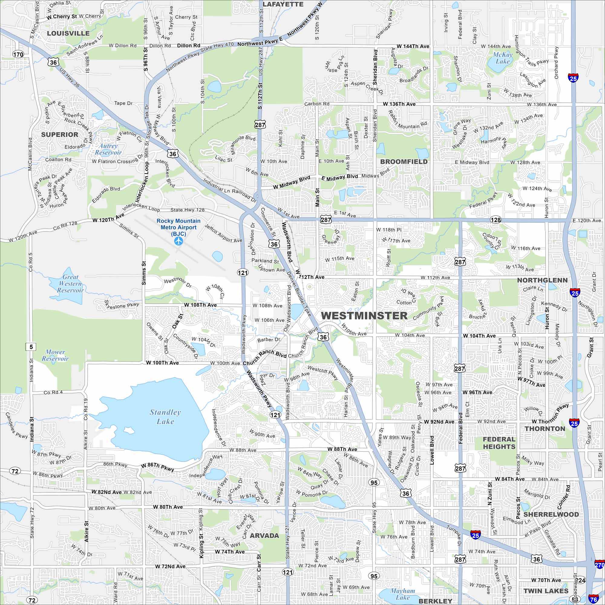
Our map of Westminster, Colorado shows its place between Denver and Boulder. Parks, lakes, and mountain views shape the city.
Colorado State Maps
Browse Colorado with our detailed state maps


Map Information
On the Map
Interstates/Highways: I-25, US Hwy 36, US Hwy 287, State Hwy 121, State Hwy 128, State Hwy 72, State Hwy 95 Major Roads: 120th Ave, 104th Ave, 92nd Ave, 88th Ave, 80th Ave, 72nd Ave, Wadsworth Blvd, Sheridan Blvd, Federal Blvd, Main St, Westminster Blvd, Lowell Blvd, Huron St, Pecos St, Simms St, Indiana St, 112th Ave, 144th Ave, 136th Ave, Church Ranch Blvd Airports: Rocky Mountain Metro Airport (BJC) Lakes and Reservoirs: Standley Lake, Mower Reservoir, Great Western Reservoir, McKay Lake, Hidden Lake, Mayham Lake Nearby Communities: Arvada, Broomfield, Northglenn, Thornton, Federal Heights, Sherrelwood, Twin Lakes, Berkley, Superior, Louisville, LafayetteColorado City Maps
Here are maps of Colorado’s urban areas


