Map of Weslaco, Texas
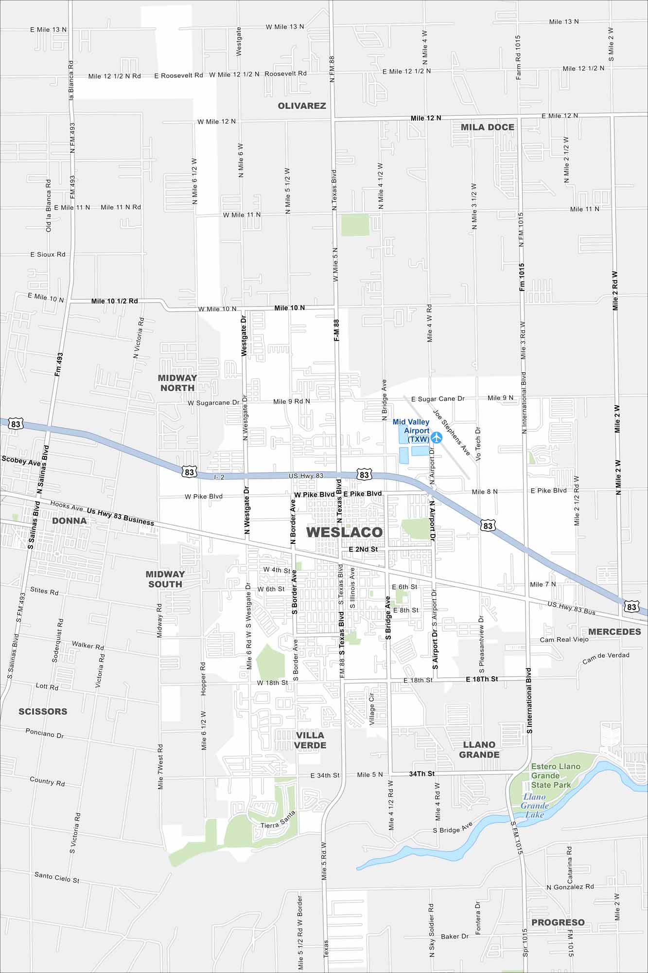
Get oriented with our Weslaco map, located in the Rio Grande Valley. The city is a gateway to wildlife refuges and the Mexican border.
Map Information
On the Map
Interstates/Highways: I-2, US Hwy 83, State Rte 88 Major Roads: Texas Blvd, Westgate Dr, Border Ave, Bridge Ave, Airport Dr, Pike Blvd, Sugarcane Dr, Mile 9 Rd, Mile 10 Rd, Mile 11 Rd, Mile 12 Rd, Mile 13 Rd, International Blvd, Pleasantview Dr, Panama Dr, Joe Stephens Ave, Vo Tech Rd, Mid Valley Dr, 2nd St, 6th St Airports: Mid Valley Airport (TXW) Lakes and Reservoirs: Llano Grande Lake Parks and Preserves: Estero Llano Grande State Park Nearby Communities: Donna, Midway North, Midway South, Olivarez, Mila Doce, Villa Verde, Llano Grande, Scissors, Progreso, MercedesTexas State Maps
Scan our maps of the massive southern state of Texas.


City Maps of Texas
Explore our map collection of Texas cities.


