Map of Tyler, Texas
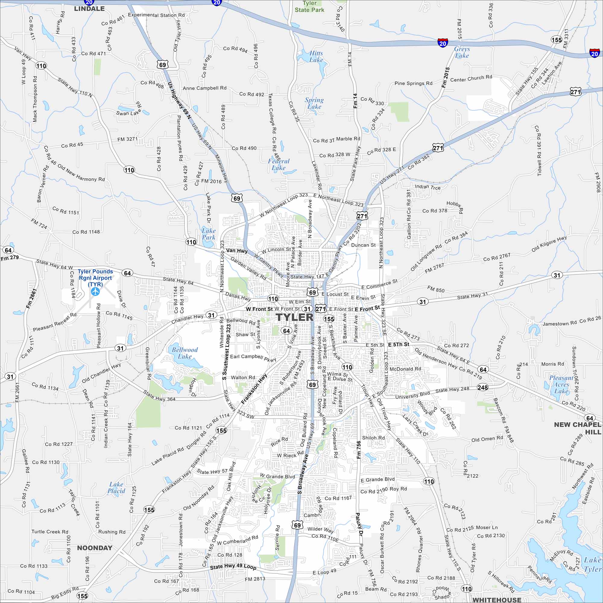
Want to see our map of Tyler, Texas? Known as the “Rose Capital of America”, our map highlights its parks, lakes, and lively downtown.
Map Information
On the Map
Interstates/Highways: I-20, US Hwy 69, US Hwy 271, State Rte 31, State Rte 64, State Rte 110, State Rte 155, State Rte 248 Major Roads: Loop 323, Broadway Ave, Gentry Pkwy, Front St, Beckham Ave, Troup Hwy, Southeast Loop 323, Northwest Loop 323, Northeast Loop 323, Southwest Loop 323, Palestine Hwy, Glenwood Blvd, Frankston Hwy, Chandler Hwy, Mineola Hwy, Old Henderson Hwy, University Blvd, Old Omen Rd, Paluxy Dr, Grande Blvd Airports: Tyler Pounds Rgnl Airport (TYR) Lakes and Reservoirs: Lake Tyler, Bellwood Lake, Lake Placid, Federal Lake, Spring Lake, Hits Lake, Greys Lake, Swan Lake, Lake Park Nearby Communities: Noonday, New Chapel Hill, Whitehouse, LindaleTexas State Maps
Scan our maps of the massive southern state of Texas.


City Maps of Texas
Explore our map collection of Texas cities.


