Map of Texas City, Texas
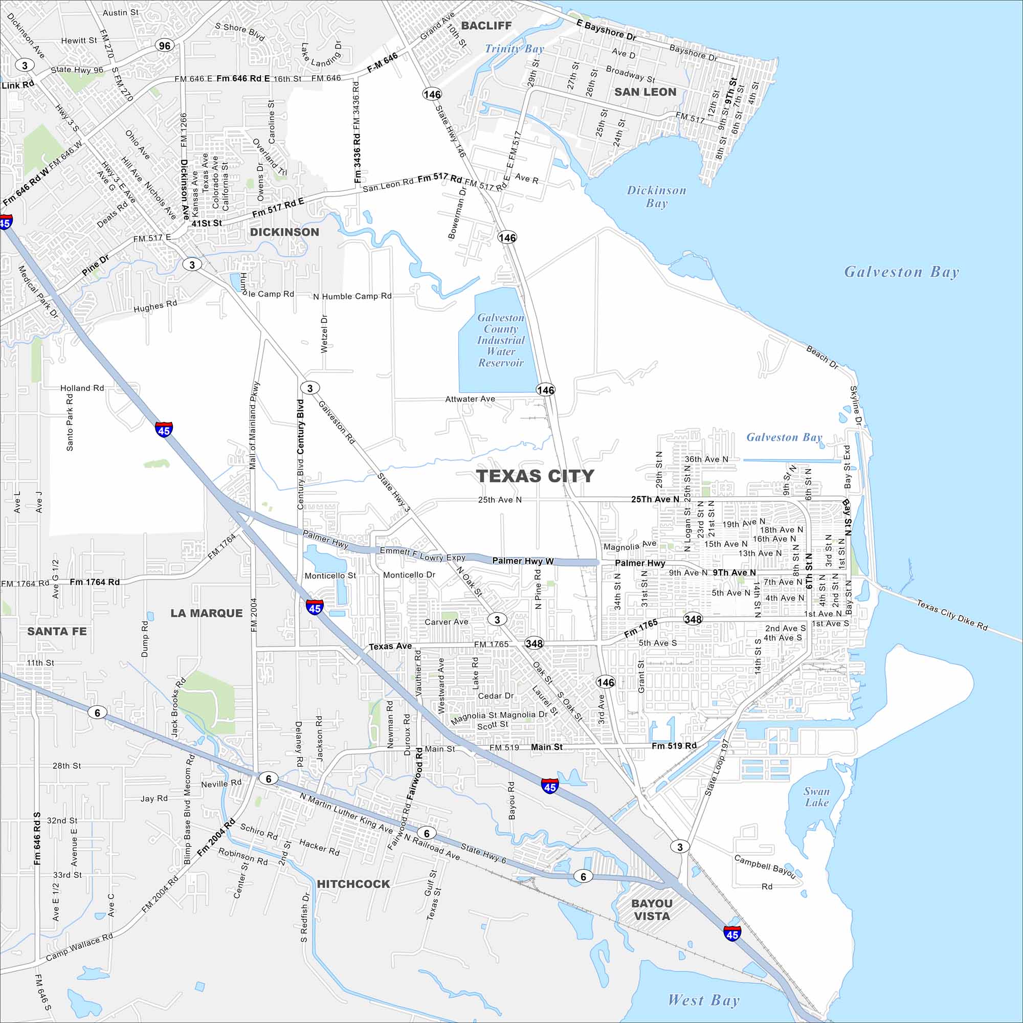
Texas City is an industrial port along Galveston Bay. See how Texas City is connected by highways, refineries, and waterfront access to the Gulf Coast.
Map Information
On the Map
Interstates/Highways: I-45, State Rte 3, State Rte 6, State Rte 146, State Rte 197 Major Roads: Gulf Fwy, Palmer Hwy, Texas Ave, Main St, Emmet F Lowry Expy, Century Blvd, Highway 3, State Hwy 6, Martin Luther King Ave, Mall of Mainland Pkwy, Texas City Dike Rd, Skyline Dr, Beach Dr, 25th Ave, 14th St Lakes and Reservoirs: Galveston Bay, Dickinson Bay, Galveston County Industrial Water Reservoir, Swan Lake, West Bay Nearby Communities: Dickinson, La Marque, Santa Fe, Hitchcock, Bayou Vista, San Leon, BacliffTexas State Maps
Scan our maps of the massive southern state of Texas.


City Maps of Texas
Explore our map collection of Texas cities.


