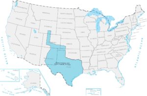
Texas Annexation 1845 Map

Texas was its own country for almost ten years after breaking away from Mexico, then joined the US as a state. Texas was absolutely huge and pushed America’s border all the way to the Rio Grande. Adding Texas made Mexico pretty angry and led to more conflict between the two countries. Our Texas Annexation 1845 map shows how it reshaped the southern edge of the United States.
Map Information
On the Map
Here is a chronological breakdown of how the United States grew from the original colonies to its current span.
|
Year |
Acquisition Name |
Source / Former Entity |
|
1783 |
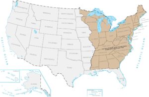
Territory of the Original Thirteen States |
Ceded by Great Britain |
|
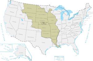
1803 |
Louisiana Purchase |
Purchased from France |
|
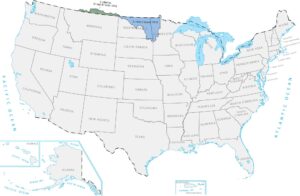
1818 |
British Cession |
Great Britain |
|
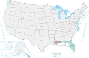
1819 |
Spanish Cession (Florida, parts of LA/CO) |
Spain |
|
1845 |
Texas Annexation |
Former Republic of Texas |
|
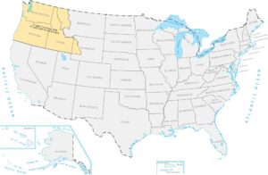
1846 |
Oregon Territory |
Treaty with Great Britain |
|
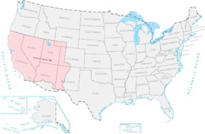
1848 |
Mexican Cession |
Mexico |
|
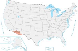
1853 |
Gadsden Purchase |
Purchased from Mexico |
|
1867 |
Alaska Purchase |
Purchased from Russia |
|
1898 |
Hawaii Annexation |
Former Republic of Hawaii |
|
1898 |
Puerto Rico |
Ceded by Spain |
|
1917 |
Virgin Islands |
Purchased from Denmark |
Maps of Territory Acquisition
Map the milestones of the American footprint.