Map of Texarkana, Texas
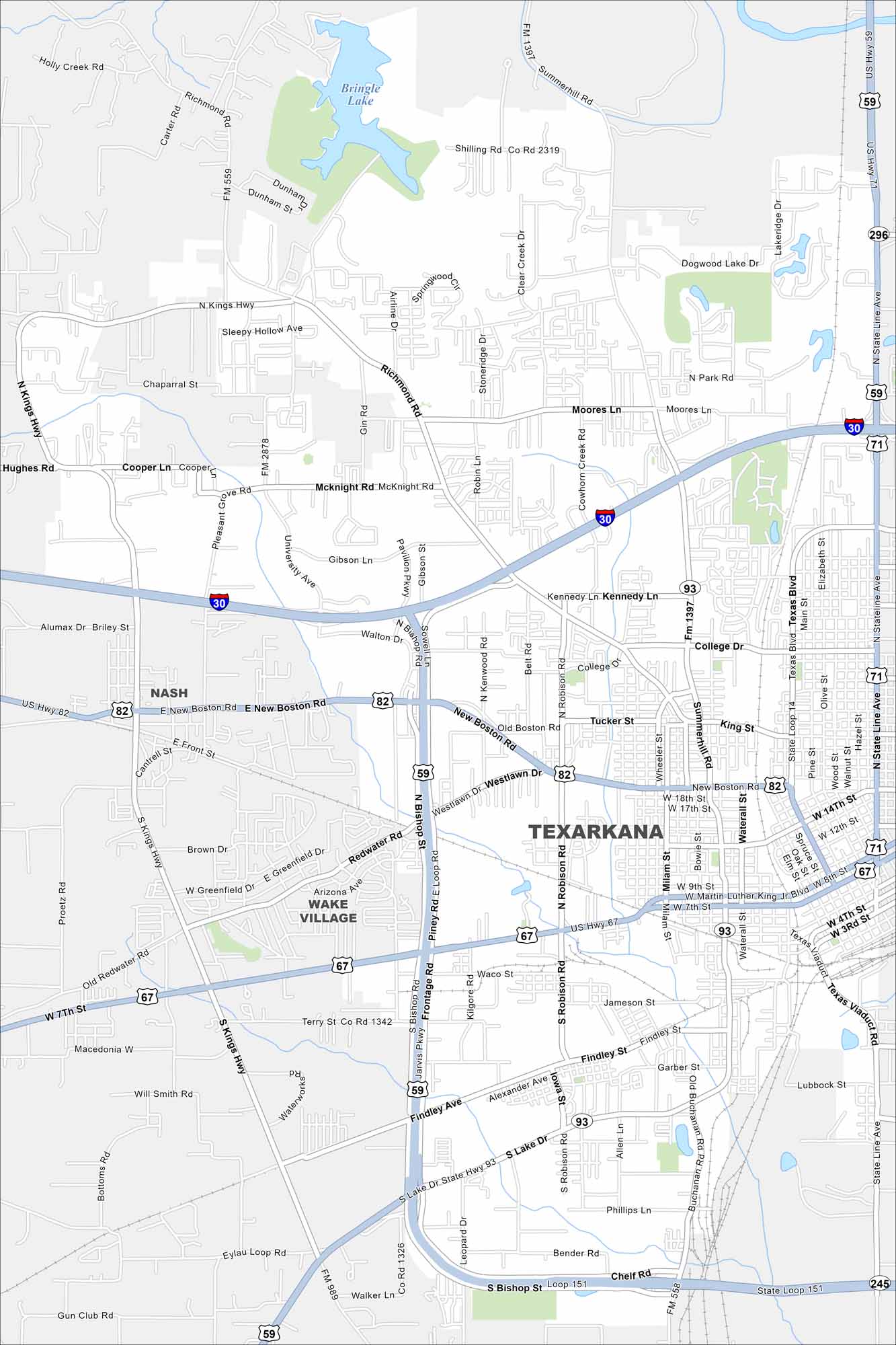
Get around Texarkana, Texas with our detailed map. The city shares culture, streets, and community with its Arkansas twin. This makes it one of America’s most unique border towns.
Map Information
On the Map
Interstates/Highways: I-30, US Hwy 59, US Hwy 67, US Hwy 71, US Hwy 82, State Rte 93, State Rte 245 Major Roads: Stateline Ave, Bishop Rd, New Boston Rd, Summerhill Rd, Richmond Rd, Kings Hwy, Texas Blvd, Main St, Robison Rd, Loop 151, State Loop 14, Seventh St, Westlawn Dr, College Dr, Walton Rd, University Ave, Cowhorn Creek Rd, Moores Ln, Park Rd, Lake Line Ave Lakes and Reservoirs: Bringle Lake Nearby Communities: Nash, Wake VillageTexas State Maps
Scan our maps of the massive southern state of Texas.


City Maps of Texas
Explore our map collection of Texas cities.


