Map of Bremerton, Washington
See Bremerton on our map, where the city meets Puget Sound. The naval base dominates but ferries still link it easily to Seattle.
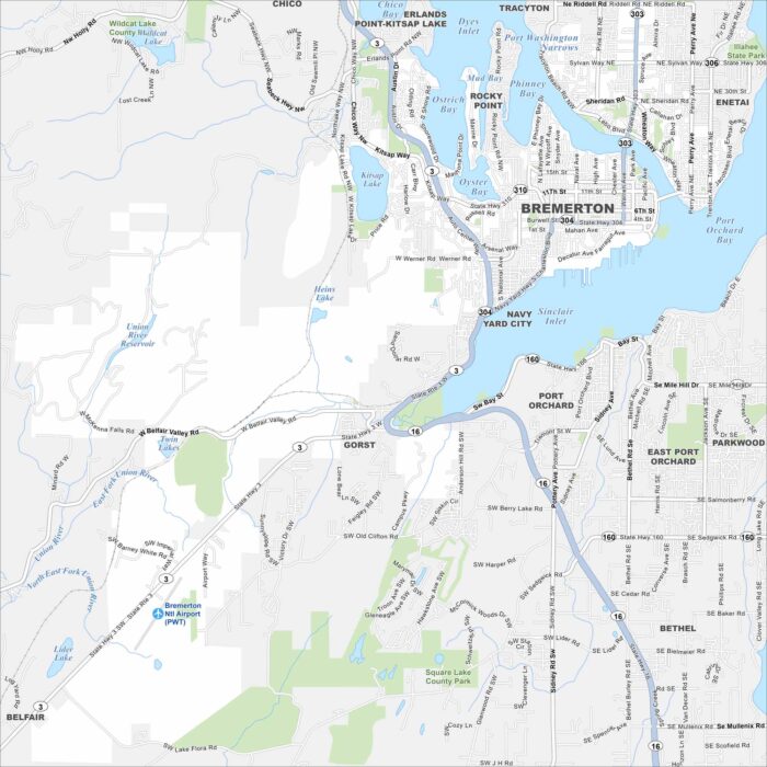
See Bremerton on our map, where the city meets Puget Sound. The naval base dominates but ferries still link it easily to Seattle.
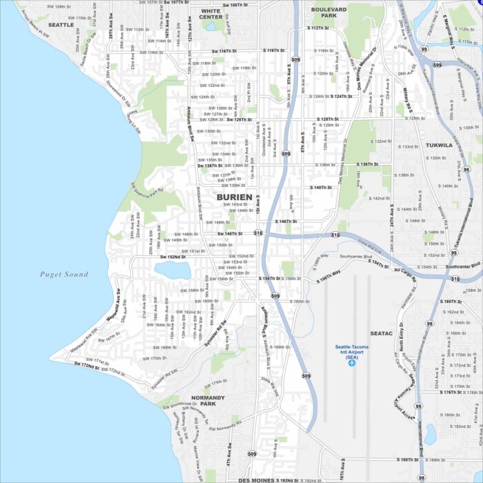
See Burien on our road map, sitting between Seattle and Puget Sound. Parks, lakes, and shoreline stand out in this area.
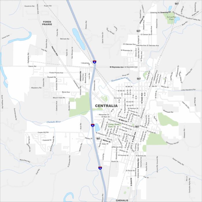
Centralia is shaped by the Chehalis and Skookumchuck Rivers. Our map follows these waterways through this city with highways/roads.
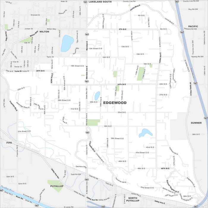
Check out Edgewood just north of Puyallup. Our map reveals this community bordered by rolling hills and open green spaces.

Edmonds rests on Puget Sound with ferry routes stretching across the water. The map shows a downtown leading straight to the shoreline.
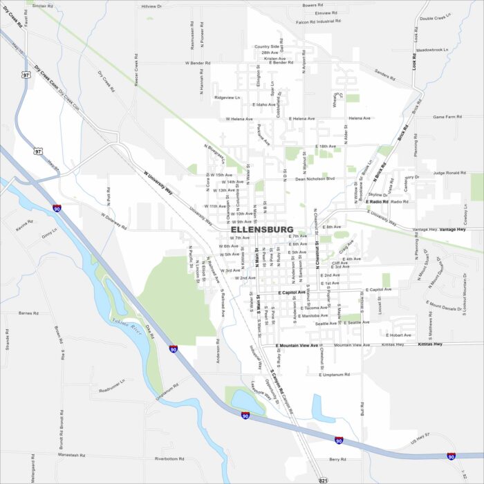
Check out our map of Ellensburg with I-90 cutting right through on the west side. The Yakima River flows nearby on the west as well.
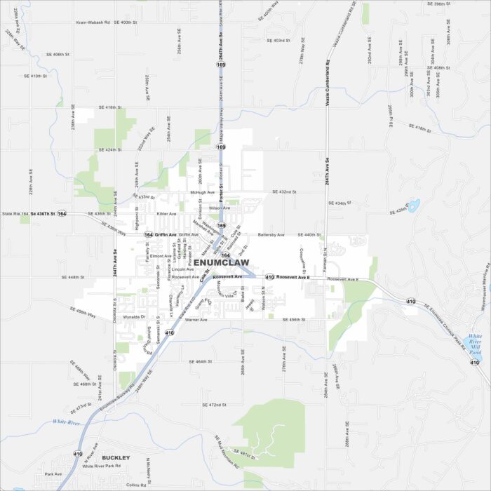
Enumclaw rests on a plateau near Mount Rainier. Farmland surrounds the area in every direction. That mountain backdrop dominates the view.
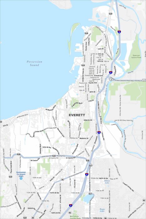
Explore our map of Everett on Puget Sound. The Snohomish River delta spreads out to the east. Its mix of water and coastline.
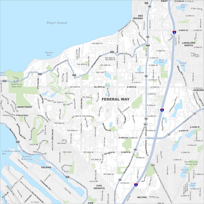
Federal Way lies between Seattle and Tacoma, with Puget Sound to the west. Evergreen forests surround much of the city.
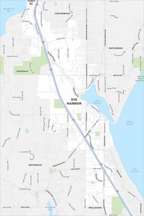
Gig Harbor is tucked on Puget Sound, with marinas and waterfronts. It’s nicknamed the “Maritime City” because of its boating history.
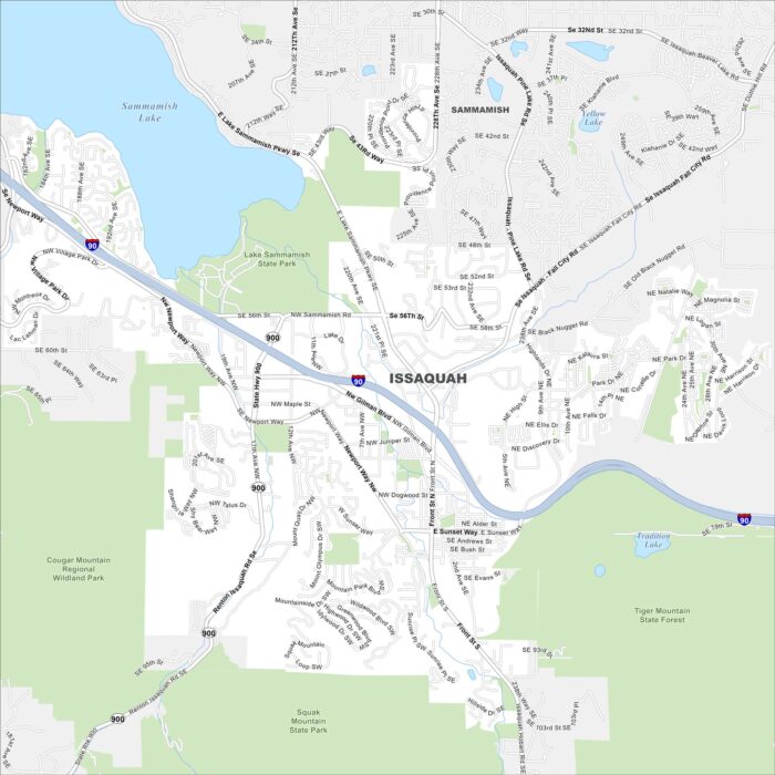
Issaquah sits at the base of the Cascade foothills with Lake Sammamish in the northwest. Our map shows I-90 cutting through the valley.
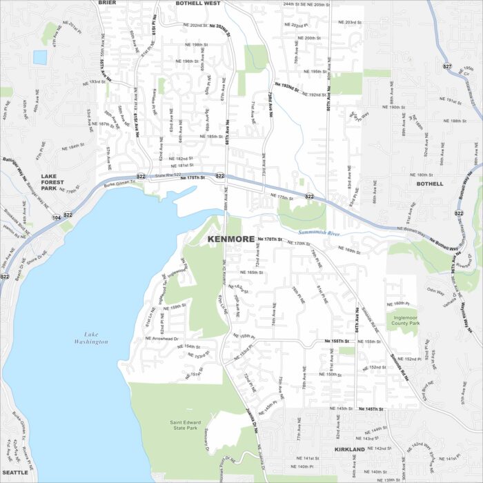
Kenmore sits at the north end of Lake Washington. Our map shows major routes, parks, and neighborhoods climbing into the hills.
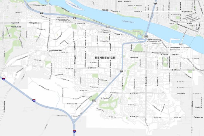
Our map of Kennewick shows its location on the Columbia River. Bridges link it with Pasco and Richland. Farmland spread out to the south.
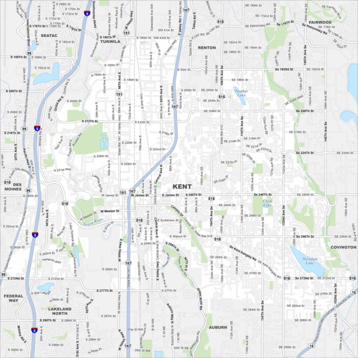
Kent is in the Green River Valley with hills rising sharply on both sides. Our map shows lakes, rivers, highways, roads, parks and much more.
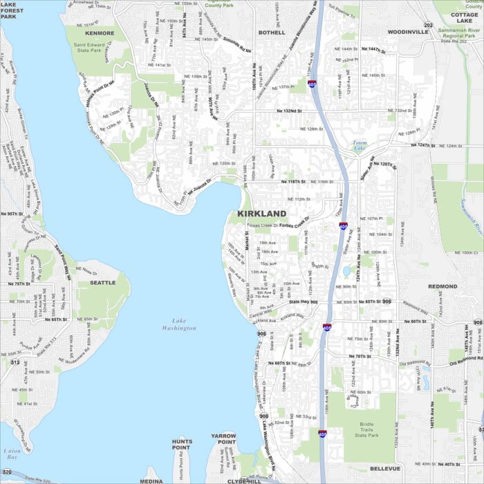
Kirkland is right on the shore of Lake Washington. Our map highlights highways, roads, and parks. Seattle sits just across the water.