Map of Lynchburg, Virginia
Our map of Lynchburg follows the James River at the city’s edge. Hills rise above the water, shaping the streets.
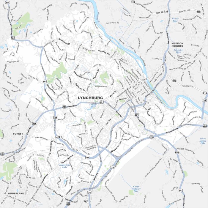
Our map of Lynchburg follows the James River at the city’s edge. Hills rise above the water, shaping the streets.
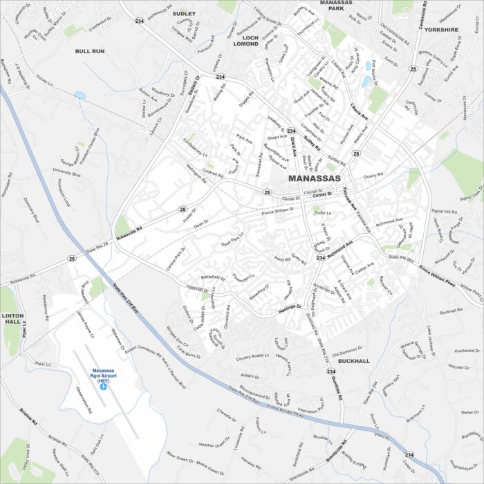
Our map of Manassas sits west of Washington, D.C. Highways and rail lines cross through its historic core.
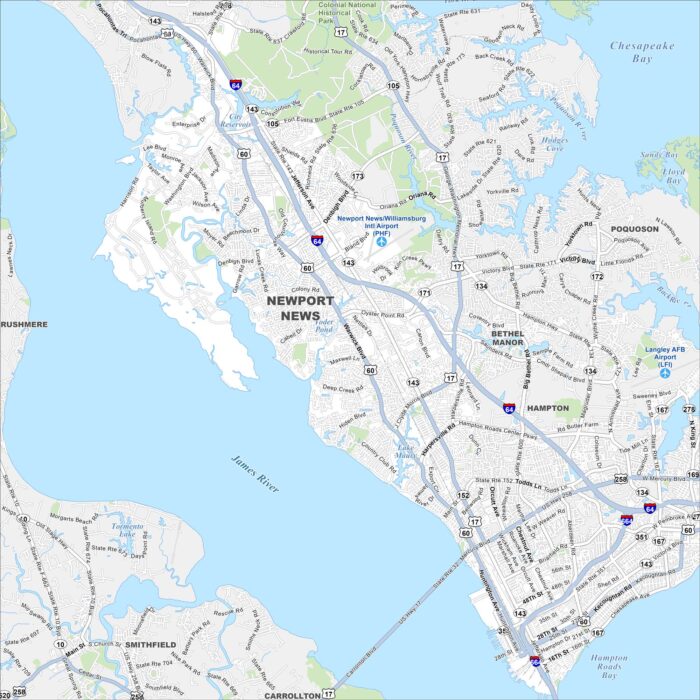
Our map of Newport News shows this city stretched along the James River. Shipyards dominate the waterfront and neighborhoods extend inland.
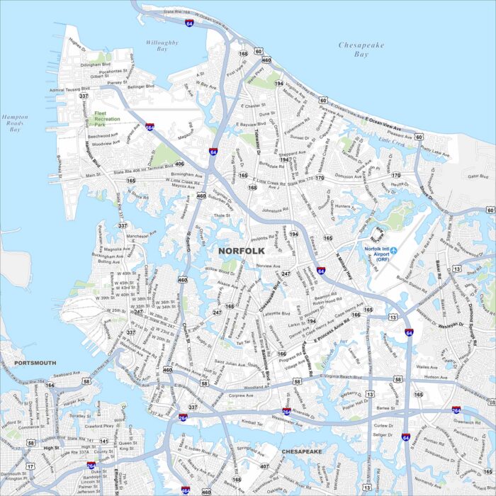
Norfolk sits at the mouth of the Chesapeake Bay. The map shows its road network, downtown streets, and a busy port.
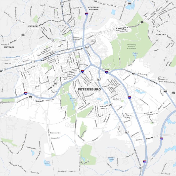
Our map of Petersburg shows a city shaped by the Appomattox River. Its historic district stands out with Civil War sites.
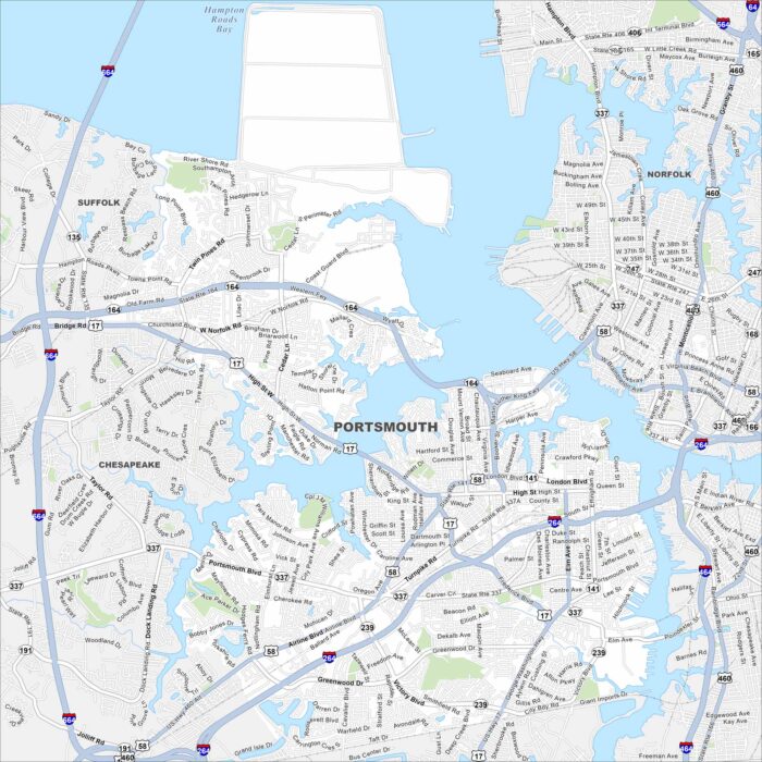
Portsmouth, Virginia sits on the Elizabeth River across from Norfolk. Shipping channels and docks line the waterfront.
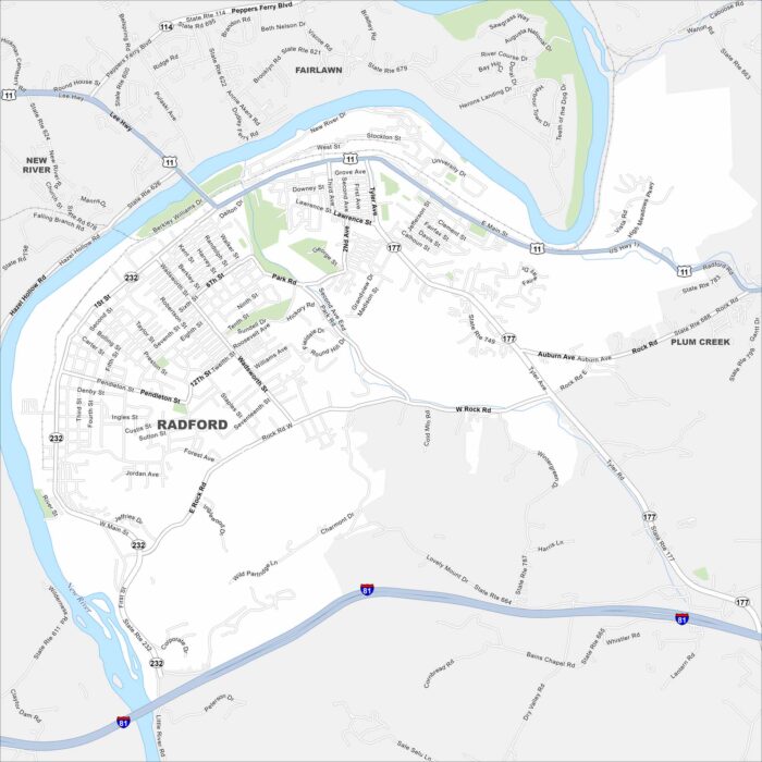
Radford sits on a bend of the New River in southwest Virginia. Our map shows the roads that follow the river valley and major parks.
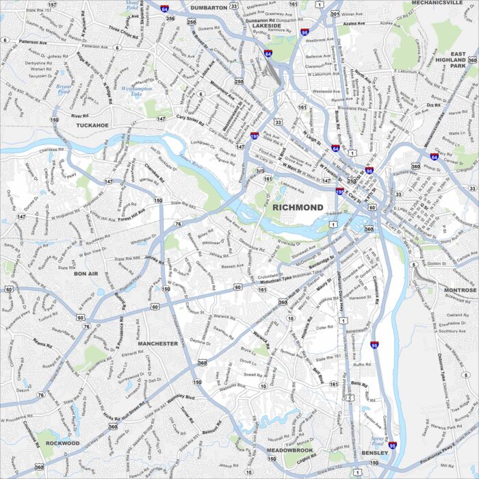
Richmond is Virginia’s capital and one of the nation’s most historic cities. The James River winds right through town, shaping its roads.
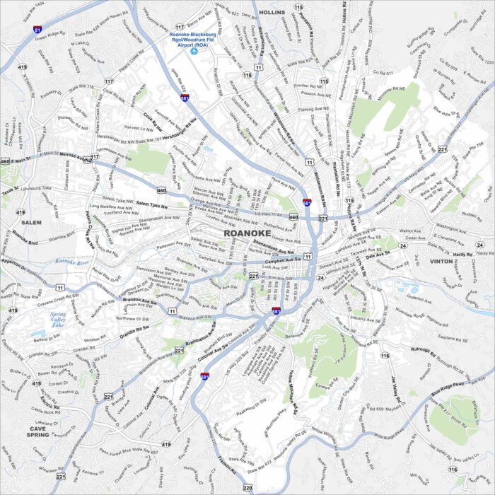
Our map of Roanoke shows the city center drawn out clearly. You can trace the roads toward the Blue Ridge Mountains.
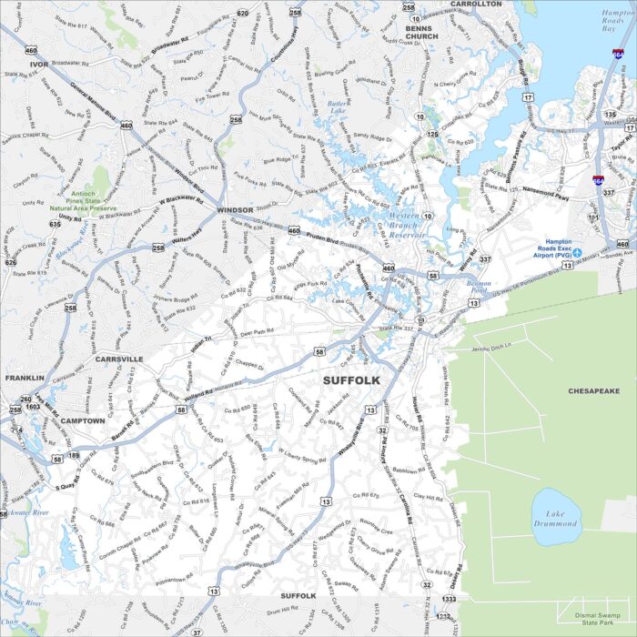
Our map of Suffolk shows the largest city in Virginia by land. You’ll find rivers, highways, farmland, and a growing downtown area.
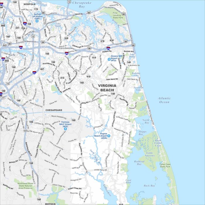
Get to know Virginia Beach with this city map. From the boardwalk to the Chesapeake Bay, it’s a coastal city full of life.
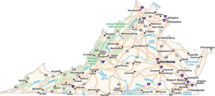
Our road map of Virginia is where the past meets the present. It stretches from the Atlantic coast to the Blue Ridge Mountains.
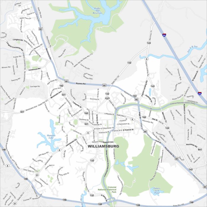
This Williamsburg map highlights the historic colonial district. It’s a living history destination with cobblestone streets and more.
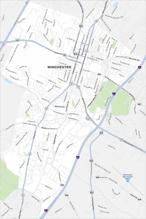
Take a look at our map of Winchester, Virginia. It highlights the downtown area and highways like U.S. 11 and I-81.