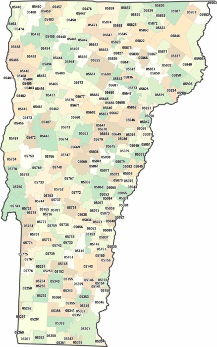
Vermont Zip Code Map
Vermont zip codes cover quiet, low-density regions. Our map highlights wide spacing between towns. Simplicity defines the layout here.
Vermont zip codes cover quiet, low-density regions. Our map highlights wide spacing between towns. Simplicity defines the layout here.
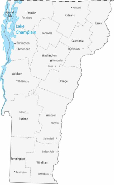
Our map of Vermont shows small counties spread across mountainous terrain. Cities are modest and spaced far apart.
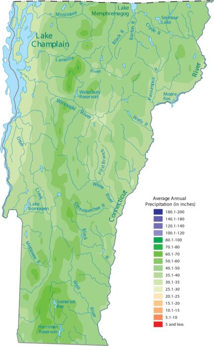
Vermont gets a lot of precipitation. Our precipitation map of Vermont shows higher elevations like the Green Mountains appearing wetter.
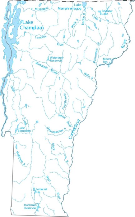
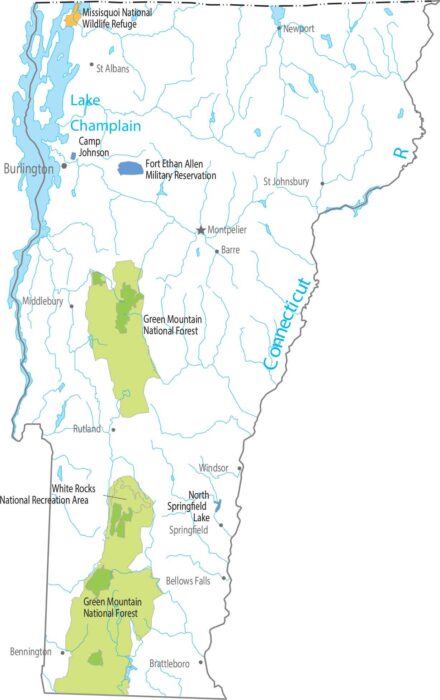
Here’s our map of Vermont’s rivers and lakes including Lake Champlain to the west and the Connecticut River to the east.
Our map highlights Vermont’s signature, north-to-south running Green Mountains. This feature define its landscape and provides its nickname.

Population density stays low across the state. Small towns are scattered among forests and hills. Our population map shows few dense clusters.
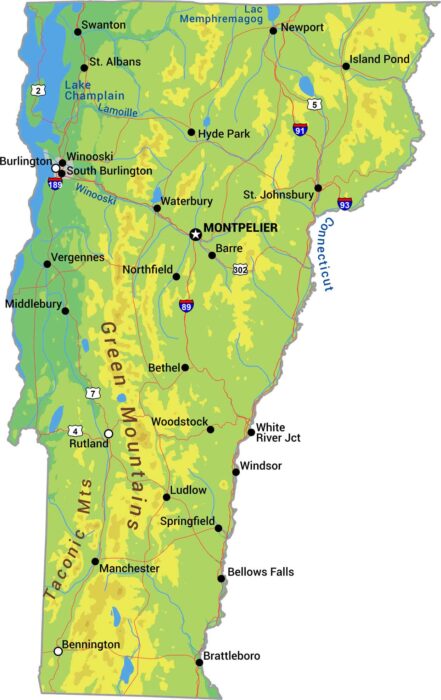
Vermont is the state of the Green Mountains. Its peaks define the state with forests covering most of the terrain between valleys.
Vermont narrows in the south and widens in the north. Its western border follows Lake Champlain while the east follows the Connecticut River.
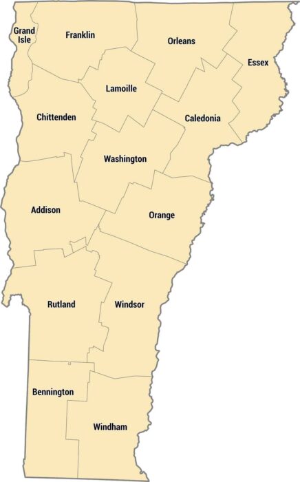
Fourteen counties make up this rural New England state located between New York and New Hampshire. The Green Mountains run down the middle.
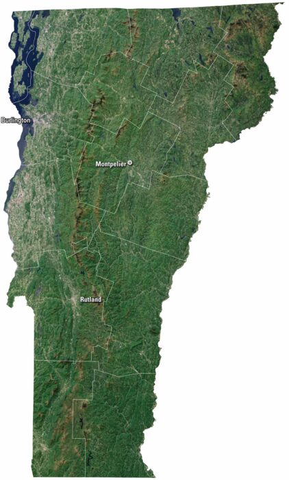
Vermont has green mountains and a landscape that feel timeless. Our satellite map of Vermont shows Burlington, which sits on Lake Champlain.
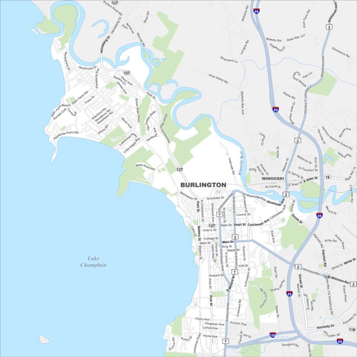
Burlington is set on the eastern shore of Lake Champlain. Our map shows its waterfront parks, highways and the Winooski River.
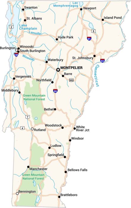
Vermont is all hills, forests, and winding backroads. Our Vermont road map displays its small towns, lakes, and the scenic Green Mountains.