Utah Biomes Map
Our biomes map of Utah highlights its deserts and forests. Elevation matters here. The geography explains the sharp biome boundaries.
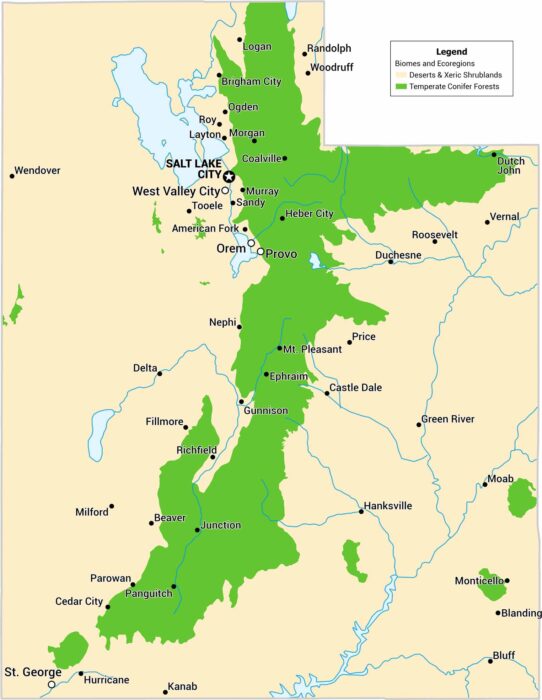
Our biomes map of Utah highlights its deserts and forests. Elevation matters here. The geography explains the sharp biome boundaries.
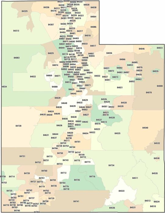
Utah zip codes cluster tightly along the Wasatch Front. Our Utah zip code map makes that concentration obvious.
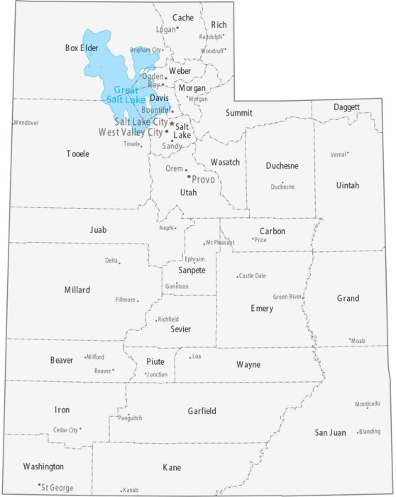
Our map of Utah displays 29 counties, with the vast majority of people living along the Wasatch Front. We also include all the major cities.
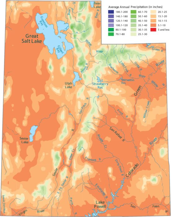
Desert basins dominate much of the state. Our precipitation map of Utah shows that the Wasatch Range in the center gets the most moisture.
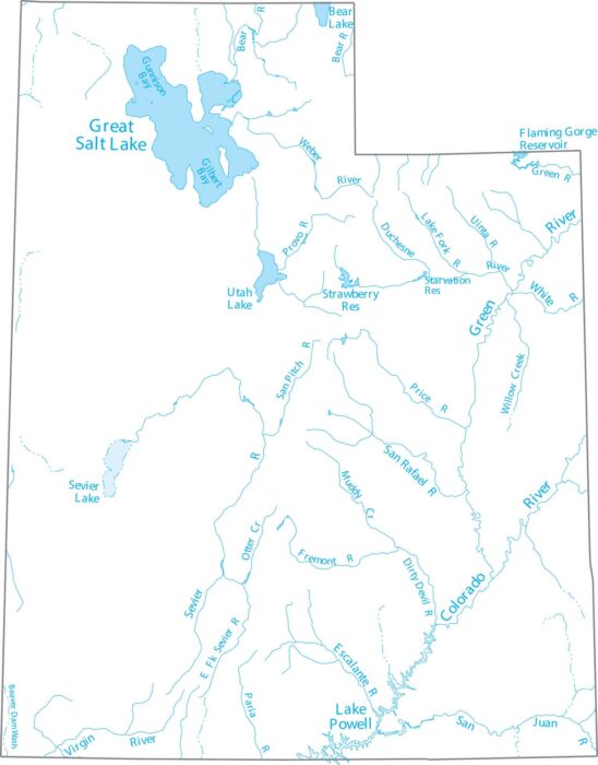
Get to know Utah’s rivers and saltwater lakes. Our Utah lakes and rivers map highlights all the tributaries of the Colorado River.
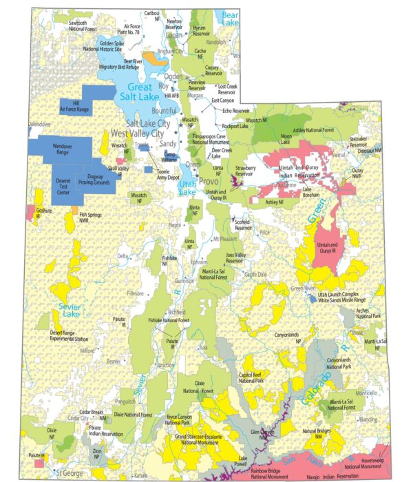
The state of Utah is special for its “Mighty 5” National Parks. It includes Zion and Bryce Canyon. Capitol Reef, Canyonlands, and Arches.
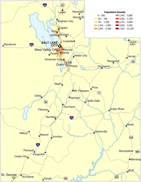
Our population density map of Utah shows sharp edges between dense and empty regions. Most of Utah’s population lines the valley regions.

Our map shows where Arizona, Utah, Colorado, and New Mexico meet. You’ll see Highway 160 and trails leading to Four Corners Monument.
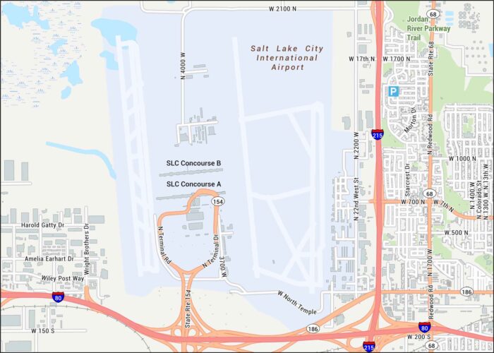
Our map of Salt Lake City Airport shows runways, terminals, and concourses. The airport sits near the Great Salt Lake.
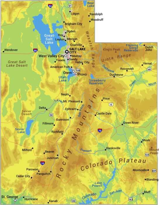
Utah is canyon country with mountains like the Rockies and the Great Salt Lake Desert. See it all with our physical map of Utah.

Check out how every single border in Utah is a straight line. The state forms a near-perfect rectangle with corners at right angles.

There are just 29 counties in Utah. But they cover everything from red rock desert to snowy mountains. Salt Lake County is most populous.
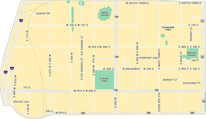
Downtown Salt Lake City is open and easy to navigate with mountains on every side. Our map lays out its highways, streets and parks.
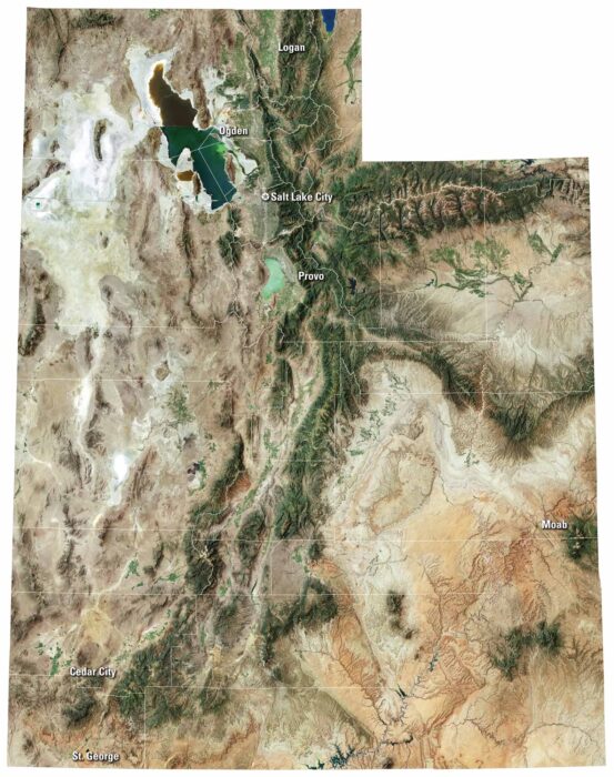
From national parks to quiet valleys, our Utah satellite map shows every corner of this state. It includes Salt Lake City and Wasatch Range.
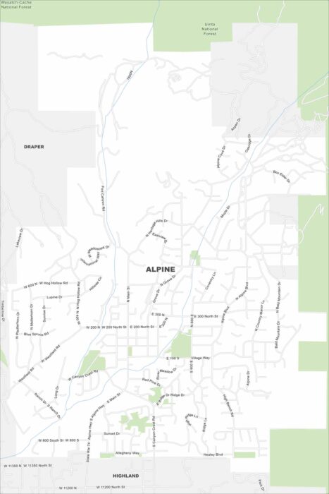
The name says it all. Alpine sits right against the Wasatch Range. This is where suburban roads meet rugged canyon trails.