Map of Hidalgo, Texas
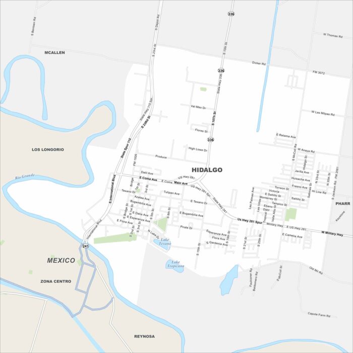
Check out our map of Hidalgo right on the US-Mexico border. The Rio Grande runs along its edge. Bridges link it directly to Reynosa, Mexico.
Check out our map of Hidalgo right on the US-Mexico border. The Rio Grande runs along its edge. Bridges link it directly to Reynosa, Mexico.
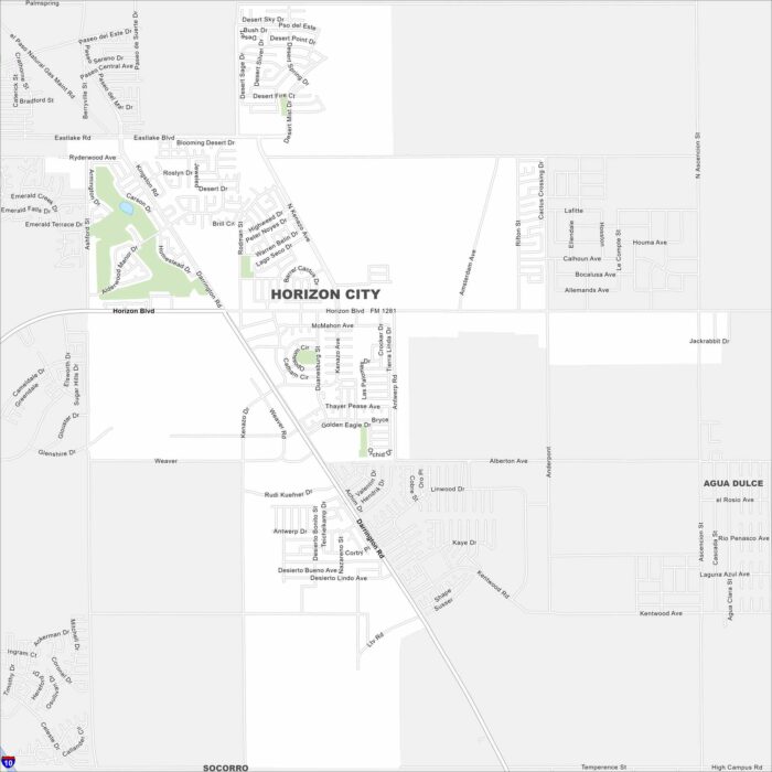
Our map of Horizon City highlights its wide grid east of El Paso. New housing developments are easy to spot.
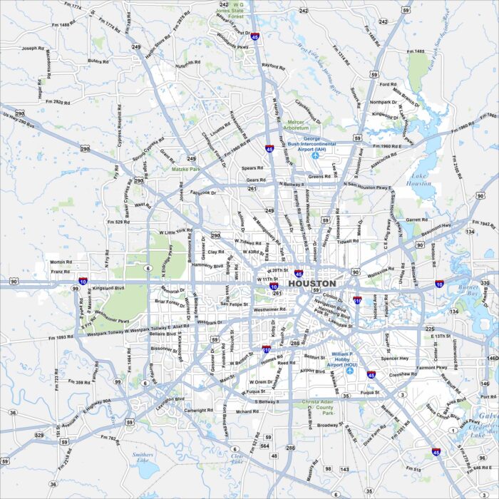
Our map of Houston shows a network of highways circling and crossing the city. Buffalo Bayou winds through the downtown area.
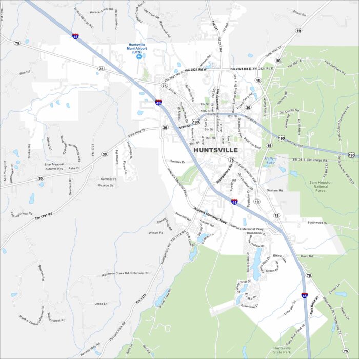
Get to know Huntsville north of Houston, Texas. Our map shows highways, roads, rivers, lakes and state parks.
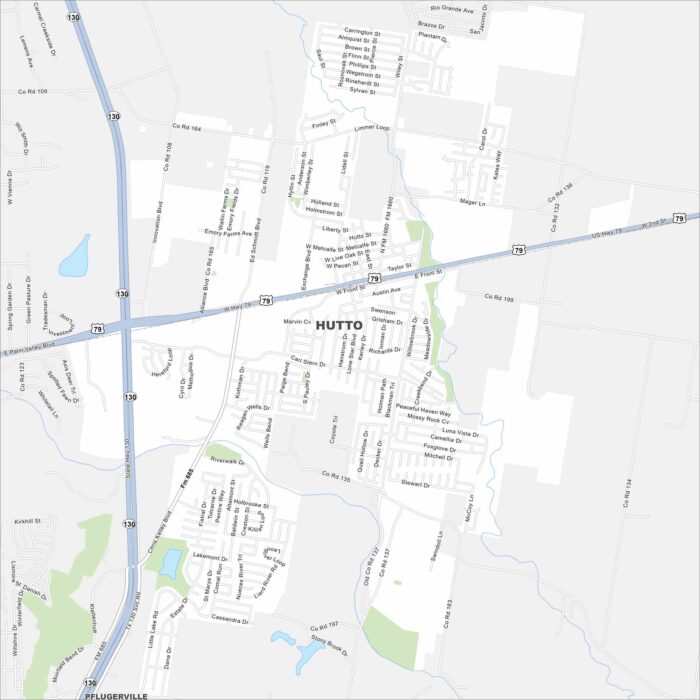
Hutto lies just northeast of Austin. This map shows residential areas expanding outward. Rail lines and highways link it to the metro area.
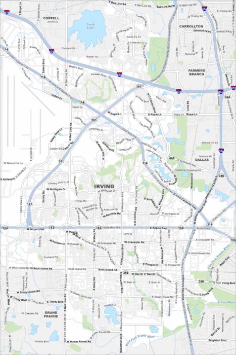
Our map of Irving shows its position between Dallas and Fort Worth. The Trinity River bends across the southern edge.
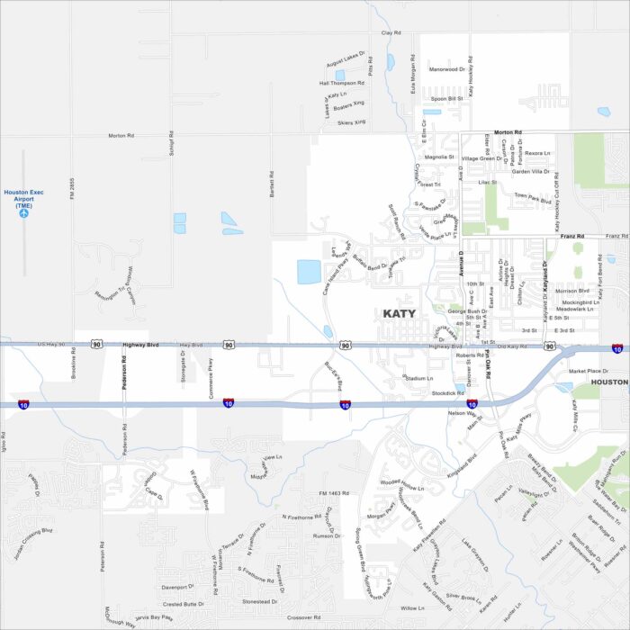
Katy is just west of Houston. Our map shows new subdivisions spreading quickly across former farmland. Interstate 10 runs straight through.
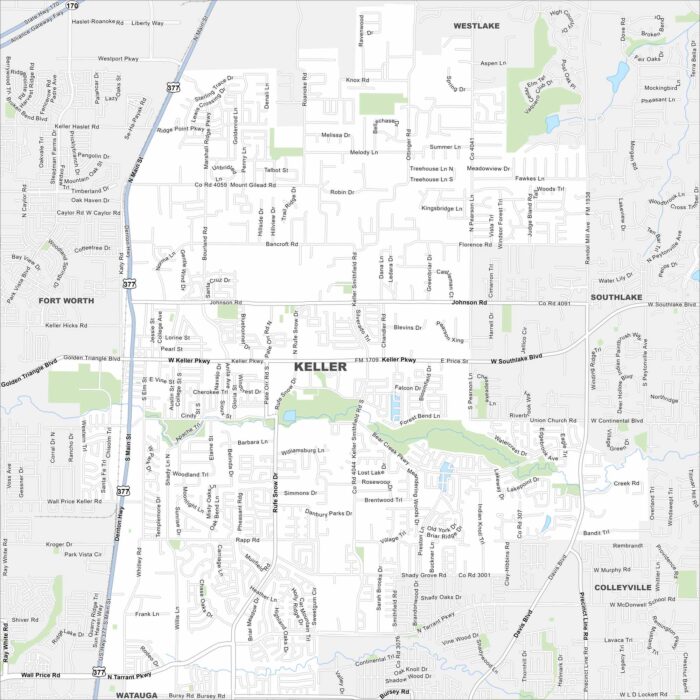
Keller sits in the Dallas-Fort Worth area. Our map shows its streets spreading across rolling land. Roads tie it closely to Fort Worth.
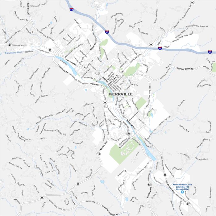
Kerrville is in the Texas Hill Country. Our map shows the Guadalupe River winding through the city. We also show parks, roads and lakes.
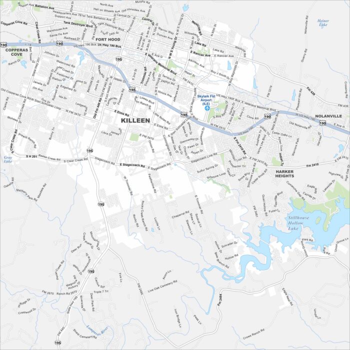
Killeen is anchored by Fort Hood. Our map shows wide highways cutting through the city. Neighborhoods sprawl outward from the military base.
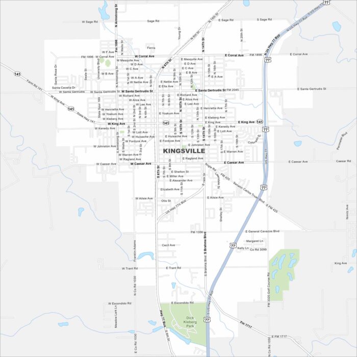
Our map of Kingsville shows its roads and open land around the city. It lies just west of the Gulf Coast with US Highway 77 cutting through.
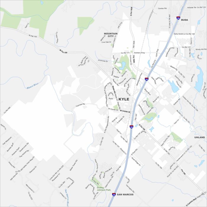
Kyle, Texas is just south of Austin. Our map shows the Blanco River running nearby. Residential areas stretch across the flat Texas landscape.

This map shows a curving street layout designed like a “tree”. While waterways flow through town, highways connect it to the Gulf Coast.
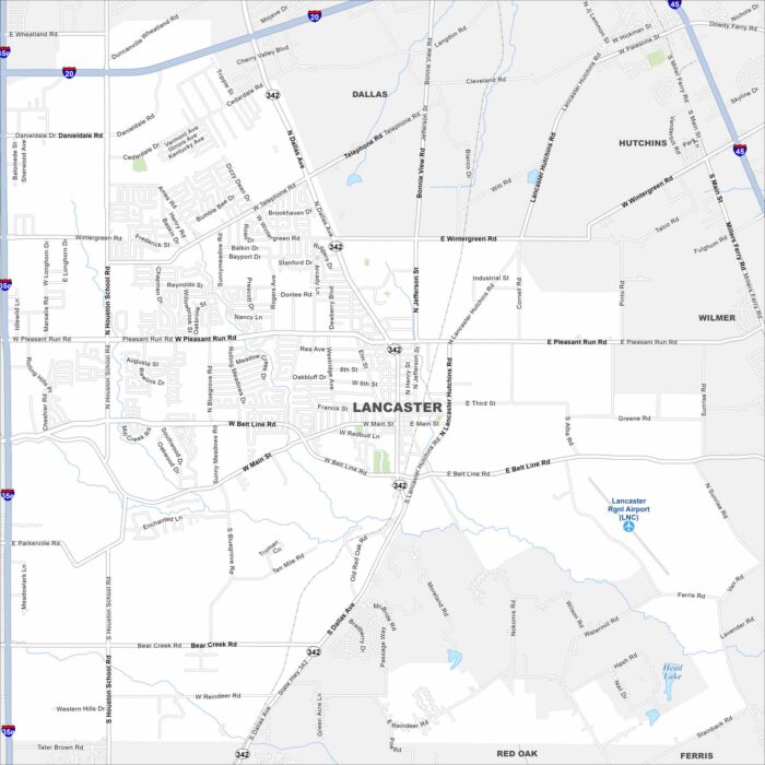
Lancaster, Texas is located south of Dallas. Our map includes highways, roads, rivers, lakes and parks. The city links directly to I-35.
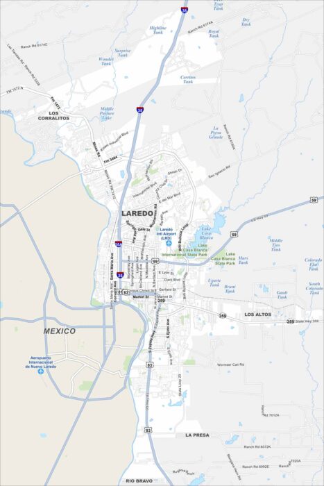
Our map shows Laredo lining up along the border, right on the Rio Grande. Interstate 35 heads north toward San Antonio.