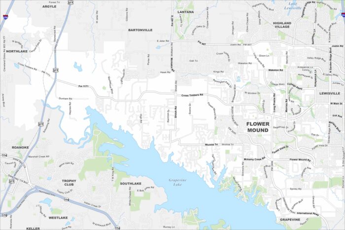
Map of Flower Mound, Texas
Check out our map of Flower Mound north of the Dallas–Fort Worth area. Grapevine Lake stretches along its eastern edge.
Check out our map of Flower Mound north of the Dallas–Fort Worth area. Grapevine Lake stretches along its eastern edge.
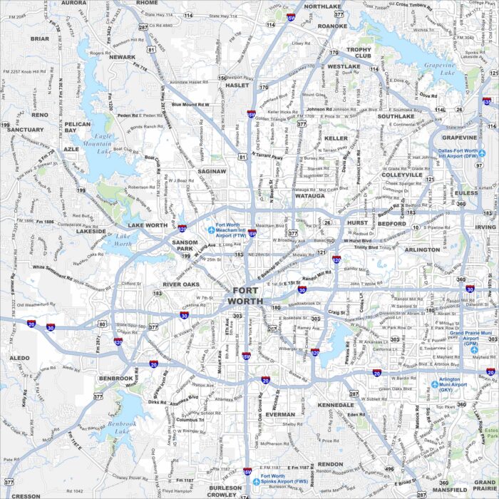
Explore our map of Fort Worth to see I-35W, I-30, and I-20 linking the city across North Texas. The Trinity River winds around downtown.
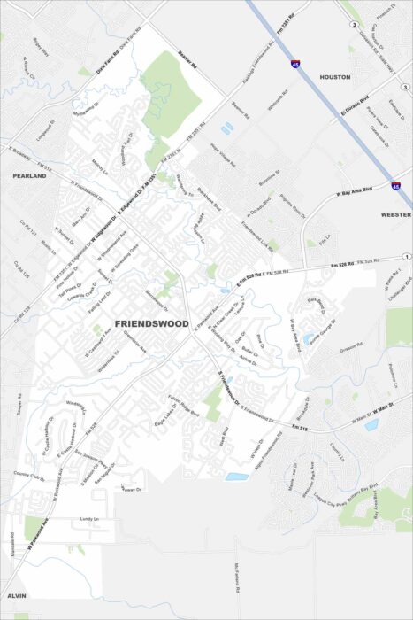
Our map of Friendswood shows it between Houston and Galveston. Bayous and greenbelts fill in highways that connect it to the city and coast.
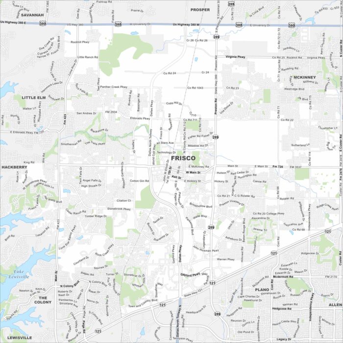
Check out our map of Frisco north of Dallas. It shows highways, lakes and rivers. Parks and open land fill in around the fast growth.
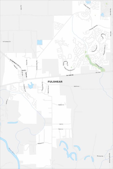
Our map of Fulshear shows a growing community west of Houston. The Brazos River curves nearby, with highways leading into open farmland.
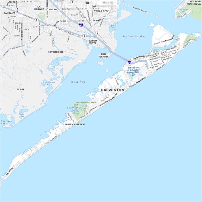
Our map of Galveston shows its streets, beaches, and harbor routes. Highways lead you across the main island. It rests on the Gulf Coast.
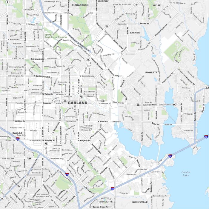
Our map of Garland shows its highways, streets, and open parks. Roads stretch wide here because it’s part of the Dallas-Fort Worth area.
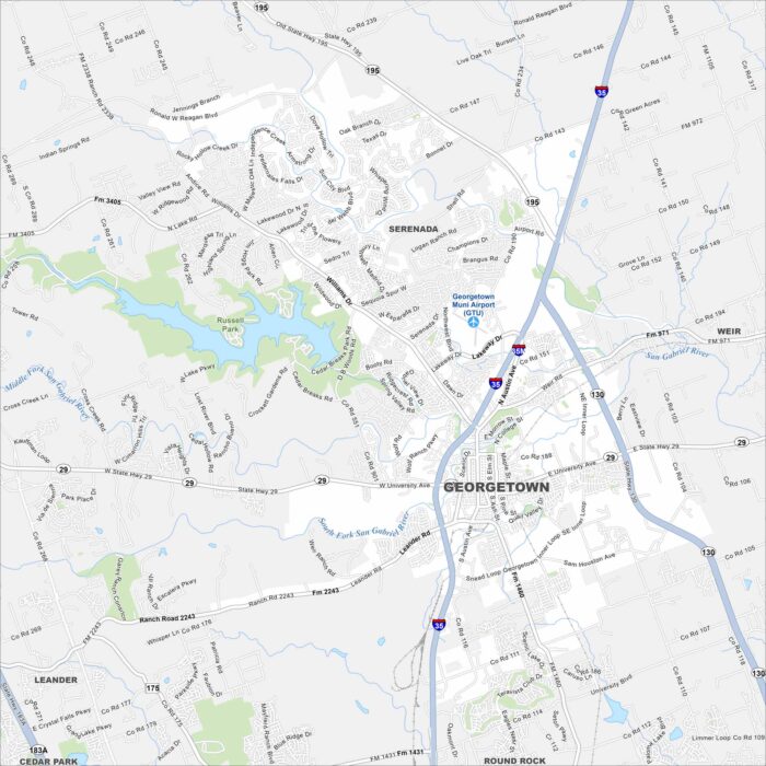
See the streets, highways, and rivers that cut through Georgetown, Texas. Our map displays its layout with plenty of green spaces.
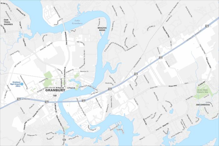
Granbury is a lakeside city in north-central Texas. Our map highlights Lake Granbury, local parks, and the town square.
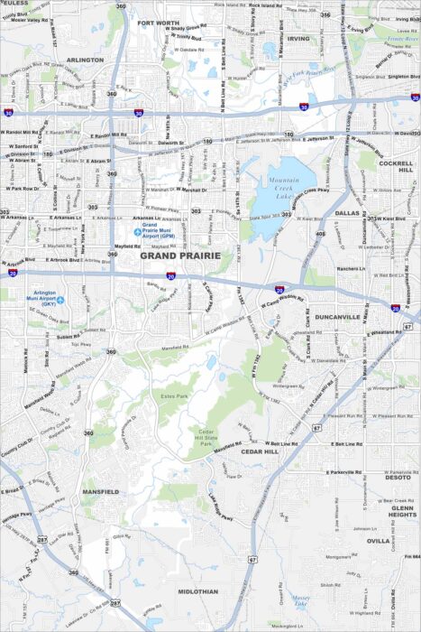
Grand Prairie is located between Dallas and Fort Worth. This map shows main roadways, local lakes, and residential areas.
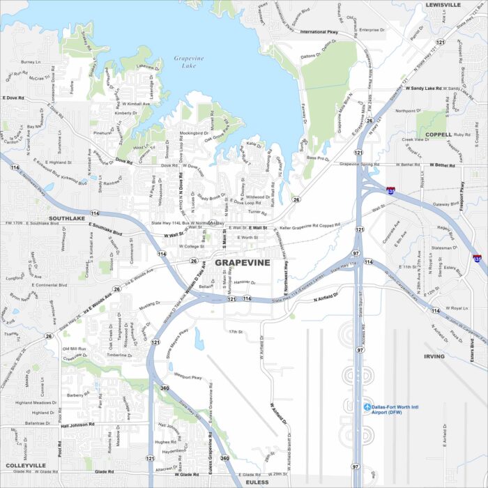
Grapevine is in the Dallas-Fort Worth area near Grapevine Lake. This map outlines the lake, major roadways and the historic downtown.
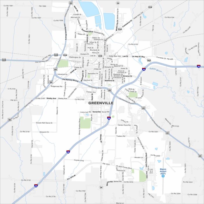
Our map of Greenville shows this city northeast of Dallas. The layout centers around U.S. Highway 69 and Interstate 30.
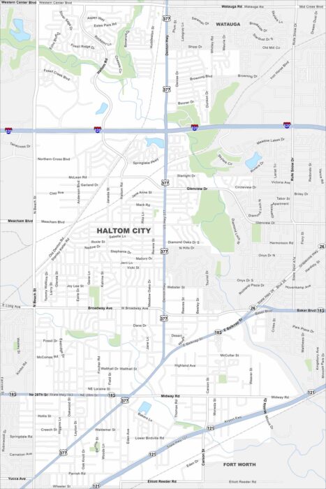
Haltom City is part of the Fort Worth area in north Texas. This map shows dense neighborhoods tied together by major roads.
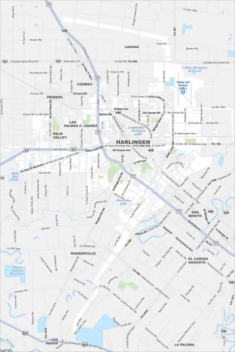
Harlingen sits in the Rio Grande Valley of far south Texas. Our map highlights highways spreading outward toward Brownsville and McAllen.
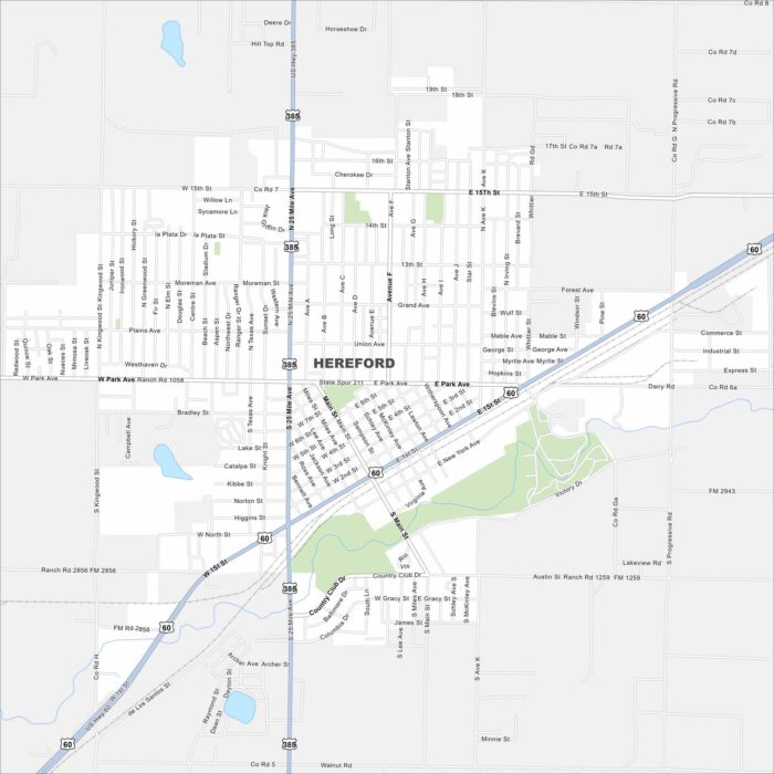
Our map of Hereford highlights its spot in the Texas Panhandle. Highways connect it west toward New Mexico.