Map of Harlingen, Texas
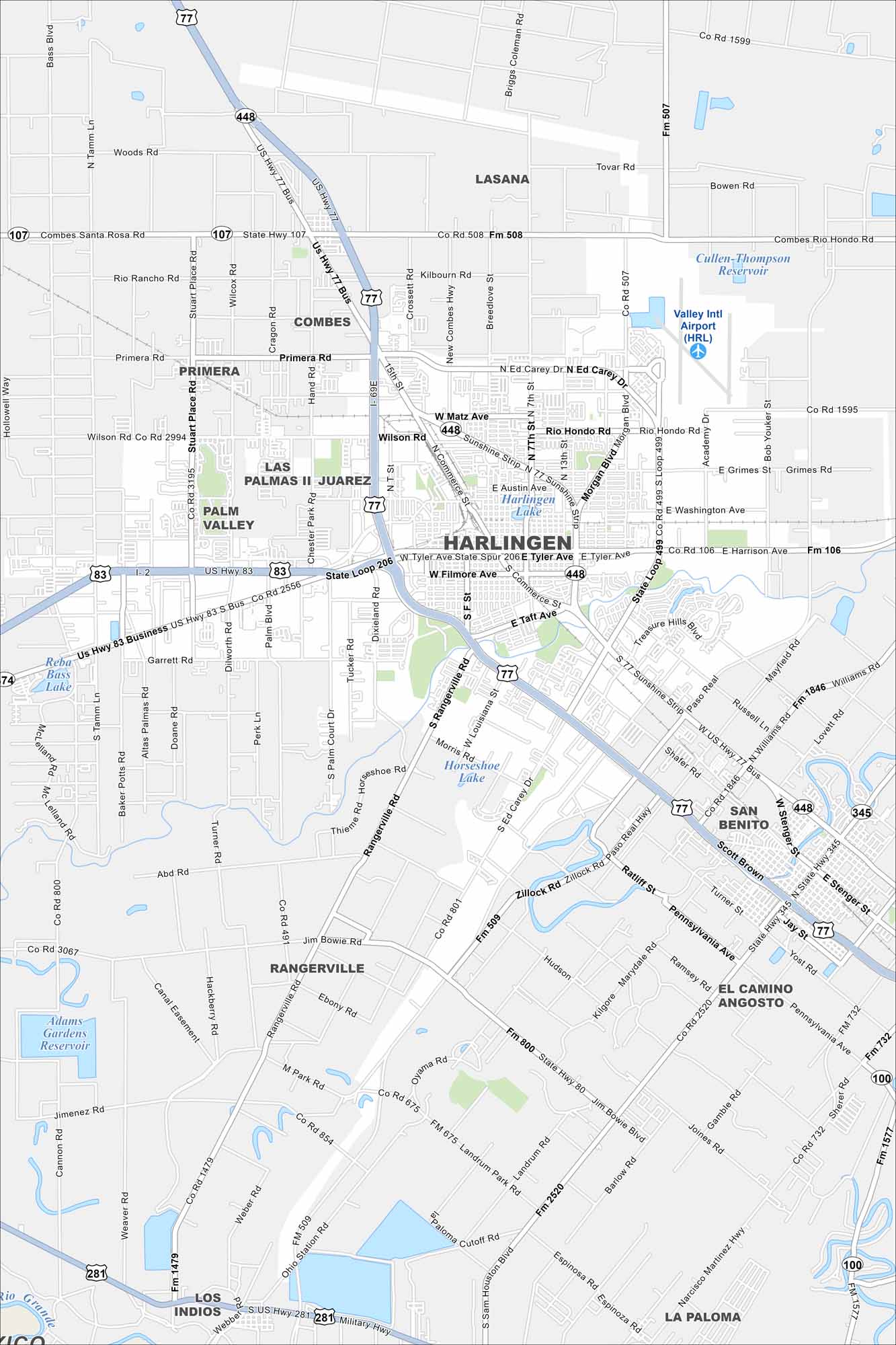
Harlingen sits in the Rio Grande Valley of far south Texas. Our map highlights highways spreading outward toward Brownsville and McAllen. This city thrives near the Mexican border.
Map Information
On the Map
Interstates/Highways: I-2, US Hwy 77, US Hwy 83, State Hwy 107, State Loop 499, State Loop 206, State Spur 206 Major Roads: Tyler Ave, Harrison Ave, 77 Sunshine Strip, Commerce St, Ed Carey Dr, Rangerville Rd, Morgan Blvd, Dixieland Rd, Expressway 83, Expressway 77, Wilson Rd, Treasure Hills Blvd, New Combs Hwy, Primera Rd, Stuart Place Rd, Bass Blvd, Military Hwy, San Jose Rd, Altas Palmas Rd, Palm Blvd Airports: Valley Intl Airport (HRL) Lakes and Reservoirs: Harlingen Lake, Horseshoe Lake, Reba Lake, Adams Gardens Reservoir, Cullen-Thompson Reservoir Major Rivers: Rio Grande Nearby Communities: Lasana, Combes, Primera, Palm Valley, Rangerville, San Benito, Los Indios, La PalomaTexas State Maps
Scan our maps of the massive southern state of Texas.


City Maps of Texas
Explore our map collection of Texas cities.


