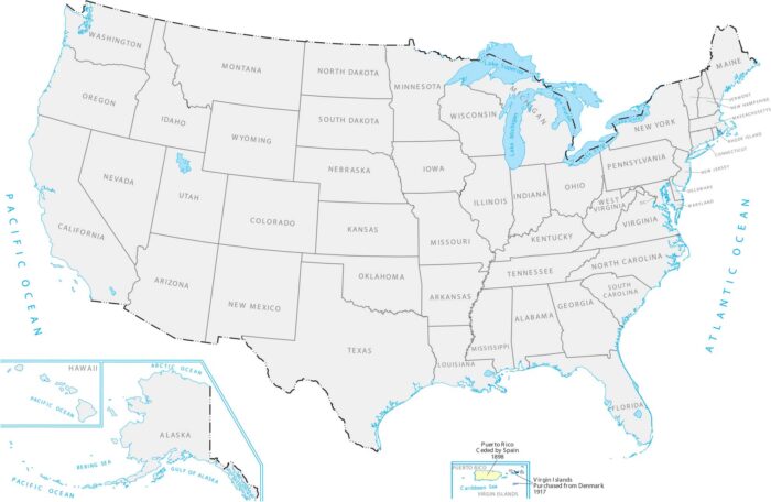
Puerto Rico and Virgin Islands Territory Acquisition Map
Our territory acquisition map shows these Caribbean islands that became US territories after a war with Spain and a purchase from Denmark.
Our territory acquisition map shows these Caribbean islands that became US territories after a war with Spain and a purchase from Denmark.
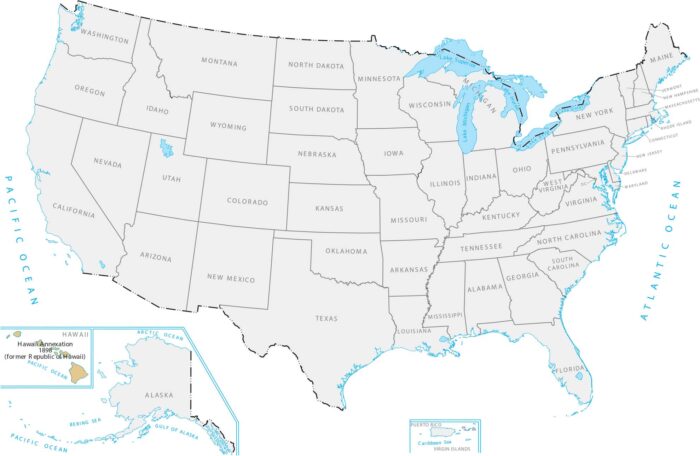
Our Hawaii Annexation of 1898 map displays this chain of islands surrounded by the Pacific Ocean far from the mainland United States.
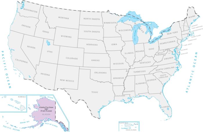
The US bought Alaska from Russia for about $7 million. This added massive northern territory way up by the Arctic in our Alaska Purchase map.
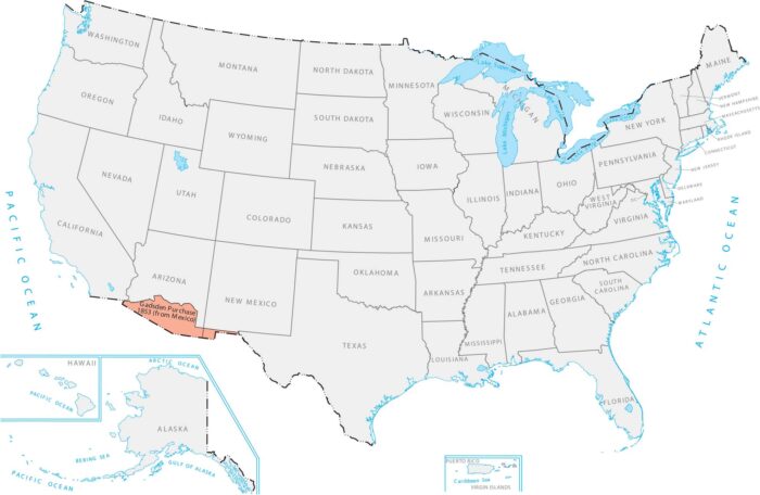
Our Gadsden Purchase map shows a small strip along the bottom of Arizona and New Mexico that the US bought from Mexico.
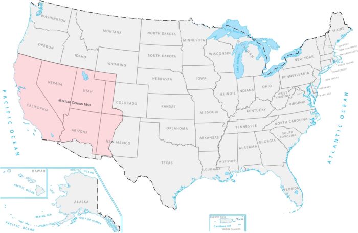
Our Mexican Cession 1848 Map shows how it included California, the Pacific Coast, and a bunch of mountains and deserts in between.
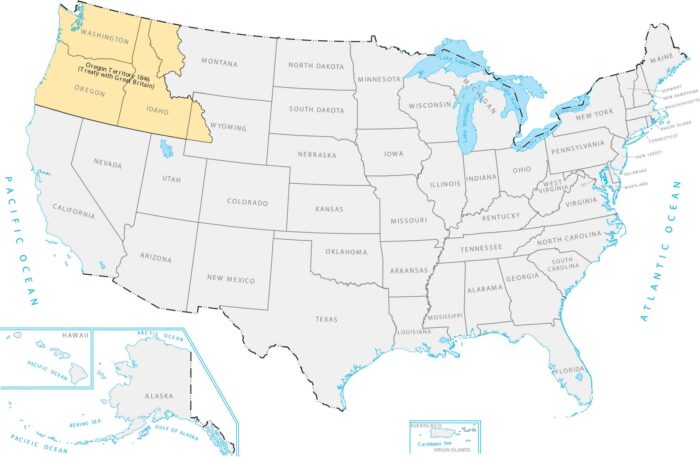
The US and Britain split up the Pacific Northwest in 1846. Our Oregon Territory 1846 map shows how it links the Pacific Coast to the Rockies.
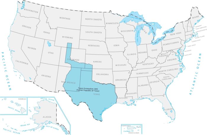
Texas was its own country for almost ten years. Our Texas Annexation 1845 map shows how it reshaped the southern edge of the United States.
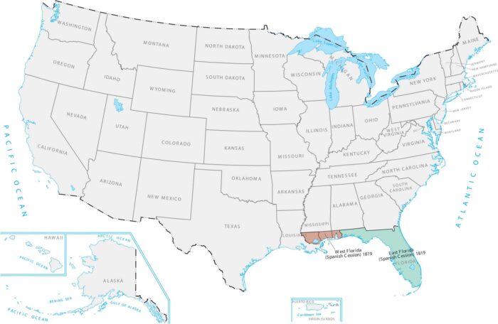
Our Treaty of Adams-Onis 1819 map shows the U.S. acquiring the Atlantic coast. America finally controlled the southeastern corner.
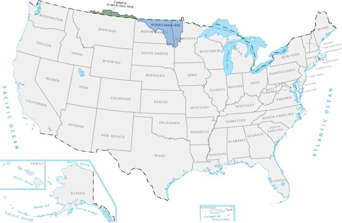
Our Treaty of 1818 map shows land that came from a deal with Britain in 1818. This treaty set the northern border at the 49th parallel.
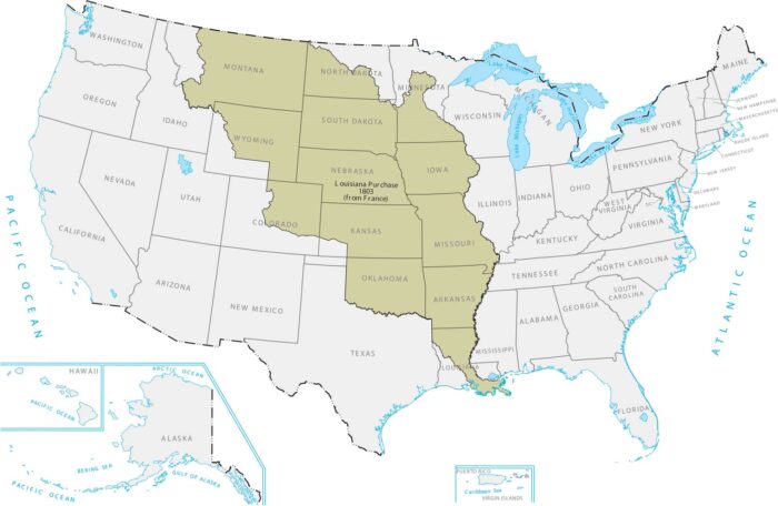
Our map of the Louisiana Purchase of 1803 shows an enormous block of land that fills the center of the country.
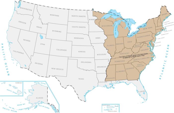
Our Territory of the Original Thirteen States map shows where America started. It was just a thin strip of colonies along the Atlantic Coast.
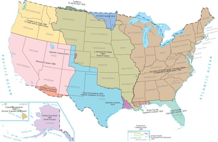
This map shows how America grew from the East Coast to the huge country it is today. Most of the expansion happened in the 1800s.