Rhode Island Outline Map
Our Rhode Island outline map shows the detailed Atlantic coastline that is full of coves and islands, and narrow inlets.
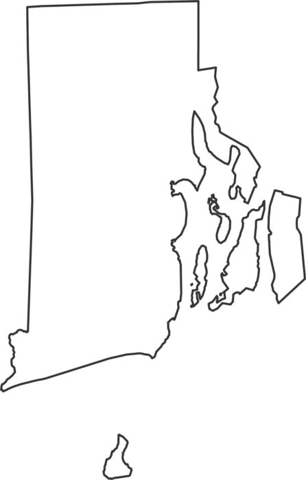
Our Rhode Island outline map shows the detailed Atlantic coastline that is full of coves and islands, and narrow inlets.
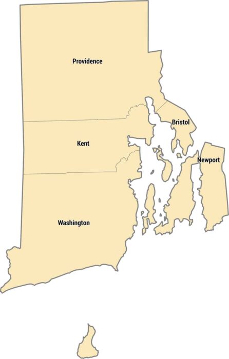
Only 5 counties exist in the smallest state. Rhode Island’s counties cover a small coastal state with bays, islands, and short distances.
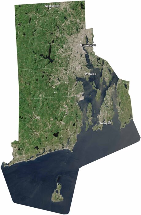
Rhode Island may be small, but it’s packed with character. Providence sits along Narragansett Bay. But Newport is on Aquidneck Island.
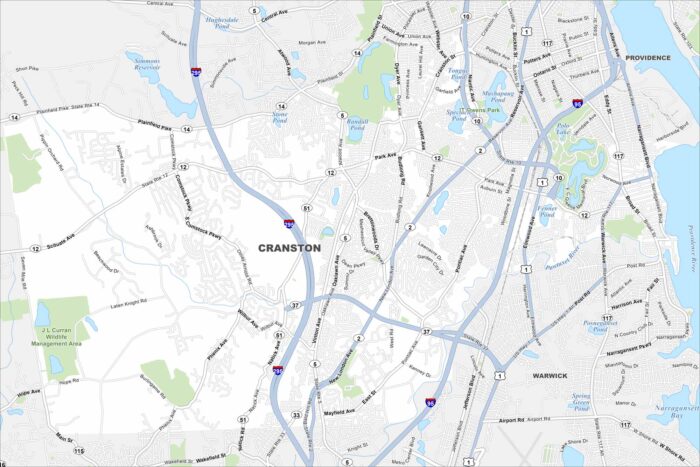
Our map of Cranston has its local roads, highways, and nearby ponds. It’s located south of Providence with tons of open green spaces.
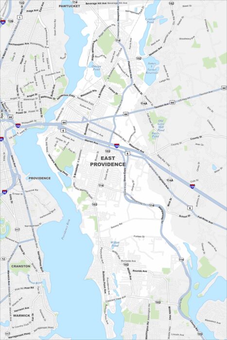
Our map of East Providence shows the Providence River cutting along the west side. Bridges connect it directly to Providence.
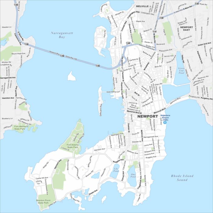
Newport lies on Aquidneck Island in Narragansett Bay. Our map shows a compact waterfront downtown, colonial streets, and surrounding beaches.
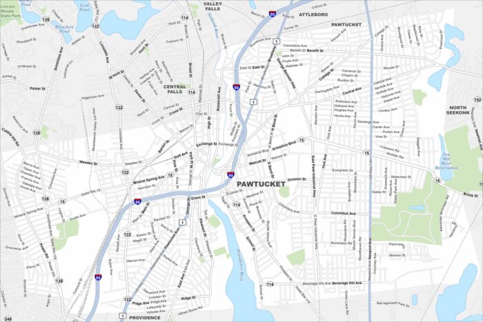
Check out Pawtucket, located northeast of Providence. Our map highlights its dense neighborhoods and roads.
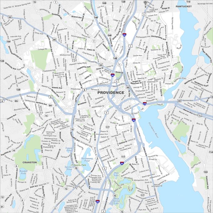
Providence is Rhode Island’s capital and one of the oldest cities in New England. Our map shows its streets, rivers, and neighborhoods.
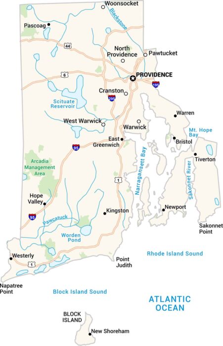
Rhode Island may be the smallest state, but it has character. Our map shows its coastal roads, towns and open waters of Narragansett Bay.
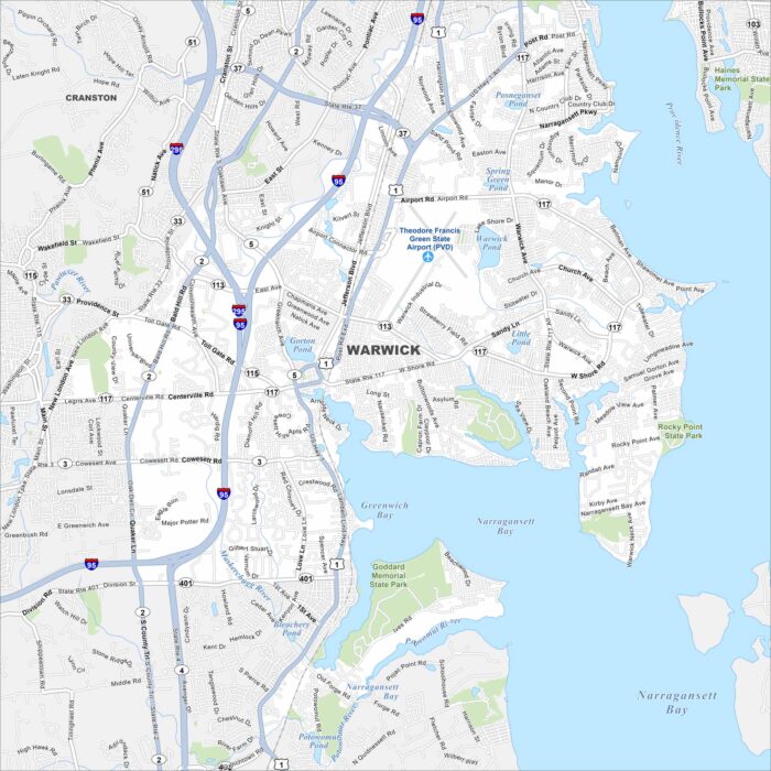
Get around Warwick with our map highlighting its Narragansett Bay shoreline. Beaches, marinas, and shopping make it a coastal city.
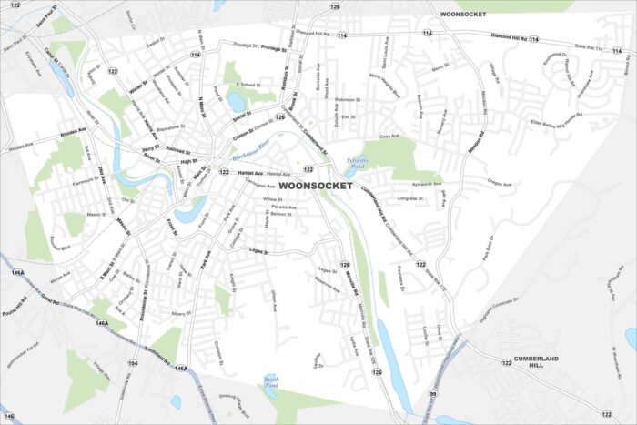
Looking for a map of Woonsocket, Rhode Island? Here’s one that shows the Blackstone River winding through its historic mill town streets.