Oregon Biomes Map
Our Oregon biomes map shows wet coastal forests, dry interior basins, and forests. It’s one state that has very different environments.
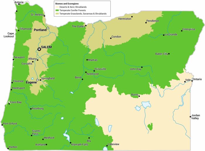
Our Oregon biomes map shows wet coastal forests, dry interior basins, and forests. It’s one state that has very different environments.
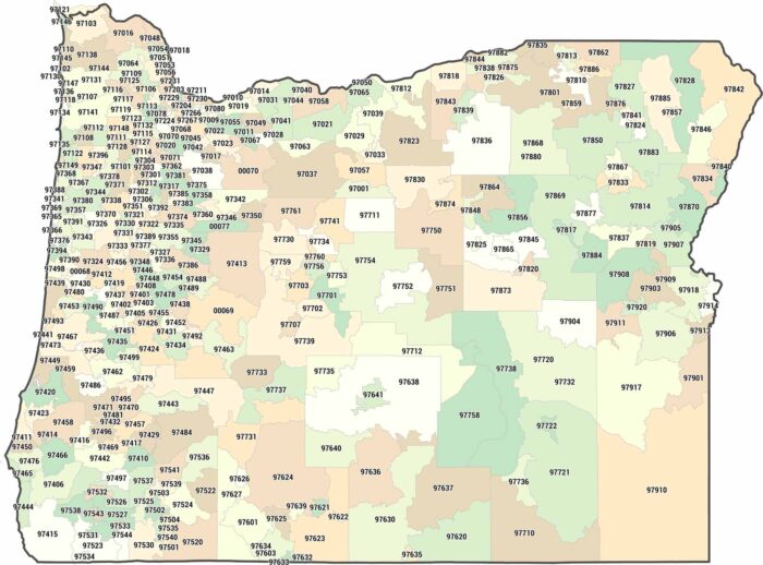
Most of Oregon’s zip codes squeeze into the narrow Willamette Valley corridor. Drive east and you’ll find zip codes spanning counties.
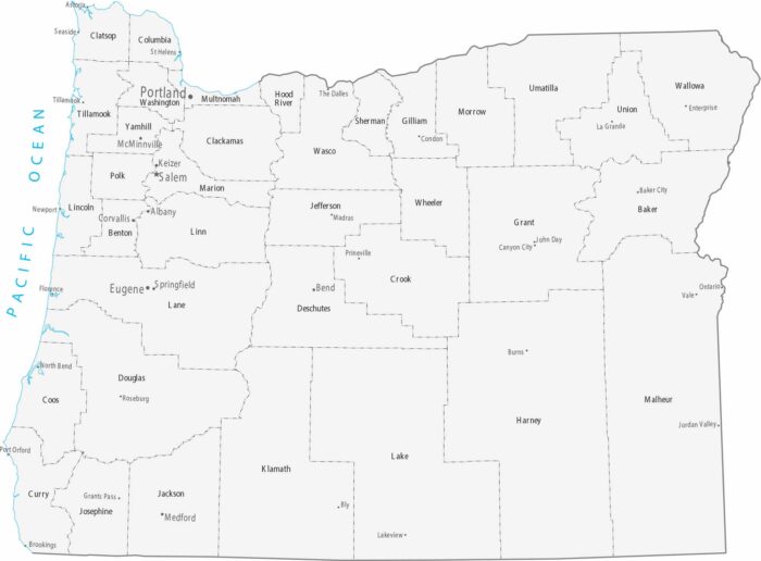
Our map of Oregon shows smaller, denser counties west of the Cascades. Portland and the capital, Salem, are in the fertile Willamette Valley.
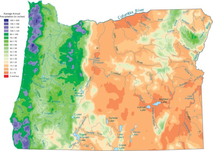
Pacific storms dump everything on the western slopes, while the east stays very dry. See it on our precipitation map of Oregon.
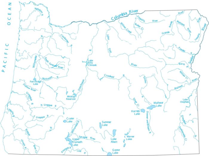
Get to know Oregon through its rivers and lakes. Our map of Oregon highlights the Columbia River, Pacific Ocean and interior lakes.
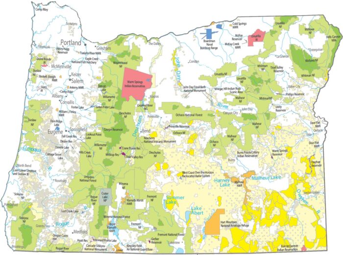
Check out our map with national parks and forests of Oregon. Crater Lake National Park protects a collapsed volcano filled with water.
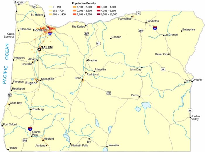
Most people in Oregon live west of the Cascade Range. Our population density map of Oregon shows very sparse density east of the mountains.
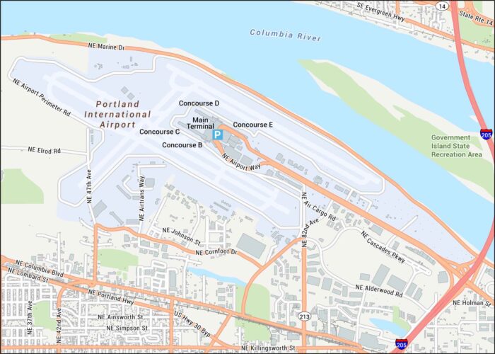
Take a look at PDX with its terminals, runways, and roads leading toward the Columbia River. We’ve mapped out all nearby highways and roads.
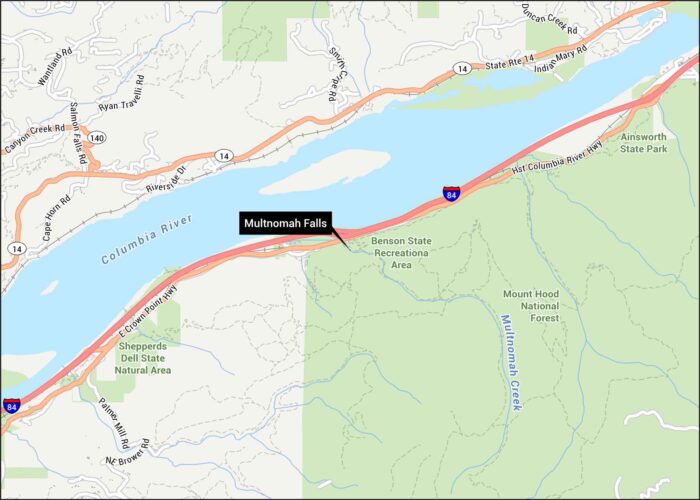
Check out Multnomah Falls with its paths and roads hugging the Columbia River Gorge. Our map shows the trails and the tight curves.
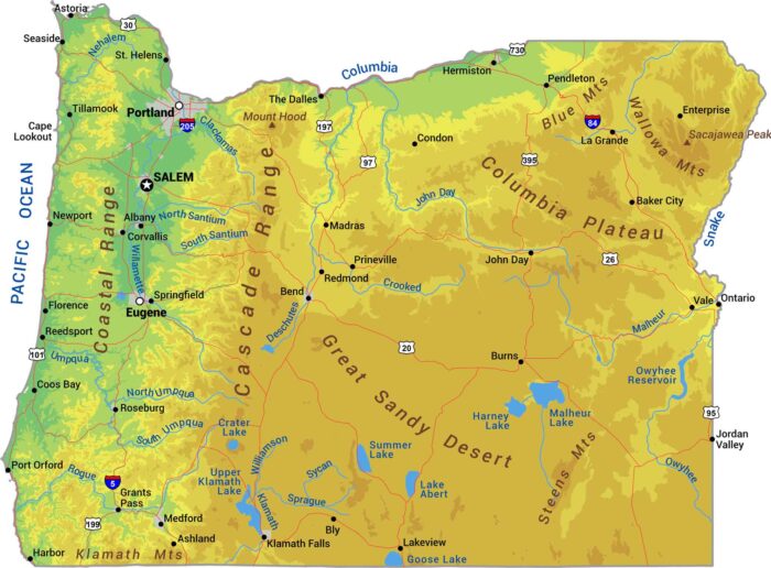
Our physical map of Oregon shows peaks like Mount Hood, the Willamette Valley, and mountain ranges. Oregon splits at the Cascades.
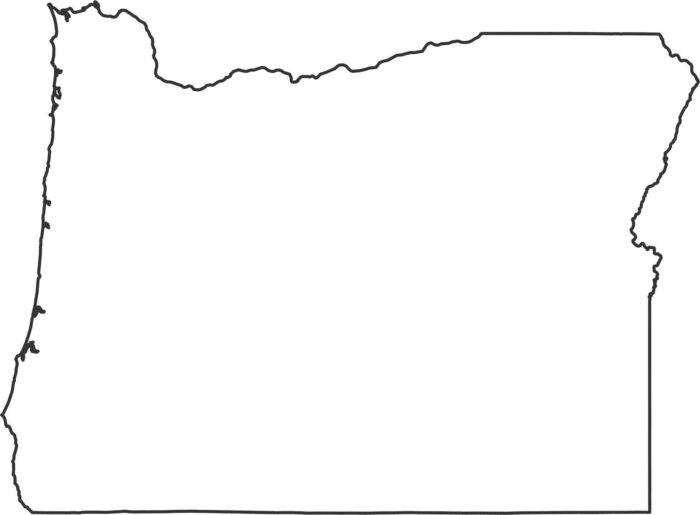
Oregon’s outline combines a Pacific coastline with angled inland borders. The western side follows bays, while the east is mostly straight.
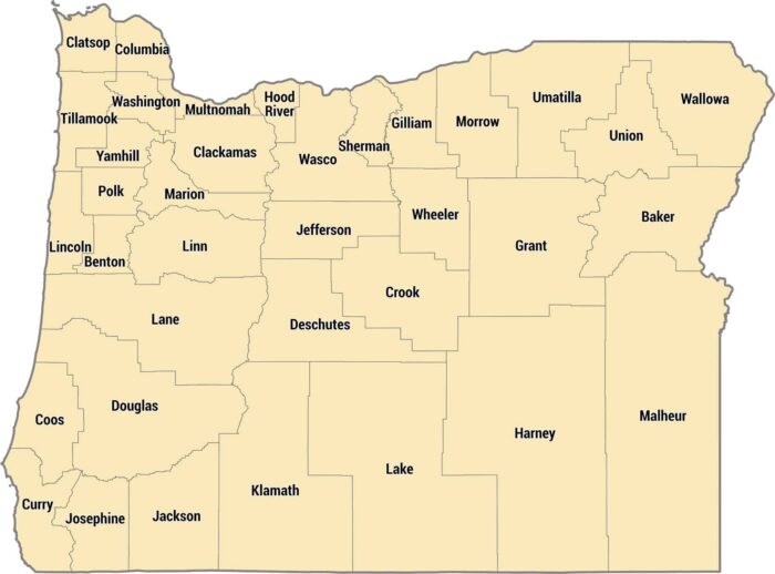
Our county map shows Oregon’s 36 counties. Coastal counties are long and thin, inland counties follow the Willamette River valley.
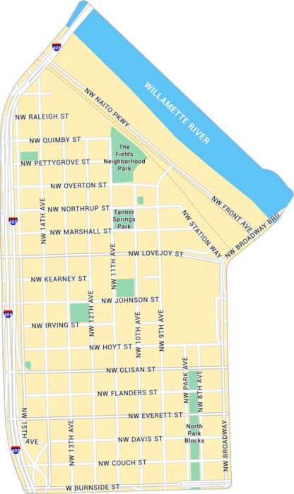
Our map of the Pearl District highlights one of Portland’s most walkable neighborhoods. It shows its streets, parks, and its rail lines.
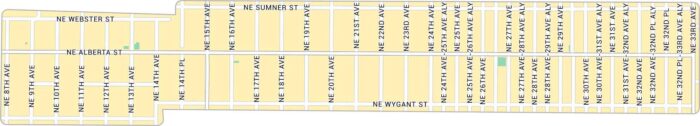
Our Alberta Arts map lays out the heart of northeast Portland. The neighborhood has a laid-back, creative energy that feels purely Portland.
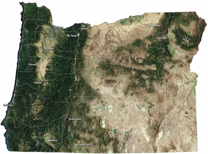
Our Oregon satellite map captures it all, from the coast to the Cascades. The state shifts from ocean cliffs to deep forests and high desert.