Home » Tourist Maps » Multnomah Falls Map

Multnomah Falls Map

Multnomah Falls Map

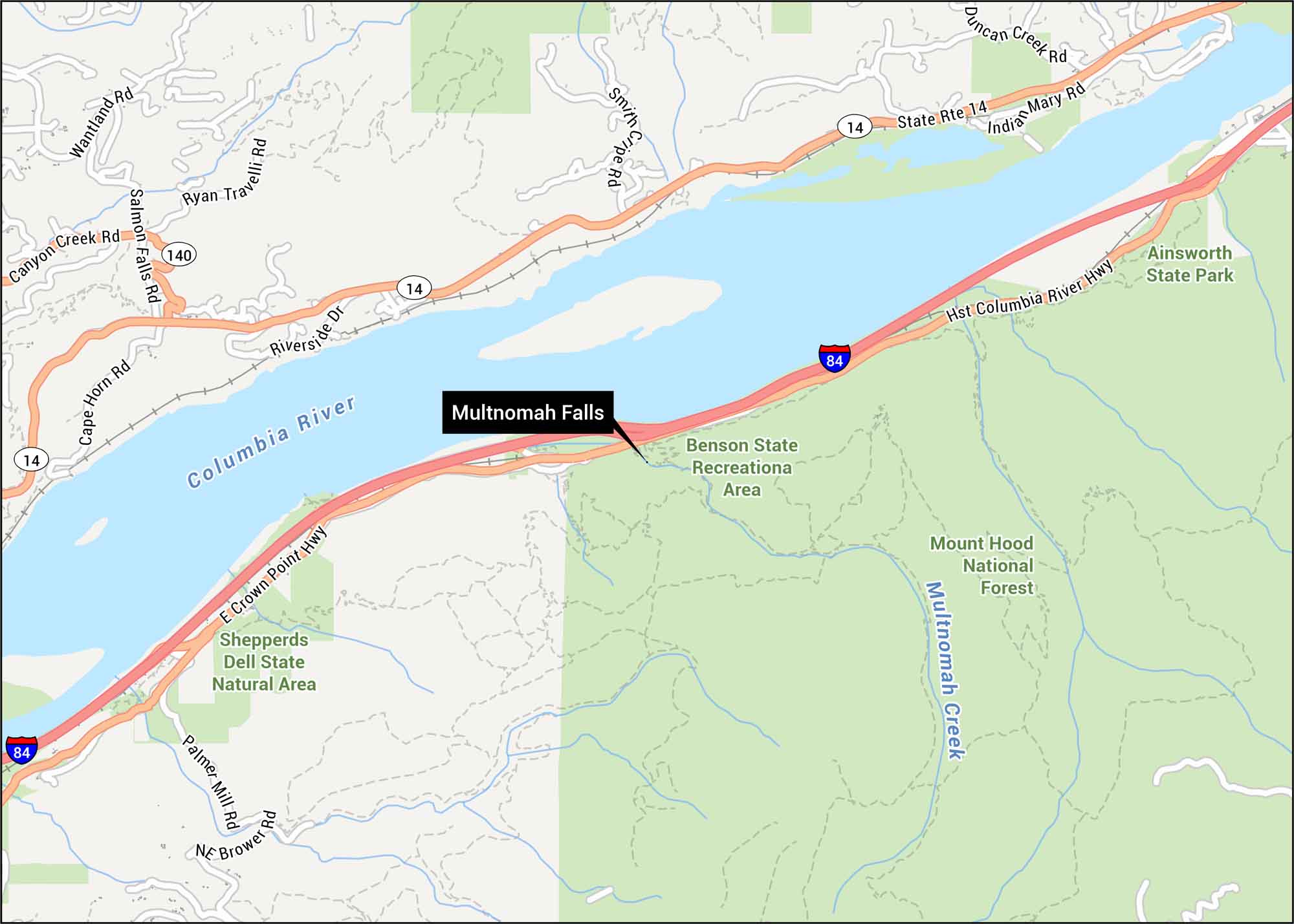
Check out Multnomah Falls with its paths and roads hugging the Columbia River Gorge. Our map shows the trails and the tight curves that guide you to the base. The falls rise from Oregon’s steep canyon walls. It’s known for lush forests and constant mist.

Map Information

  • Multnomah Falls, Oregon
  • Map of Multnomah Falls
  • Free for personal and commercial purpose. Attribution is required. How to attribute?

On the Map

Interstates/Highways: I-84, State Rte 14 Major Roads: Riverside Dr, Palmer Mill Rd, Brower Rd, Cape Horn Rd, Salmon Falls Rd, Canyon Creek Rd, Wantland Rd, Ryan Rd, Travelli Rd, Smith Cripe Rd, Duncan Creek Rd, Indian Mary Rd Rivers/Lakes: Columbia River, Multnomah Creek Parks/Forests: Mount Hood National Forest, Benson State Recreation Area, Ainsworth State Park, Shepperds Dell State Natural Area

References

Leave a Reply

Your email address will not be published. Required fields are marked *