Oregon Outline Map
Oregon’s outline combines a Pacific coastline with angled inland borders. The western side follows bays, while the east is mostly straight.
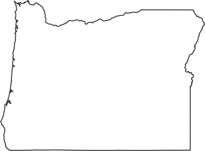
Oregon’s outline combines a Pacific coastline with angled inland borders. The western side follows bays, while the east is mostly straight.
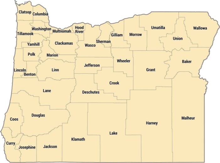
Our county map shows Oregon’s 36 counties. Coastal counties are long and thin, inland counties follow the Willamette River valley.
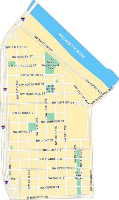
Our map of the Pearl District highlights one of Portland’s most walkable neighborhoods. It shows its streets, parks, and its rail lines.
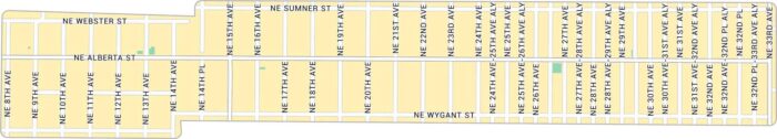
Our Alberta Arts map lays out the heart of northeast Portland. The neighborhood has a laid-back, creative energy that feels purely Portland.
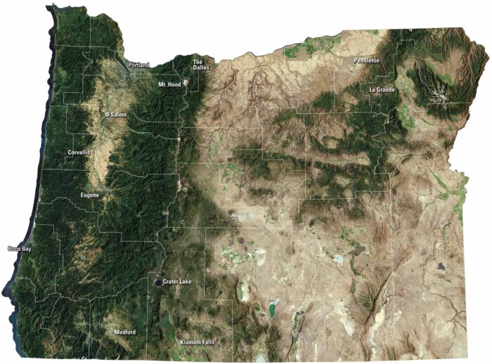
Our Oregon satellite map captures it all, from the coast to the Cascades. The state shifts from ocean cliffs to deep forests and high desert.
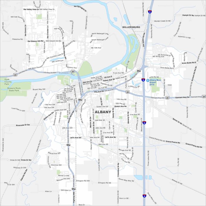
Our map of Albany shows how the city spreads across the Willamette River. Bridges link neighborhoods on both sides of the bank.
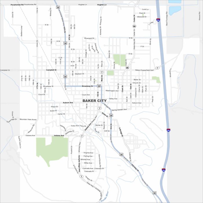
See the highways, streets, and open park areas in this map. Our map of Baker City highlights its position along the Powder River.
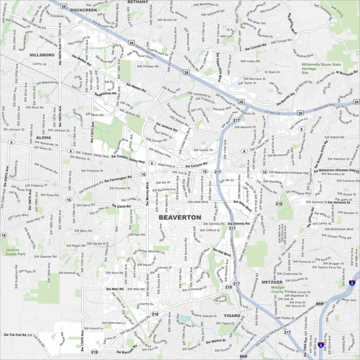
Get oriented with our Beaverton map. Close to Portland, our map shows its network of roads, parks, and railways.
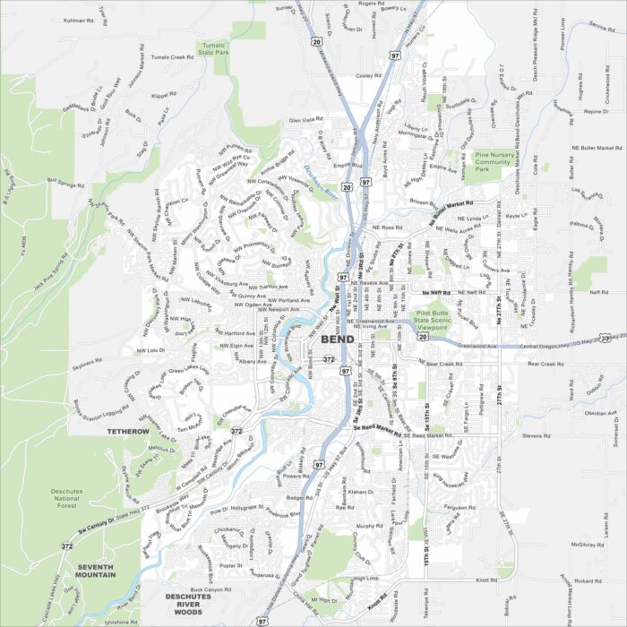
Check out Bend with our map in central Oregon. The Deschutes River, parks, and nearby mountains shape the layout.
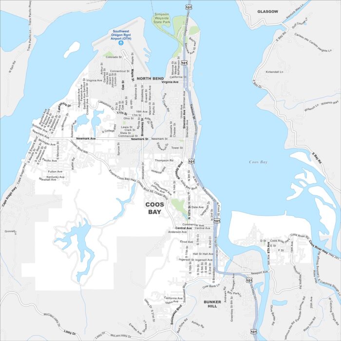
See our Coos Bay map with its streets, highways, and harborfront. This coastal city is Oregon’s largest along the Pacific.
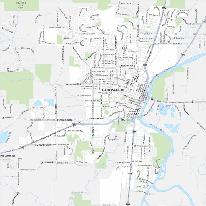
Our map of Corvallis outlines the streets, highways, and the Willamette River. It’s home to Oregon State University with college life.
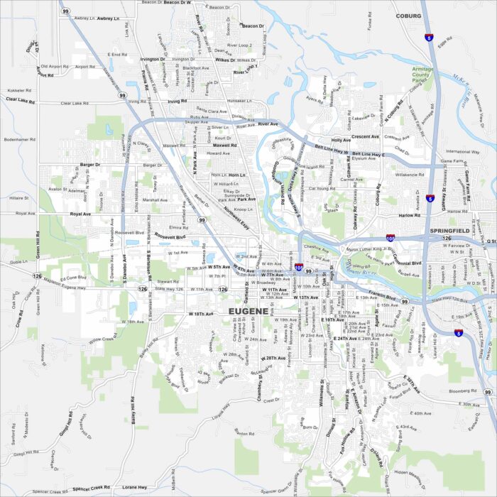
Our map of Eugene shows the city along the Willamette River. The foothills are on nearly every side with I-5 and I-105 as the main highways.
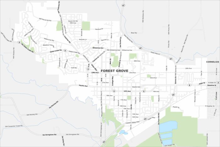
Explore our map of Forest Grove west of Portland. Vineyards and farmland surround the city on all sides. The backdrop is the Coast Range.
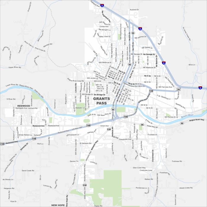
Take a look at Grants Pass, Oregon, along the Rogue River. Our map reveals interstates, roads, rivers and green spaces.
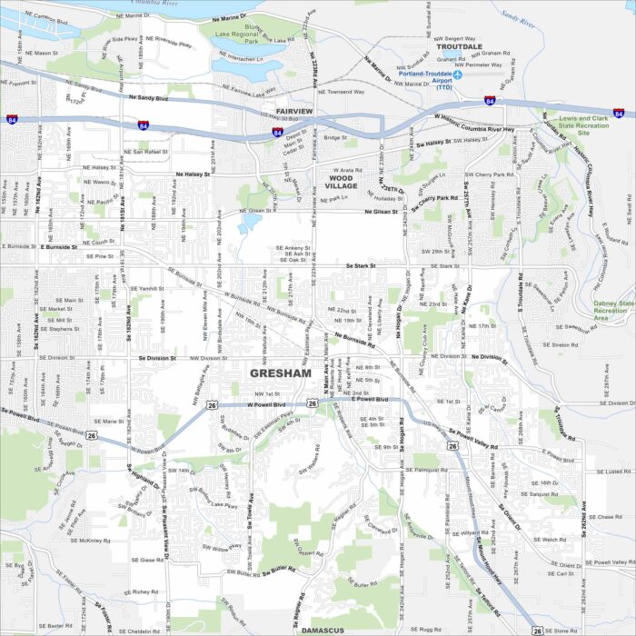
Our map of Gresham places it east of Portland. The layout spreads toward the Columbia River Gorge. Residential areas fill most of the city.