Map of Midwest City, Oklahoma
Our map of Midwest City highlights its suburban layout just east of Oklahoma City. Tinker Air Force Base is a defining feature.
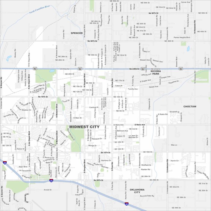
Our map of Midwest City highlights its suburban layout just east of Oklahoma City. Tinker Air Force Base is a defining feature.
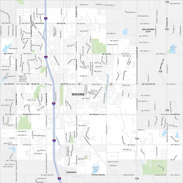
Check out Moore, Oklahoma with our road map. It fills the space between Oklahoma City and Norman, with major highways crossing through.
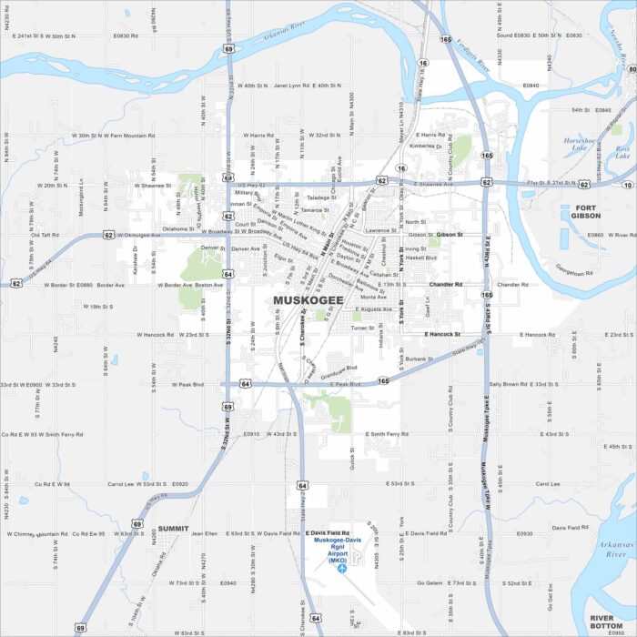
Get to know Muskogee by checking our map of eastern Oklahoma. It sits at the confluence of the Arkansas, Verdigris, and Grand Rivers.
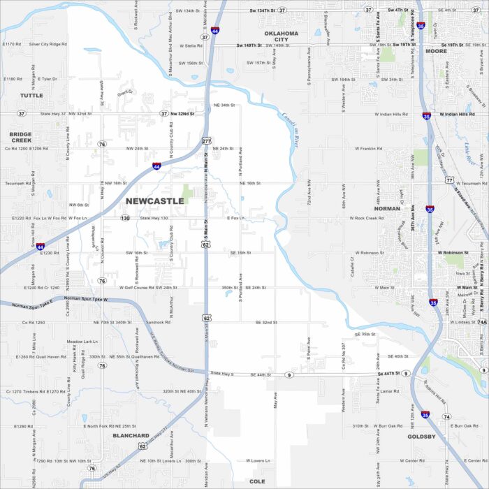
Newcastle lies just southwest of Oklahoma City. This map shows the Canadian River, highways, and open farmland.
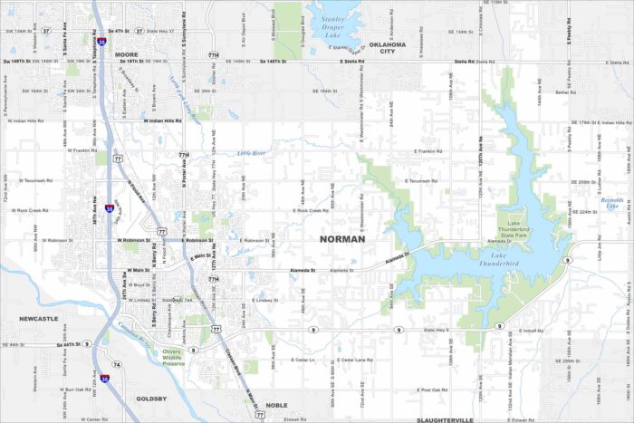
Norman is home to the University of Oklahoma. Our map shows the downtown area stretching outward to Lake Thunderbird in the east.
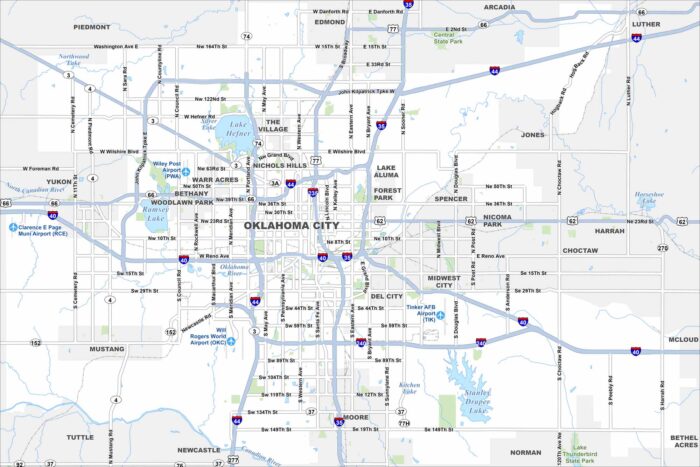
Oklahoma City stretches across the central plains with a wide urban layout. Use our map to see its downtown, parks, and major highways.
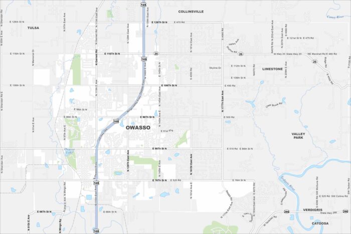
Our map of Owasso highlights a fast-growing suburb north of Tulsa. This map includes residential neighborhoods, ponds and highways.
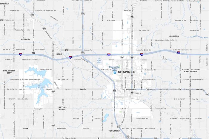
Our Shawnee map helps you get around the city. Shawnee blends Native American heritage, Route 66 landmarks, and a small-town feel.
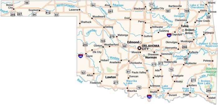
Oklahoma is wide horizontally with its mix of prairie, hills, and open sky. Our map displays its long highways past lakes and small towns.
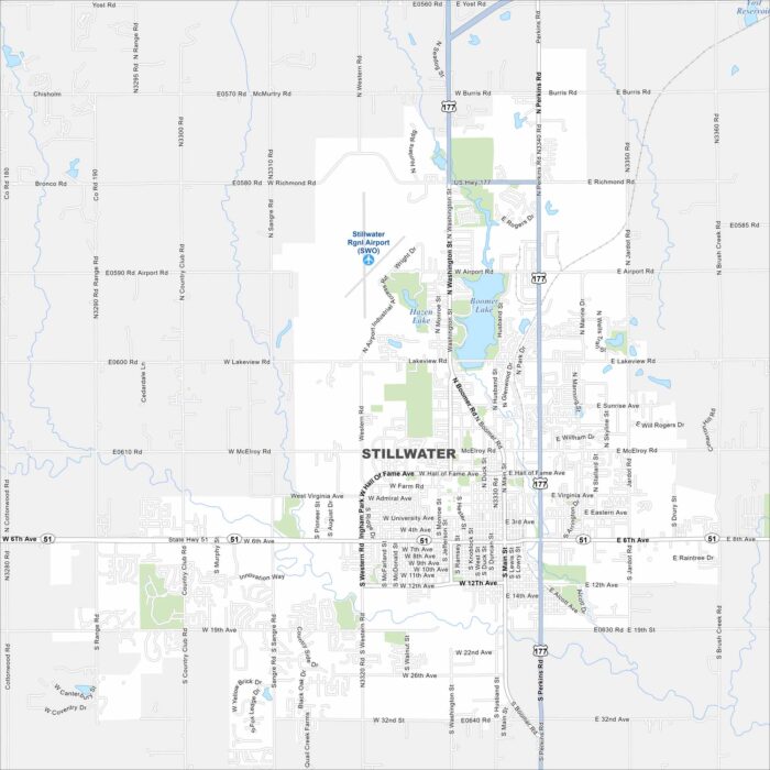
Our map of Stillwater shows the home of Oklahoma State University. Football games and campus life bring the town together.
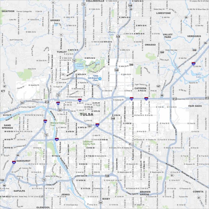
We’ve mapped out every major road in Tulsa. From the Arkansas River to Art Deco downtown, it’s a city with deep energy roots.
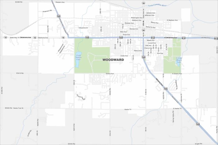
Here’s our map of Woodward, situated in northwestern Oklahoma. The city is a gateway to the Great Plains and outdoor recreation.
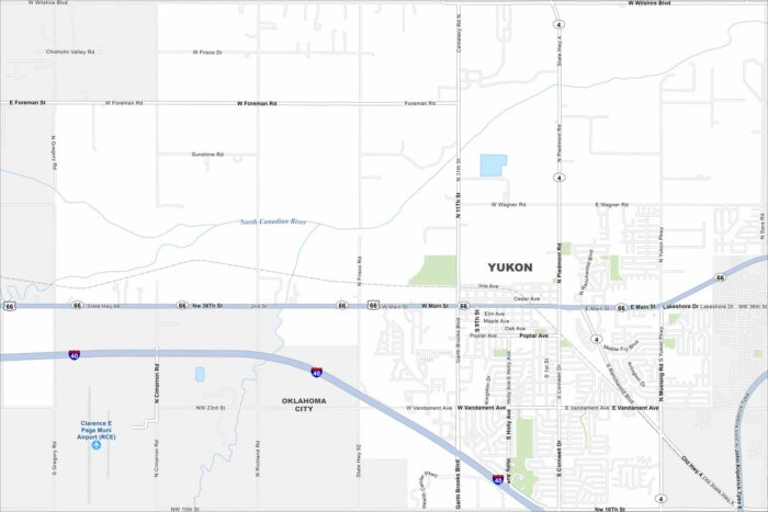
See the streets of Yukon, a city along historic Route 66. It’s just minutes from Oklahoma City but keeps its small-town look and feel.