Map of Cincinnati, Ohio
Our map of Cincinnati shows highways, city streets, and the Ohio River curving along downtown. It’s nicknamed the “Queen City”.
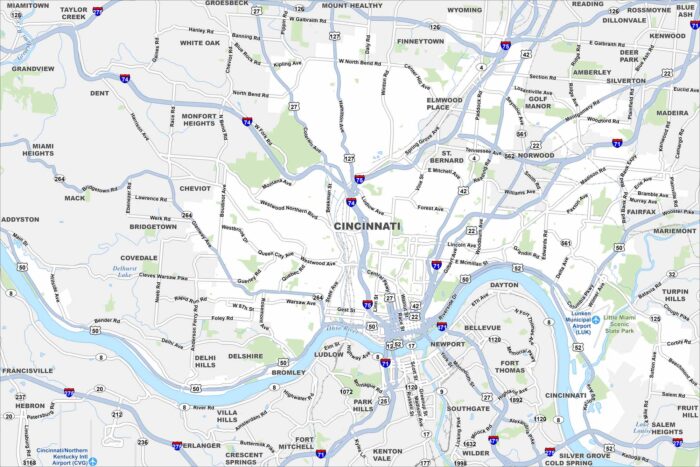
Our map of Cincinnati shows highways, city streets, and the Ohio River curving along downtown. It’s nicknamed the “Queen City”.
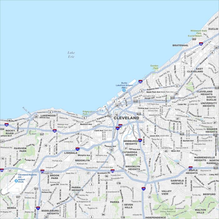
Our map of Cleveland follows the Cuyahoga River as it snakes into Lake Erie. On the south shore of Lake Erie, it has a waterfront setting.
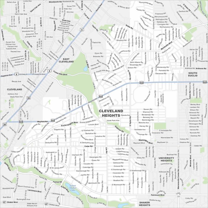
Cleveland Heights spreads east of downtown. Its elevation changes give the city its name. See it on our map of Cleveland Heights.
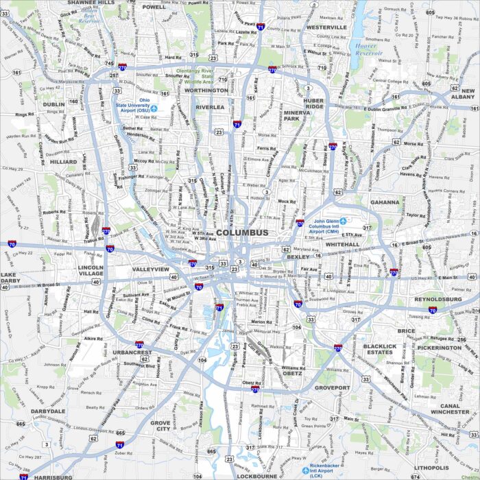
See Columbus on our map with its highways, roadways, and river crossings. The city, Ohio’s capital, spreads across the Scioto River.
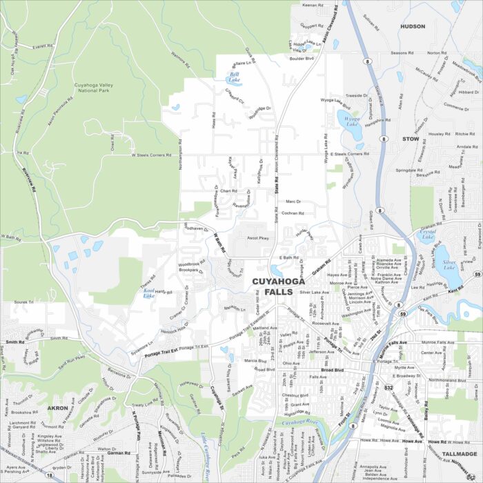
See the mapped streets, highways, and river crossings in Cuyahoga Falls. This city grew around the Cuyahoga River.
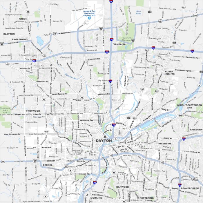
Take a look at Dayton with its mapped roads, highways, and the Great Miami River. The city is known for aviation history and innovation.
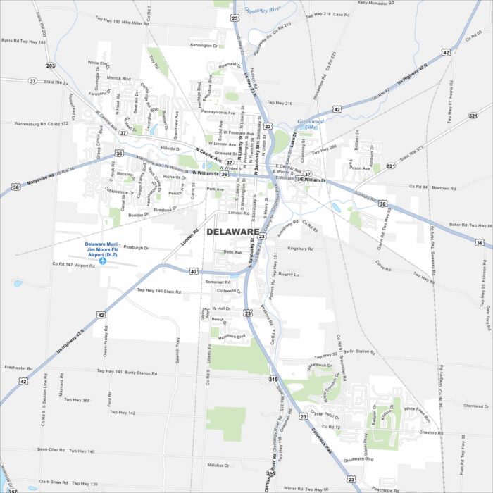
Our map of Delaware shows the Olentangy River as the main waterway. Streets travel out from a historic downtown square.
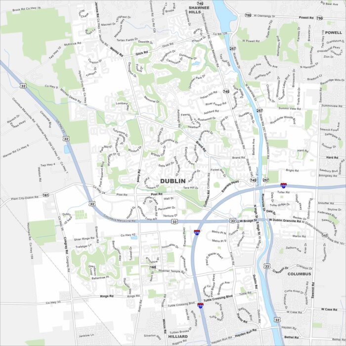
Dublin sits along the Scioto River northwest of Columbus. This map shows residential streets, greenbelt parks, and a riverfront district.
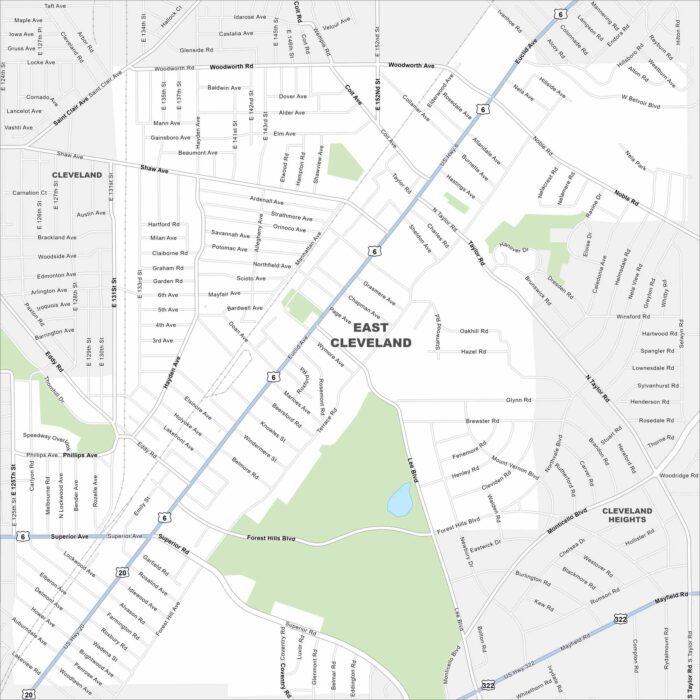
East Cleveland sits close to Lake Erie. On the map, you’ll see it bordered by Cleveland’s east side and major roadways.
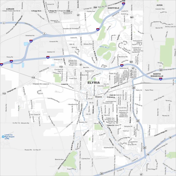
Our map of Elyria shows I-80 and I-90 running just north of the city. The Black River cuts through its center in two branches (west and east).
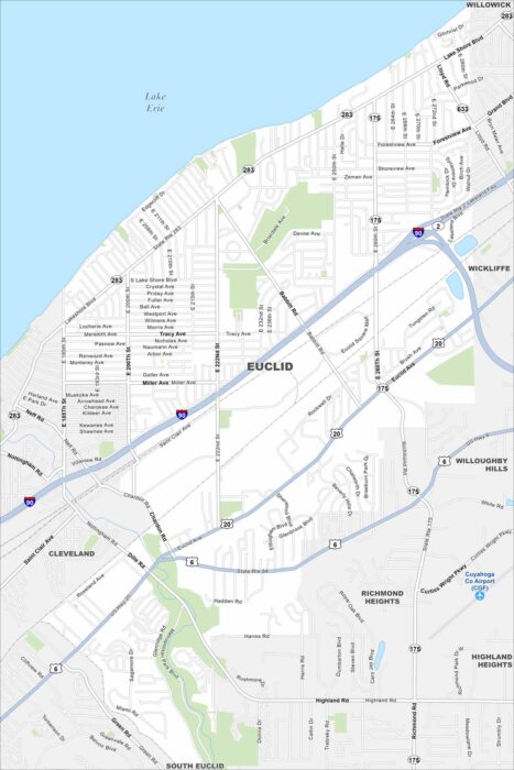
Euclid is right on the shore of Lake Erie, east of Cleveland. The highways and streets runs straight into the lakefront.
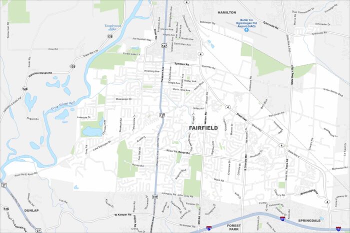
Fairfield is north of Cincinnati in southwest Ohio. The Great Miami River runs along its edge. That river gives the city its western boundary.
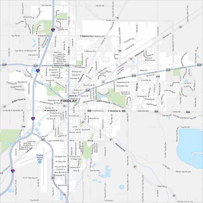
Findlay is on the banks of the Blanchard River in northwest Ohio. The river curves through the downtown area.
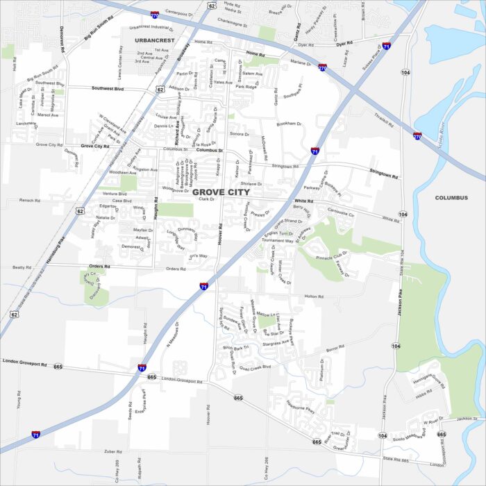
Grove City is in central Ohio. It’s located just south of Columbus. Interstates 71 and 270 connect it into the region.
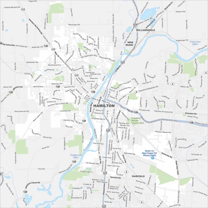
Hamilton sits along the Great Miami River in southwestern Ohio. Our map shows the river bending right through downtown.