New Mexico Outline Map
New Mexico forms a mostly rectangular shape with only slight border shifts. Our outline map of New Mexico displays this rectangular state.

New Mexico forms a mostly rectangular shape with only slight border shifts. Our outline map of New Mexico displays this rectangular state.
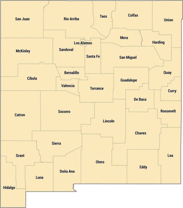
There are 33 counties across New Mexico’s deserts, mountains, and mesas. Northern counties reach all the way into the Rockies.
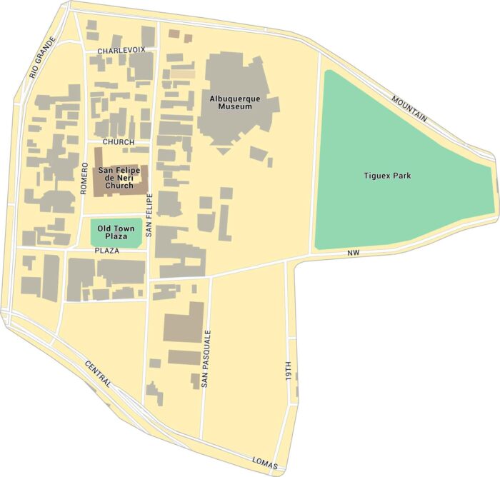
Old Town Albuquerque lies just west of downtown, near the Rio Grande. Our map shows its streets, landmarks, and surrounding parks.
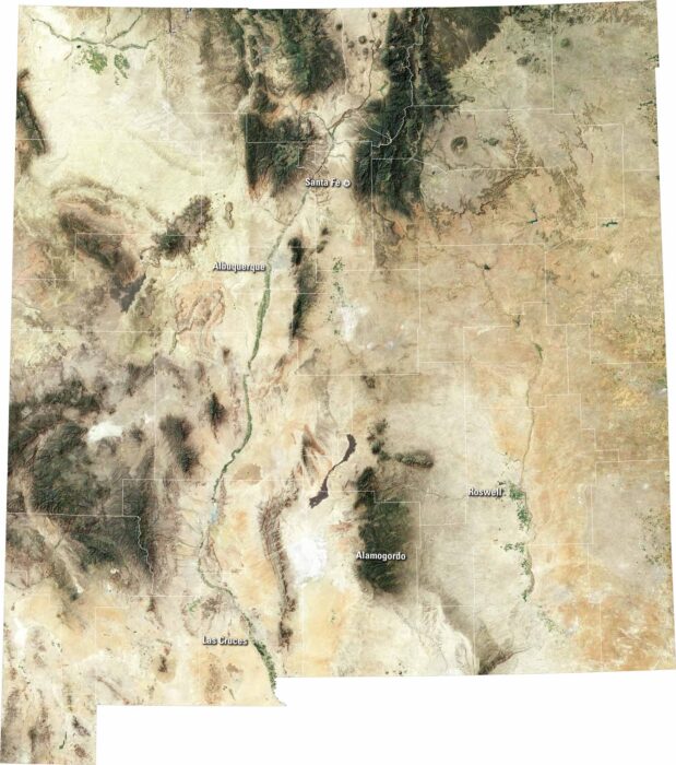
See deserts and mesas on our New Mexico satellite map. You’ll be able to spot Albuquerque, Santa Fe, and Las Cruces on our map.
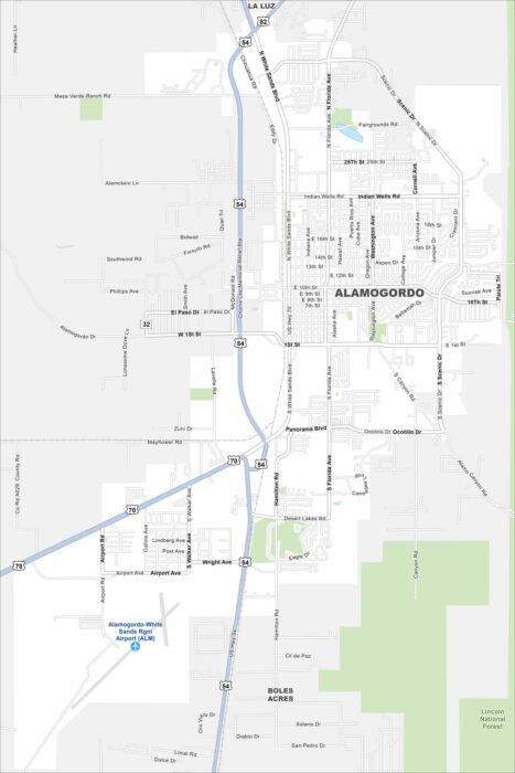
Alamogordo is a desert city next to the Sacramento Mountains. Our map shows its streets traveling out under wide skies.
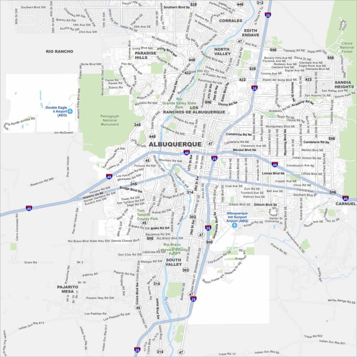
Albuquerque is a desert city in New Mexico. Highways stretch across mesas and the Rio Grande cuts right through the middle.
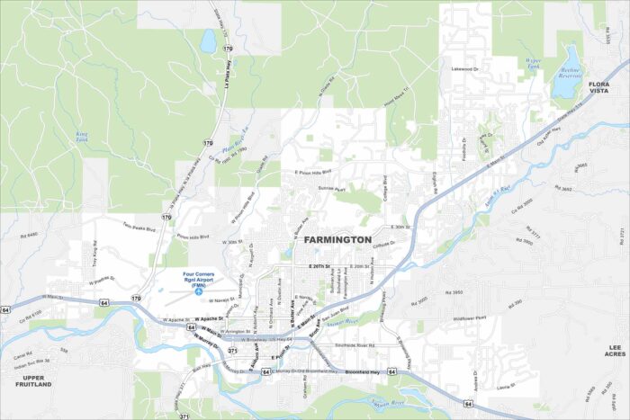
Farmington sits where the San Juan, Animas, and La Plata rivers meet. High desert terrain surrounds the city with mesas and open land.
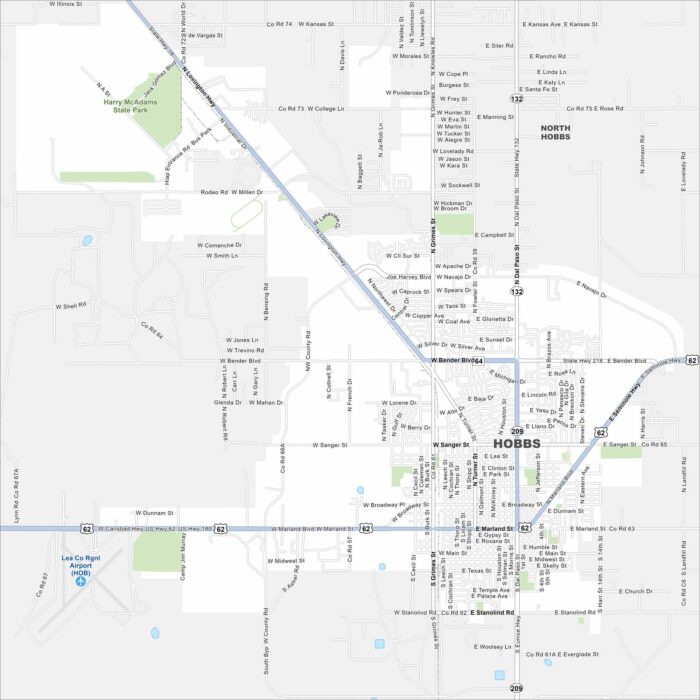
Check out our map of Hobbs near the Texas border. The grid of roads spreads into open plains and oil fields.
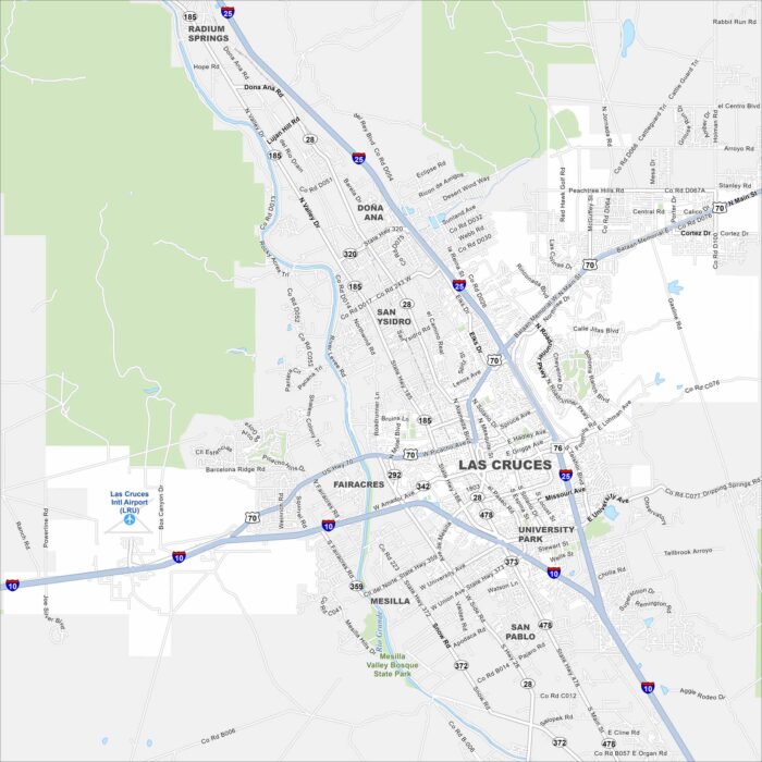
Our map of Las Cruces shows the city spread beneath the Organ Mountains. The Rio Grande winds past the west side.
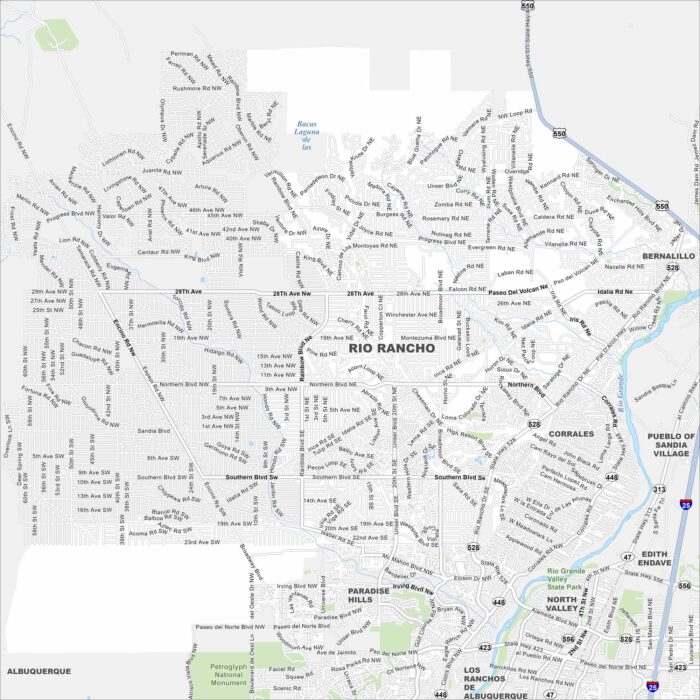
Our map of Rio Rancho shows neighborhoods and roads across the growing city. It also shows how highways link it directly to Albuquerque.
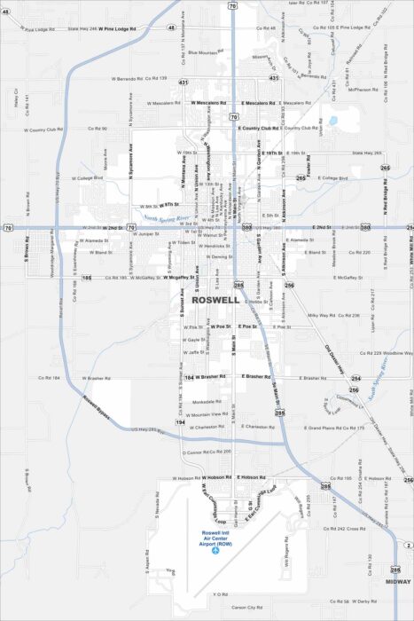
Our Roswell map puts downtown and the museum district front and center. It shows key roads and how the city connects to the desert beyond.
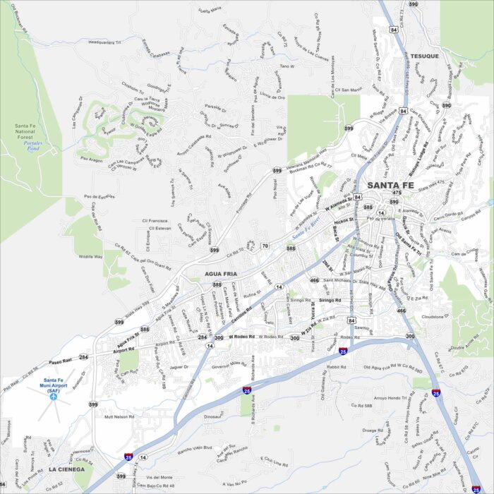
Get to know Santa Fe, New Mexico with our map. From adobe plazas to Canyon Road’s galleries, it’s a city steeped in art and history.
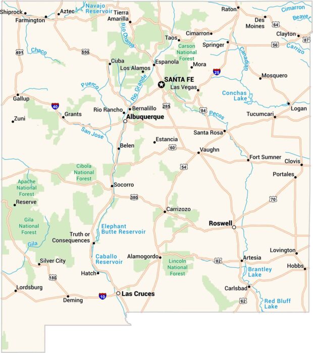
Our map of New Mexico feels wide open, like the land itself. Santa Fe sits high and calm, while Roswell keeps its mystery.