Map of Point Pleasant Borough, New Jersey
Point Pleasant borough lies along the Manasquan River. Our map makes the shore, boardwalk, and neighborhood streets easy to follow.
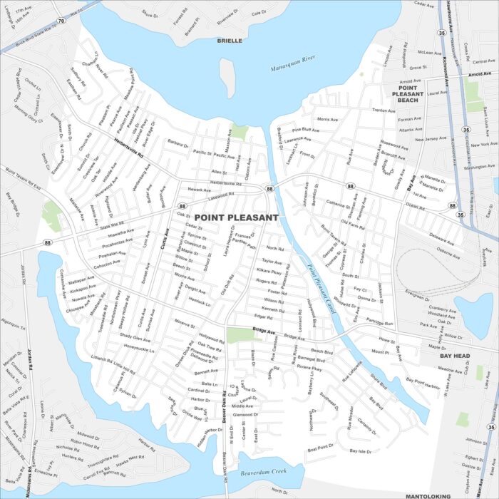
Point Pleasant borough lies along the Manasquan River. Our map makes the shore, boardwalk, and neighborhood streets easy to follow.
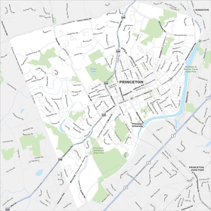
Home to Princeton University, the town has an Ivy League atmosphere. Our map shows the historic campus alongside the busy downtown streets.
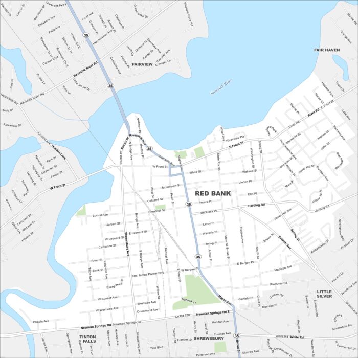
Red Bank sits along the Navesink River and is known for its music scene. Our map highlights the small downtown and riverside streets.
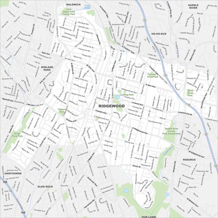
Here’s our road map of Ridgewood highlighting the downtown and surrounding streets. You can see the railway and parks on the map.
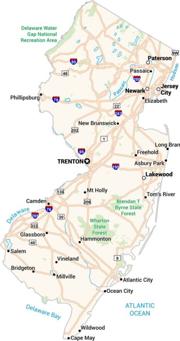
New Jersey might be small in size, but our map shows how packed it really is. Highways twist past cities like Newark and Jersey City.
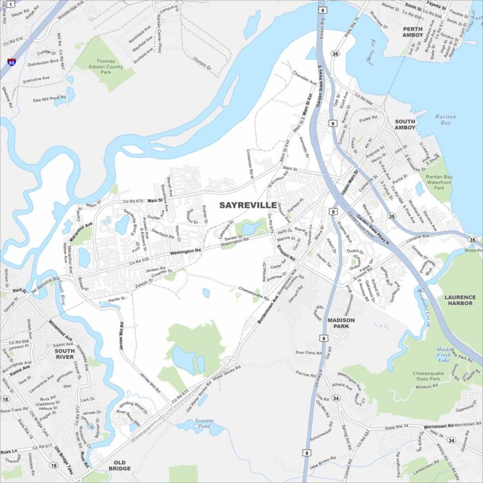
Here’s our map of Sayreville. It’s a central New Jersey community along the Raritan River. Routes like US-9 connect easily to nearby towns.
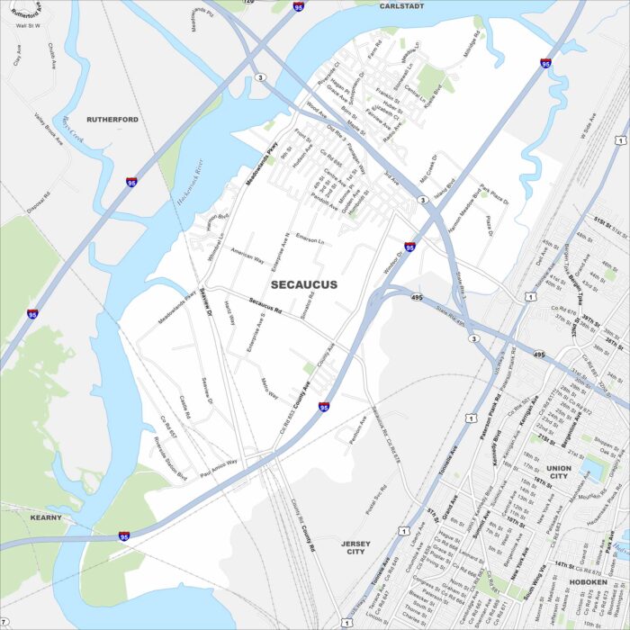
Check out our map of Secaucus, New Jersey. Just across the river from Manhattan, it’s a hub of parks, shopping, and easy commuter routes.
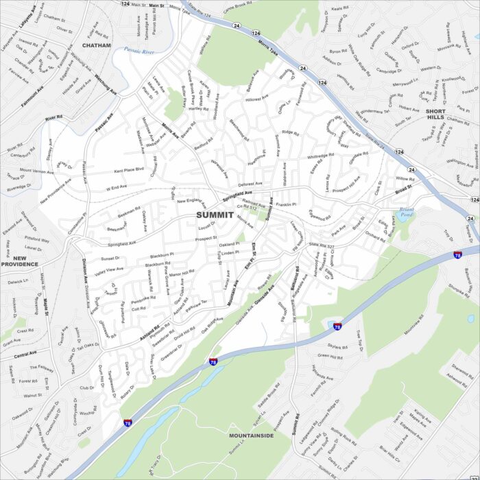
Our map of Summit shows this suburban city near New York. Its train line, downtown shops, and quiet neighborhoods make it easy to get around.
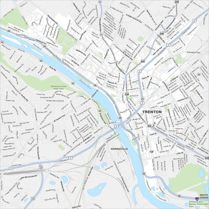
Our road map of Trenton highlights the New Jersey capital. The city is rich in Revolutionary War history and sits on the Delaware River.
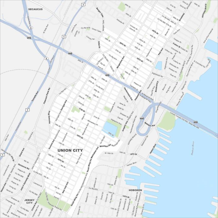
Need directions for Union City? This city is perched on the Palisades above the Hudson. Our map highlights its dense streets.
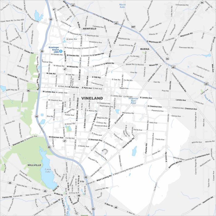
Take a look at Vineland, one of South Jersey’s largest cities. Our map shows its grid of neighborhoods, farms, and local streets.
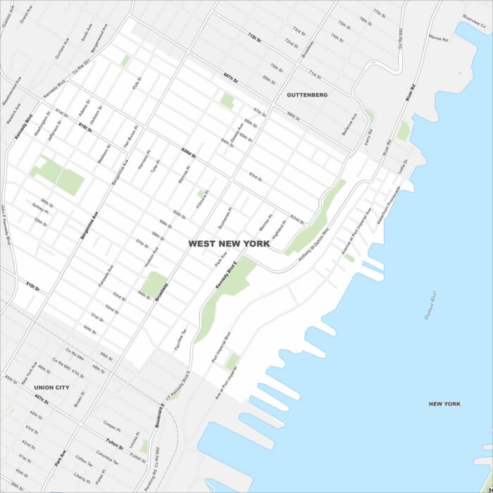
This West New York map highlights its Hudson River setting. Our map shows steep bluffs, dense streets, and Manhattan views.
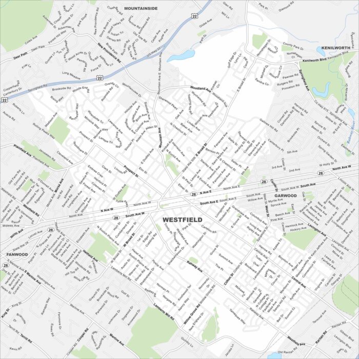
Our road map of Westfield highlights this town located in northern New Jersey. The walkable downtown is a central feature.
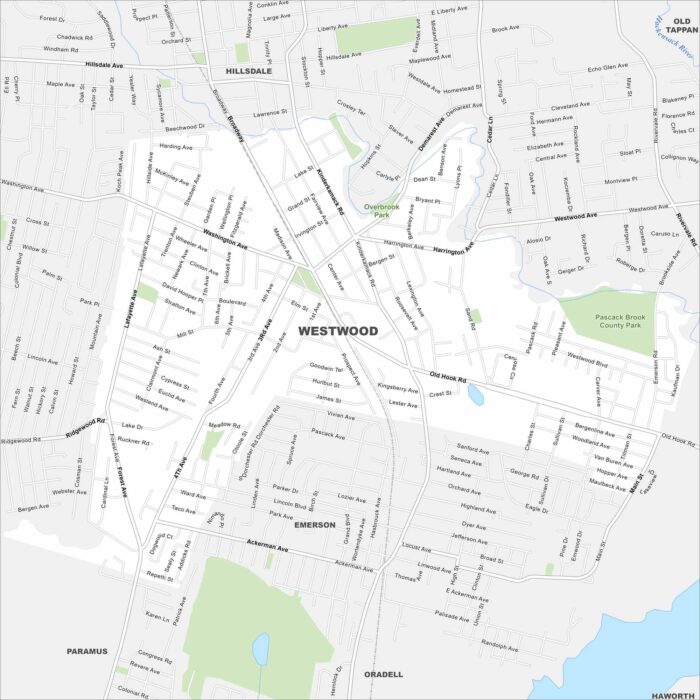
Our map of Westwood highlights this small town in Bergen County. It has a walkable downtown and nearby parks which define the borough.
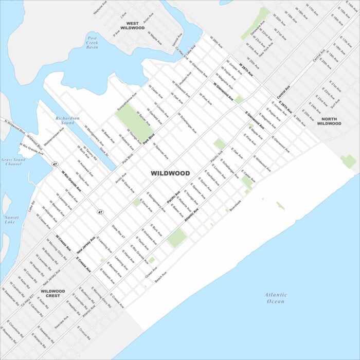
See Wildwood here on our map of this classic Jersey Shore destination. It’s a boardwalk and beach city that draws visitors every summer.