Montana Outline Map
Montana has a wide, heavy outline with only a few angled borders. Our outline map hints at just how big and open the state is.
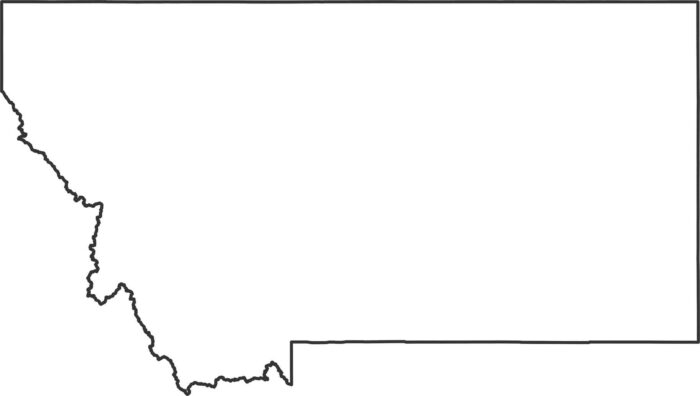
Montana has a wide, heavy outline with only a few angled borders. Our outline map hints at just how big and open the state is.
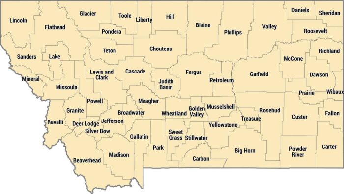
Montana keeps it real with 56 counties across Big Sky Country. Their county boundaries are defined by the Rocky Mountains and geography.
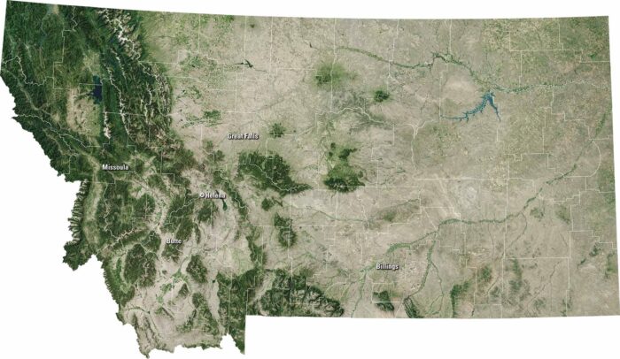
Our satellite map shows this state of open skies and rugged beauty, labeling major cities like Billings, Missoula, and Great Falls.
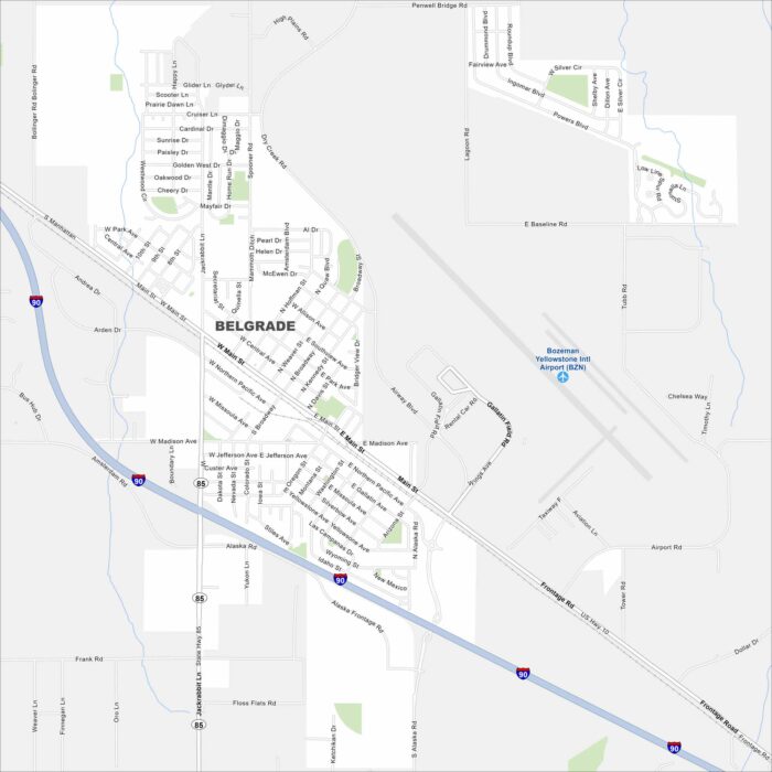
Belgrade is in southwest Montana near Bozeman. Our map highlights its roads, rivers, and parks. It’s part of the Gallatin Valley.
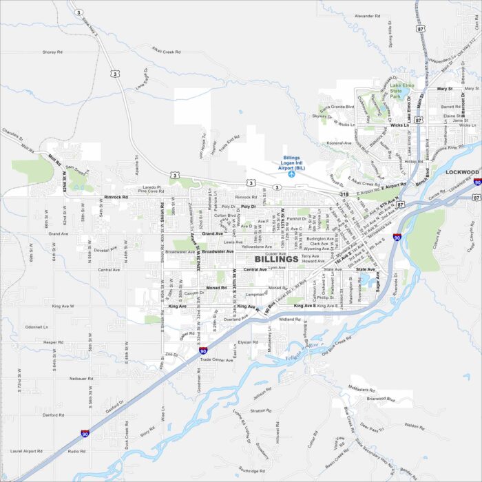
Billings is the largest city in Montana. Our map shows the Yellowstone River in the south. It also has wide roads and nearby bluffs.
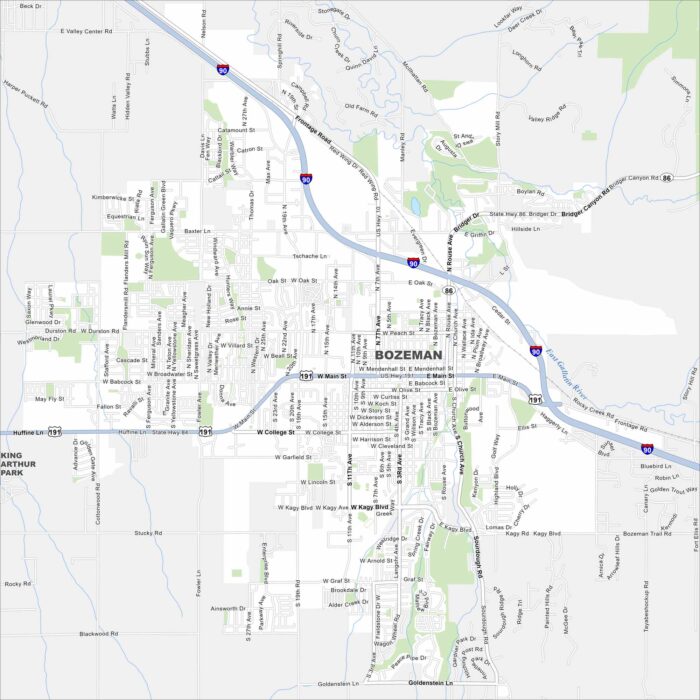
Our map of Bozeman shows its roads, parks and waterways. Mountains are on all sides. It’s a small city but feels busy with outdoor life.
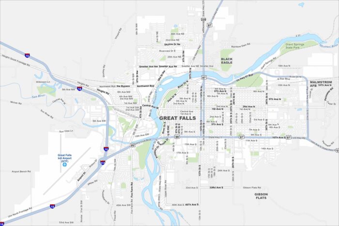
Explore our map of Great Falls, a city in central Montana. Located along the Missouri River, it shows roads, rivers and green spaces.
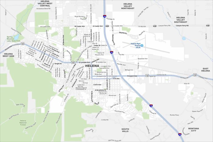
Helena sits in west-central Montana, resting against the Rocky Mountain foothills. This map highlights its mountain backdrop.
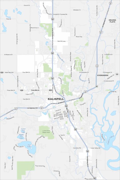
Kalispell is set in the Flathead Valley. This map shows it as a gateway to Glacier National Park. Surrounding mountains rise on every side.
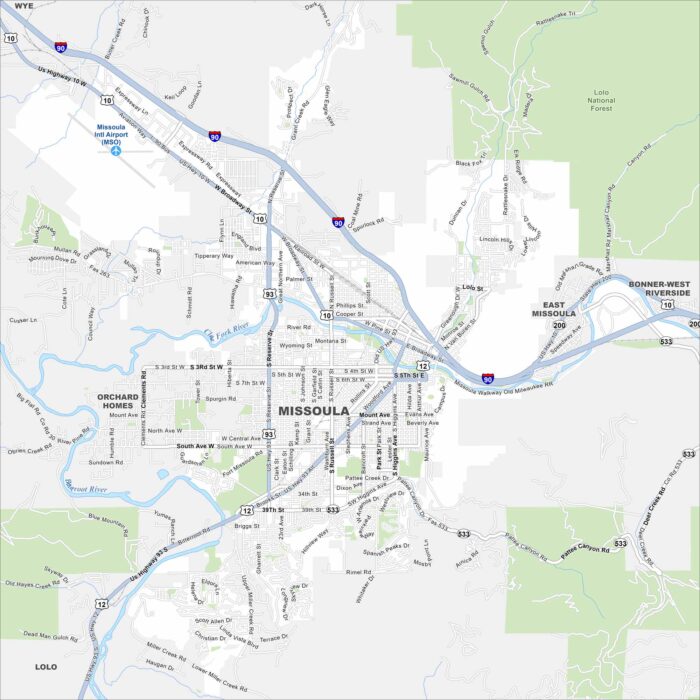
Missoula lies where five valleys meet. Our map shows the Clark Fork River winding through, with mountains enclosing the city.
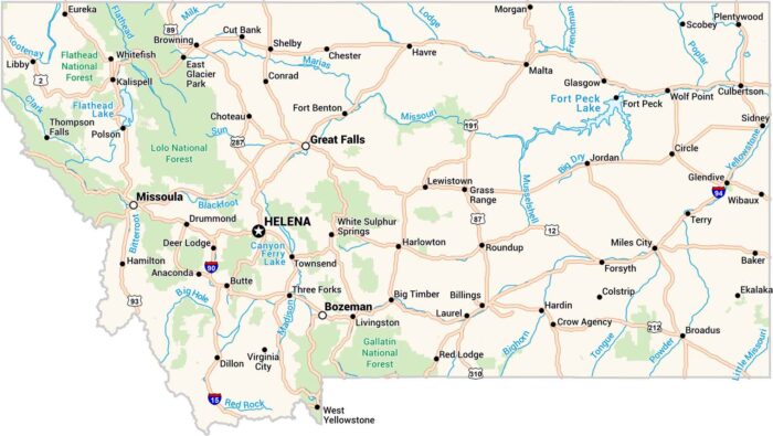
Our map of Montana stretches wide showing cities, lakes and highways. Rivers carve through the land, from the Missouri to the Yellowstone.