Map of Kansas City, Missouri
Kansas City spreads wide across the Missouri side. Our map highlights the Missouri River bending around downtown.
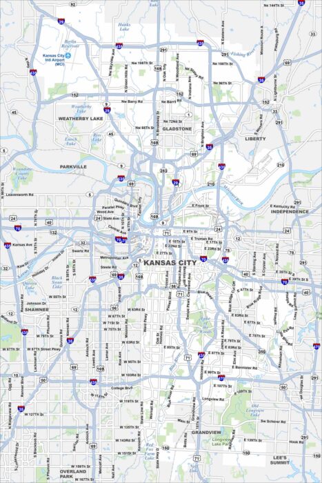
Kansas City spreads wide across the Missouri side. Our map highlights the Missouri River bending around downtown.
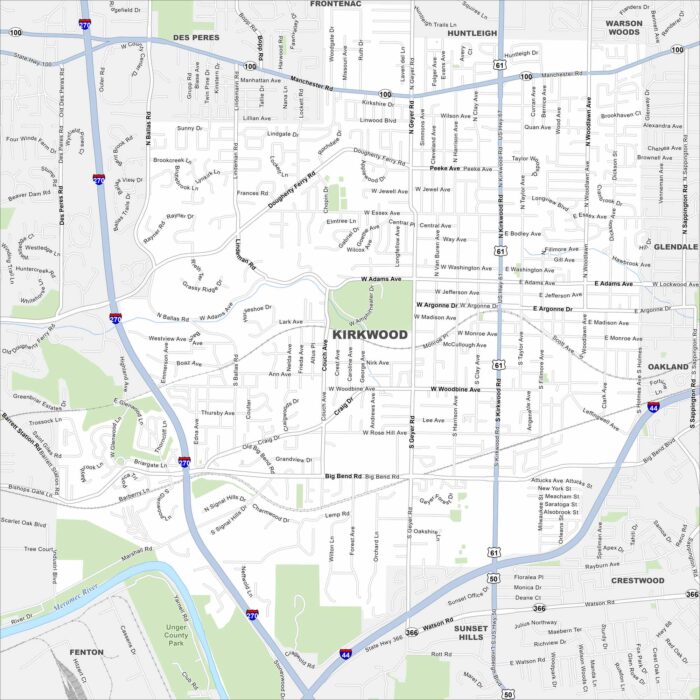
Our map of Kirkwood shows a leafy suburb west of St. Louis. Railroad tracks cut through the heart of downtown.
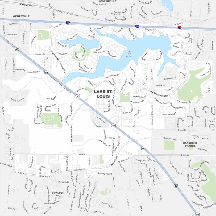
Our Lake St. Louis map shows the twin lakes that give the city its name. Neighborhoods wrap around the shoreline in sweeping curves.
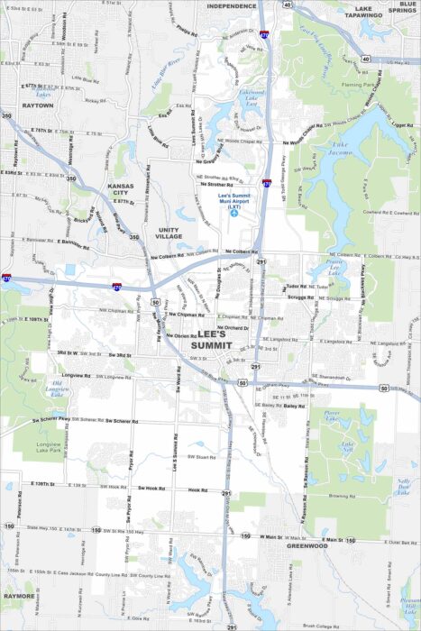
Our map of Lee’s Summit highlights lakes scattered across the city. The setting mixes open land with residential growth.
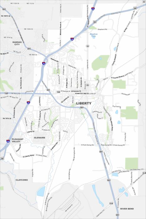
Liberty lies just northeast of Kansas City. The map shows its streets at the center. Surrounding it, neighborhoods fan outward.
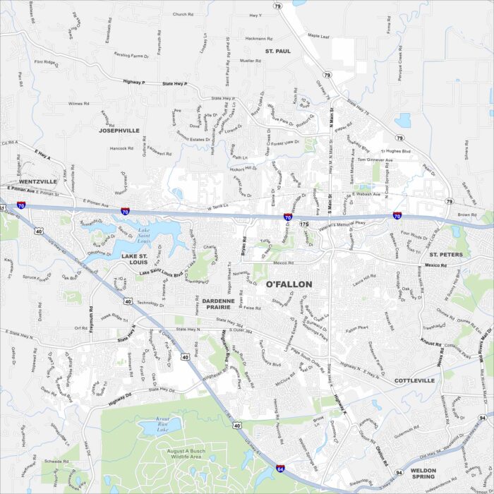
O’Fallon sits west of St. Louis in St. Charles County. Our map shows residential areas, parks, and highways crossing through.
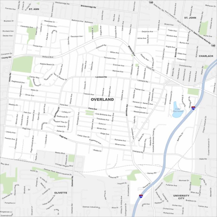
Check out Overland just west of St. Louis. This map highlights residential neighborhoods, parks, and busy roadways.
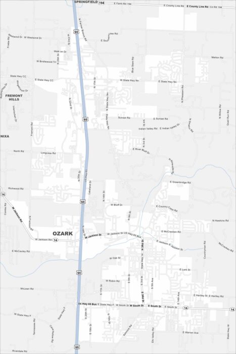
Our map of Ozark shows this city, located between Springfield and Branson. Suburban neighborhoods spread across rolling hills.
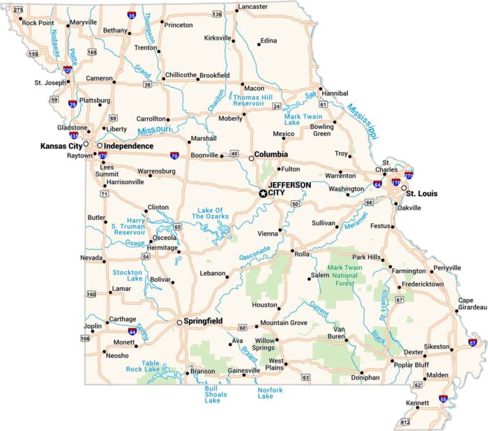
Missouri sits where the Midwest meets the South. Our map shows its rivers, highways, and growing cities like St. Louis and Kansas City.
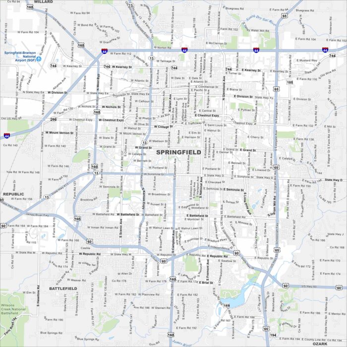
Our Springfield Missouri map highlights a city often called the “Queen City of the Ozarks”. Find its downtown streets, parks, and highways.
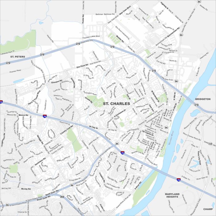
Our map of St. Charles highlights its historic Main Street district. The Missouri Riverfront and old brick buildings give the city its look.
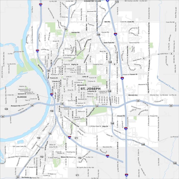
Familiarize yourself with St. Joseph, Missouri using our road and highway map. The Missouri River forms its western border.
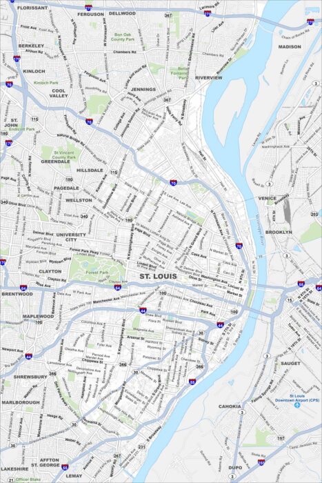
Our road map of St. Louis shows the second largest city in Missouri. The Mississippi River splits it off from Illinois to the east.
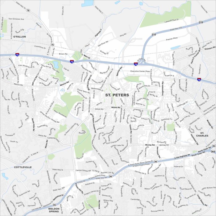
Here’s our map of St. Peters to help you get around this Missouri city. It’s known for its neighborhoods and recreational activities.
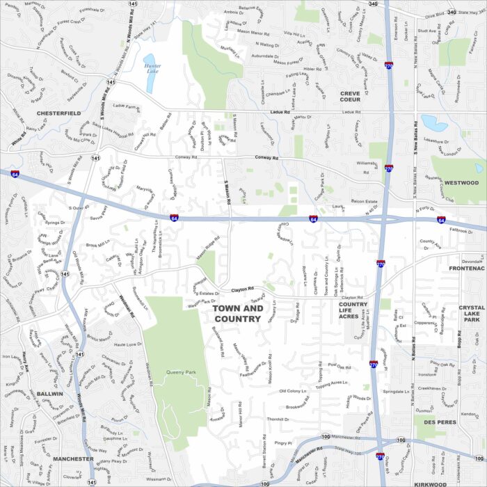
Our Town and Country map helps you explore this St. Louis suburb. Known for its green space and quiet neighborhoods, it has a rural feel.