Missouri Zip Code Map
Missouri claims zip codes from 630XX to 658XX. We’ve mapped each one from edge to edge. Nothing feels extreme. Some follow urban growth.
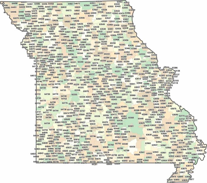
Missouri claims zip codes from 630XX to 658XX. We’ve mapped each one from edge to edge. Nothing feels extreme. Some follow urban growth.
Our map shows two big metro areas. Kansas City is situated in the west and St. Louis is in the east. Lots of small cities are between the two.
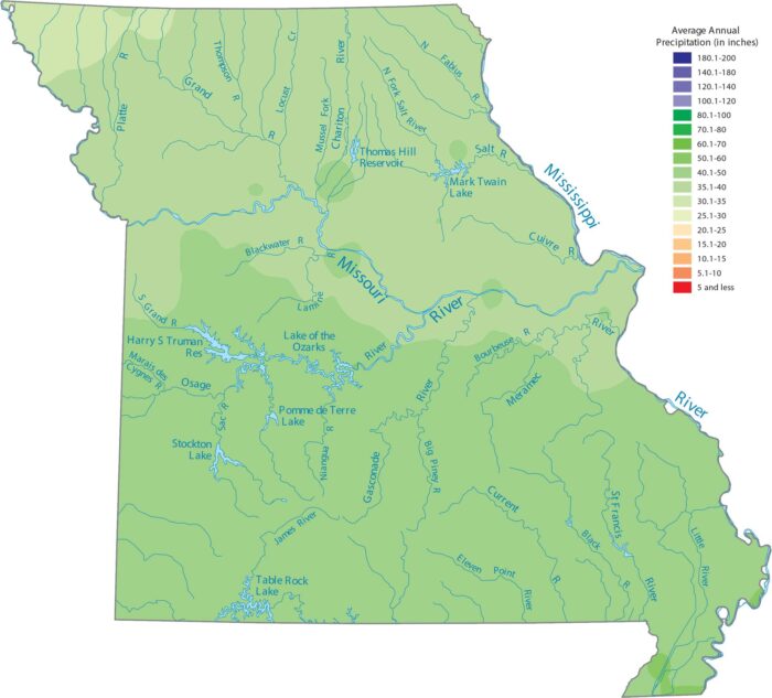
Missouri sees the most rain in the southeastern lowlands region. Our precipitation map of Missouri reflects this contrast.
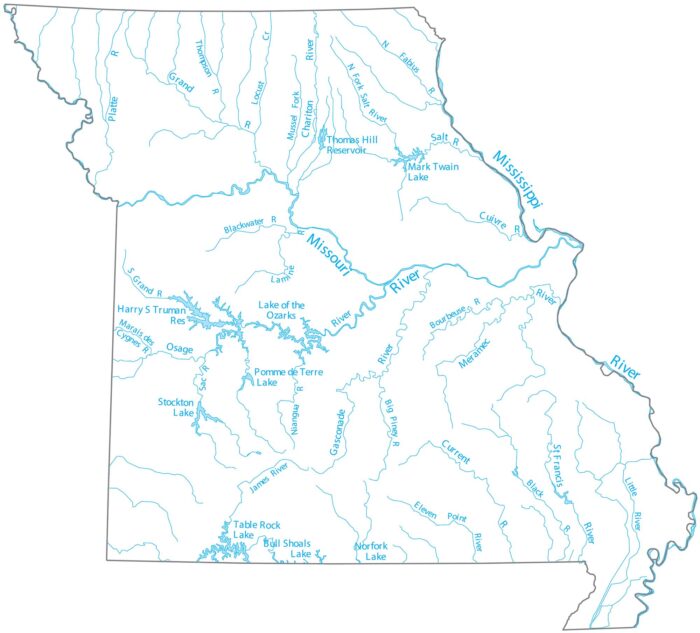
Missouri is where the Missouri River joins the Mississippi just north of St. Louis. Our map follows the Osage River and its lake system.
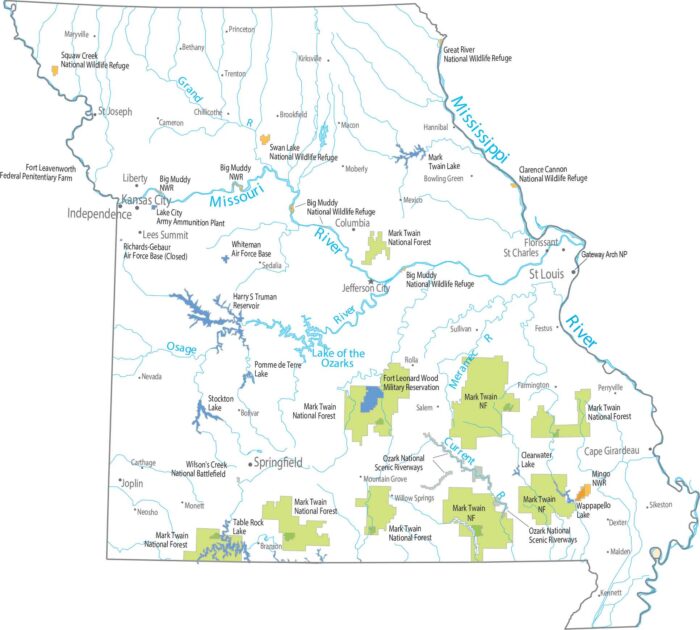
Our national forests and parks map highlights Mark Twain National Fores. The southern half is in the Ozark highlands with scattered forests.
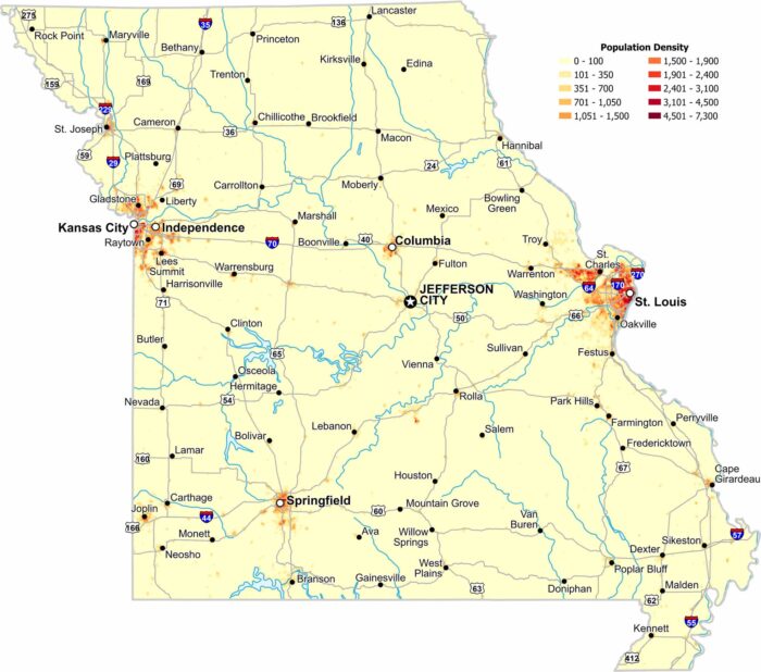
Population clusters around major metro areas like St. Louis and Kansas city. Central regions stay open with lower population density.
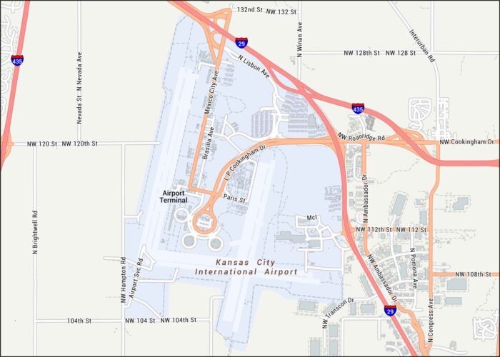
Our map of MCI Kansas City International Airport lays out the terminals, runways, and the big highway loops around them.
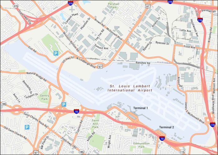
Lambert Airport is shown here with its terminals and runways. Our map gives you a view of the airport’s highways, which serves St. Louis.
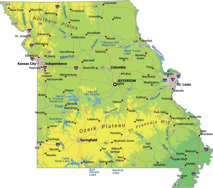
Missouri splits down the middle. There is the rugged Ozark highlands in the south. Then, everything flattens into farmland up north.

Our Missouri outline map shows how it bends around major rivers, giving it an uneven look. The Mississippi River forms the eastern border.
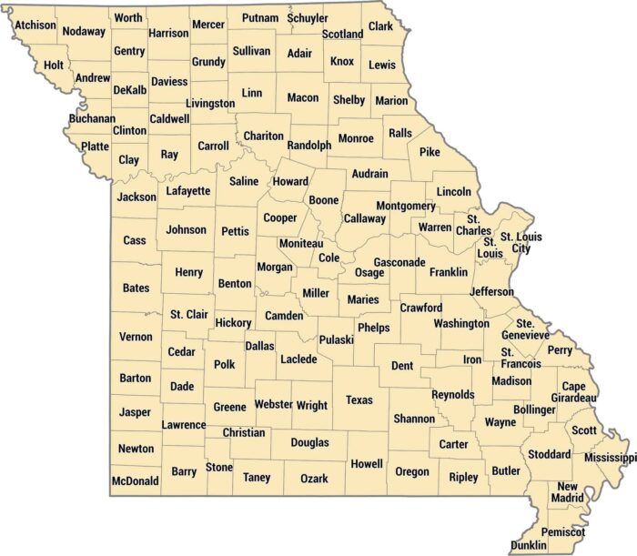
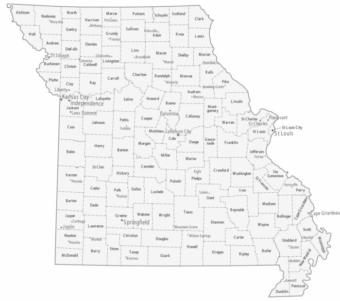
Check out our Missouri county map with its 114 counties plus St. Louis as an independent city. The Ozarks create hilly counties in the south.
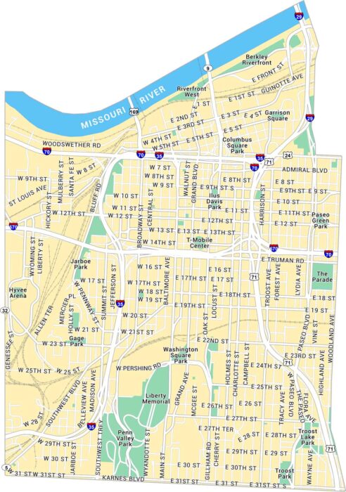
Our map of Downtown Kansas City shows this neighborhood set along the Missouri River. You’ll see parks, highways, and local routes.
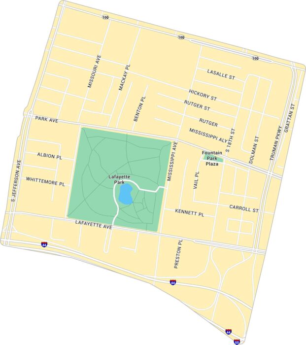
Our map of Lafayette Square shows the historic St. Louis neighborhood. It’s centered around the park with its surrounding streets.
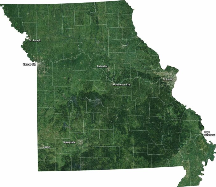
Our satellite map of Missouri displays its forests and plains that stretch across the state. You’ll see the Mississippi and Missouri Rivers.
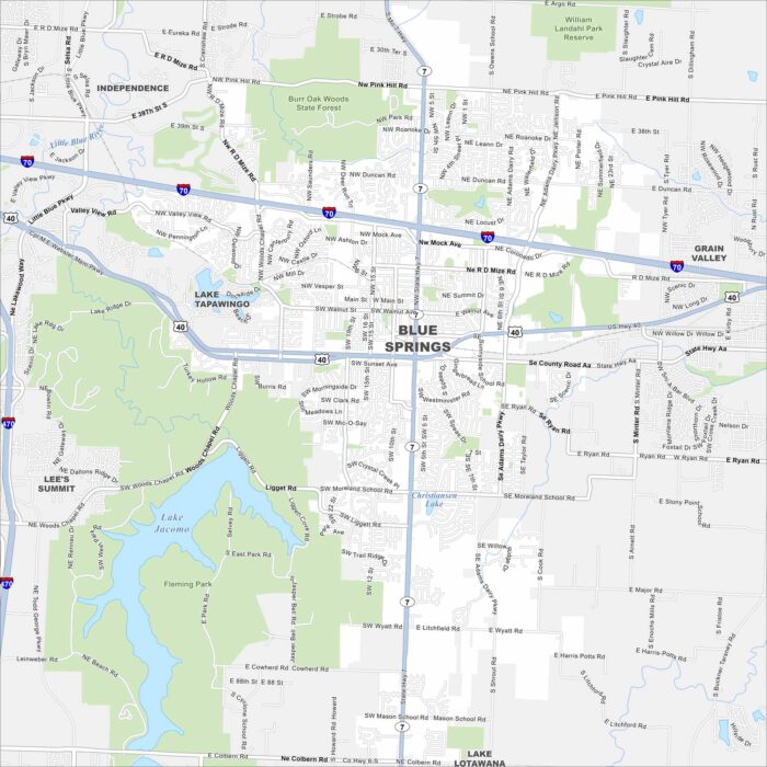
We’ve mapped out Blue Springs with its highways, streets, and nearby lakes. The roads here eventually tie into Kansas City.