Missouri Outline Map
Our Missouri outline map shows how it bends around major rivers, giving it an uneven look. The Mississippi River forms the eastern border.

Our Missouri outline map shows how it bends around major rivers, giving it an uneven look. The Mississippi River forms the eastern border.
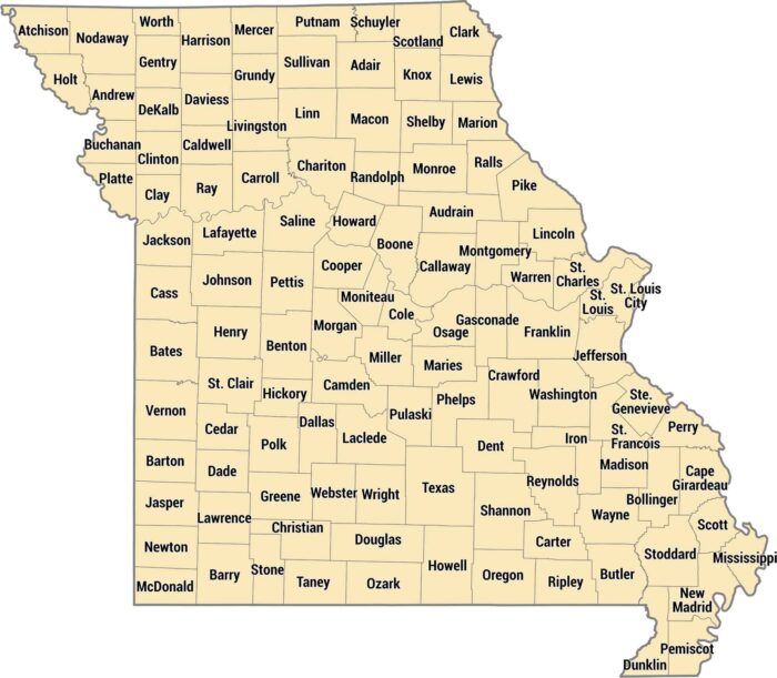
Check out our Missouri county map with its 114 counties plus St. Louis as an independent city. The Ozarks create hilly counties in the south.
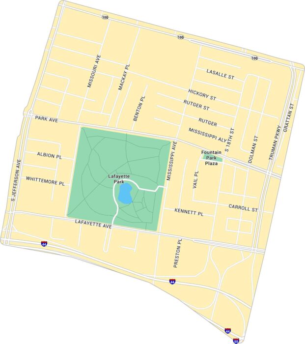
Our map of Lafayette Square shows the historic St. Louis neighborhood. It’s centered around the park with its surrounding streets.
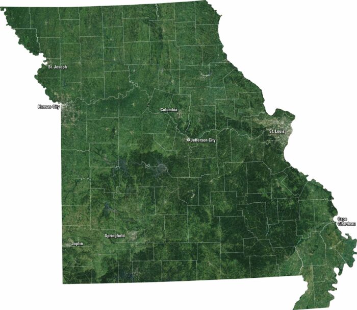
Our satellite map of Missouri displays its forests and plains that stretch across the state. You’ll see the Mississippi and Missouri Rivers.
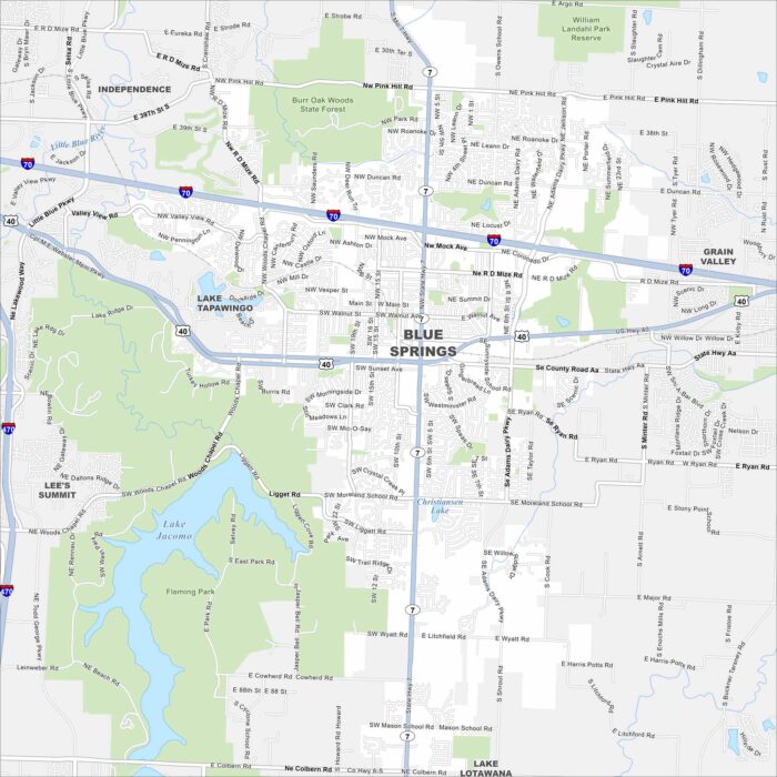
We’ve mapped out Blue Springs with its highways, streets, and nearby lakes. The roads here eventually tie into Kansas City.
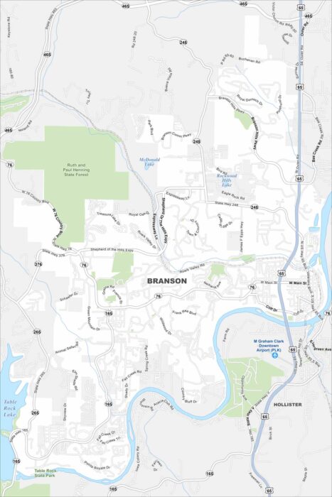
See Branson with our road map. Tourism dominates but the Ozarks give it a natural backdrop. A key feature here is Table Rock Lake.
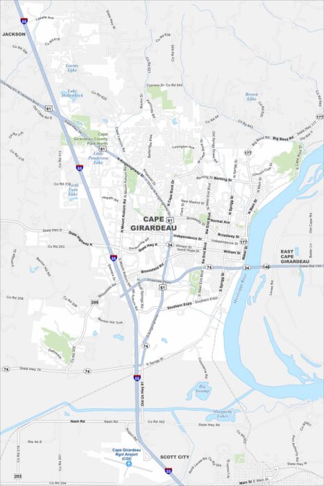
Our map of Cape Girardeau shows this city along the Mississippi River in southeast Missouri. Streets climb up from the river.
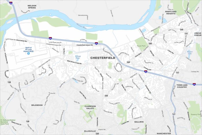
Our map of Chesterfield highlights its neighborhoods, interstates, and parkland. West of St. Louis, it stretches along the Missouri River.
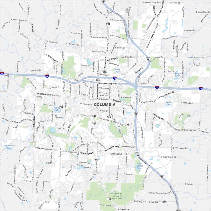
Our map of Columbia shows the layout of streets, highways, and surrounding countryside. It’s between Kansas City and St. Louis.
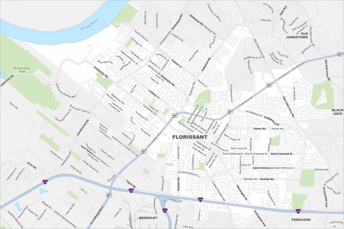
Florissant sits in north St. Louis County near the Missouri River. Residential neighborhoods spread widely across the map.
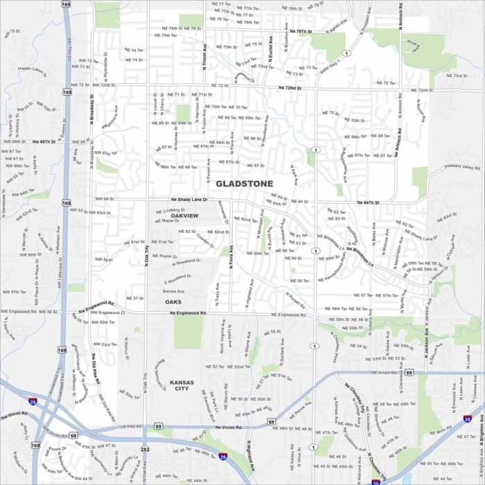
Gladstone, Missouri is a small city in the Kansas City metro. Our map shows its highways, roads, streams and local parks.
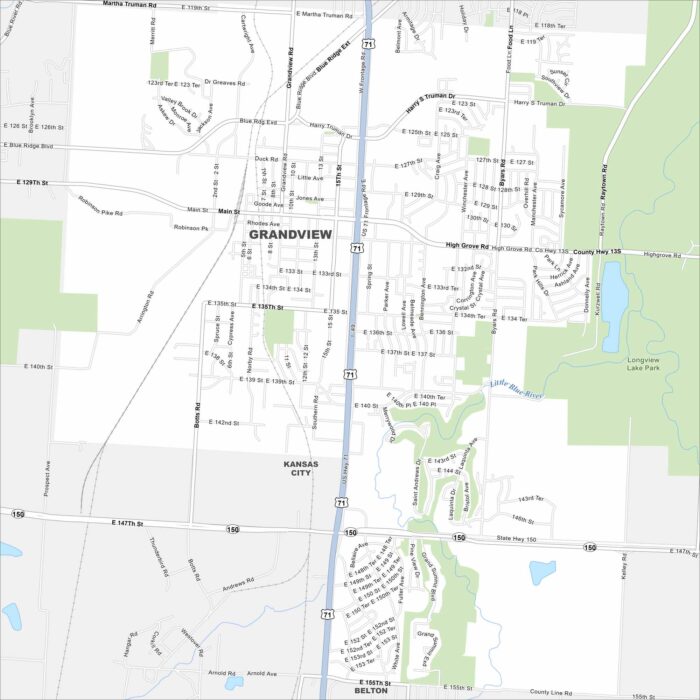
Grandview is a suburb just south of Kansas City. This map highlights its street grid, parks, and nearby highways.
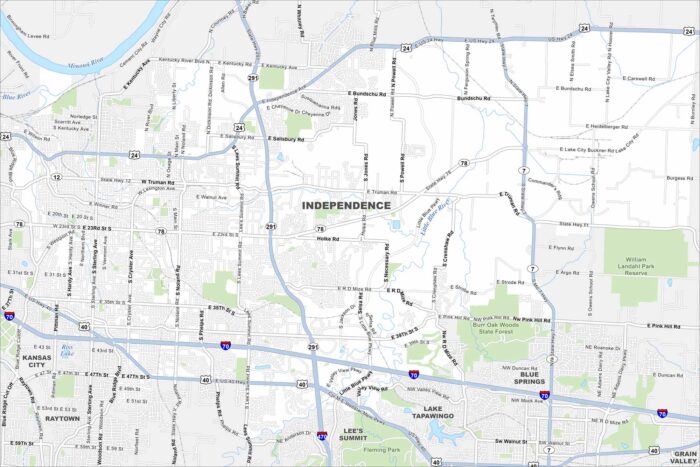
Our map of Independence shows its highways and rail lines that run through its historic center. It’s situated just east of Kansas City.
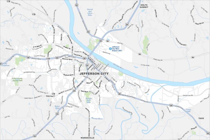
Our map of Jefferson City highlights its spot on the Missouri River. The state capitol stands out near the riverfront.
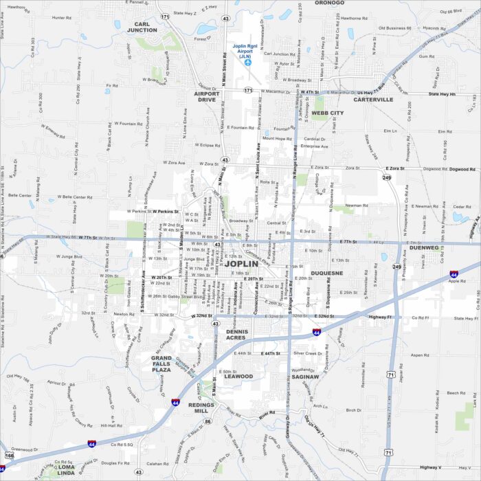
Joplin is near the meeting point of Missouri, Kansas, and Oklahoma. The map shows Interstate 44 running just south of the city.