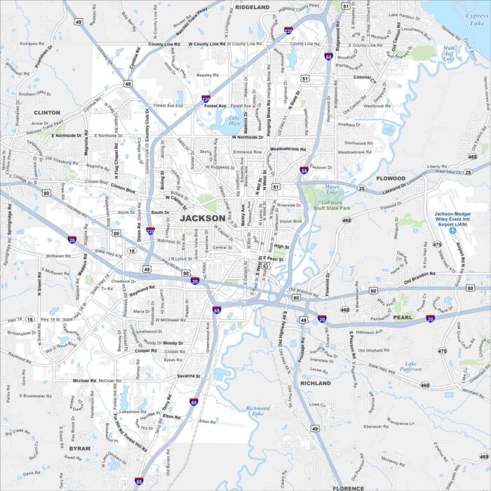
Map of Jackson, Mississippi
Jackson is centered on the Pearl River. Our map shows highways circling the city and roads. State government buildings stand near the river.
Jackson is centered on the Pearl River. Our map shows highways circling the city and roads. State government buildings stand near the river.
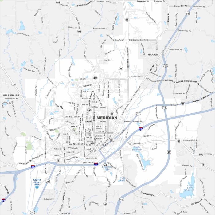
Check out Meridian with our road map. Railroads and highways converge here, shaping its layout. The city has long been a transportation hub.
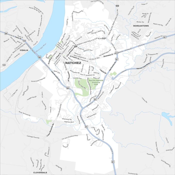
Our map of Natchez highlights a bluff city on the Mississippi River. Take a look at this map to see its downtown, riverfront and roads.
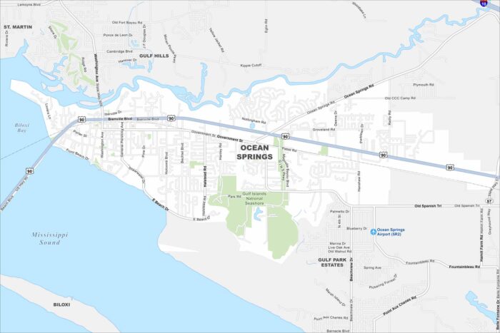
Our map of Ocean Springs outlines a Gulf Coast city east of Biloxi. Its downtown is near the water, while neighborhoods extend inland.
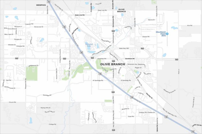
Take a look at Olive Branch just outside Memphis. Our map shows suburban neighborhoods mixed with open farmland.
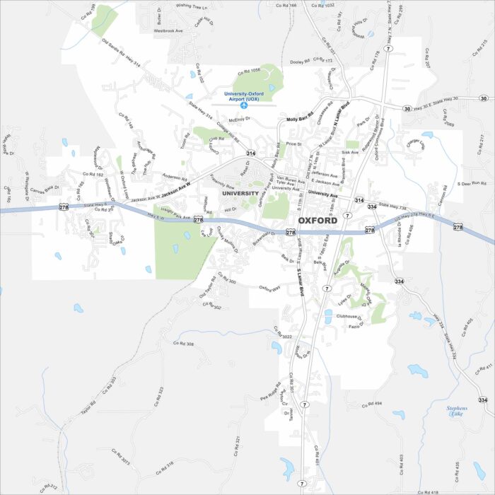
Oxford is home to the University of Mississippi. Take a look at the map to spot the central Square, neighborhoods and campus streets.
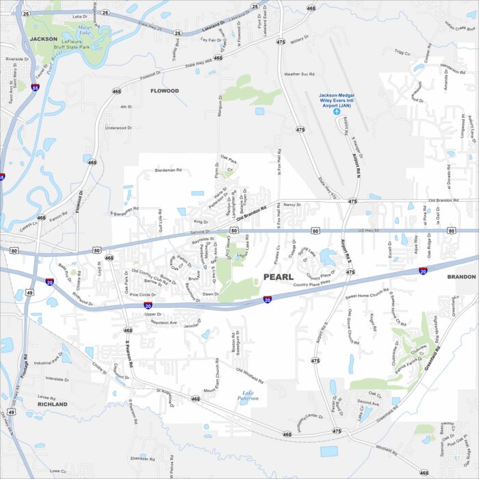
Pearl stretches along the Pearl River just east of Jackson. Our map shows neighborhoods, highways, and open green spaces.
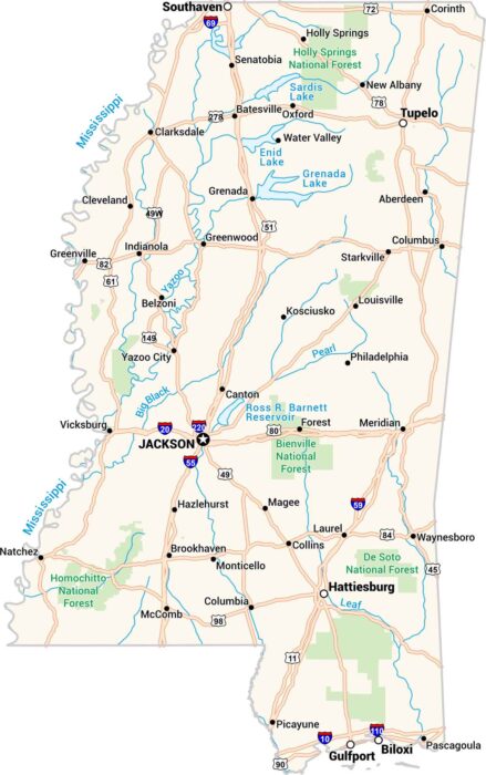
Our map of Mississippi shows every bend of the river and every small town along the way. You’ll see Jackson, Biloxi, and the Delta.
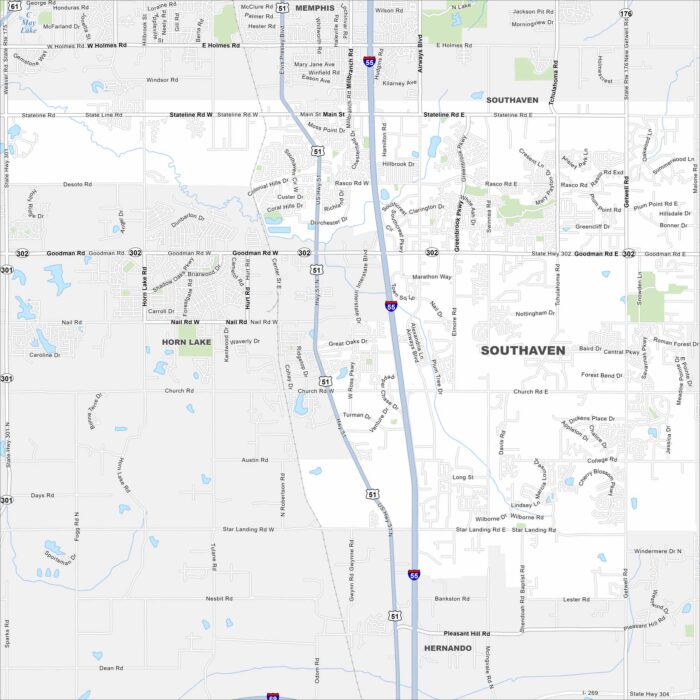
Our map of Southaven shows you around the largest suburb of Memphis. It’s a place with shopping centers, local parks, and a community feel.
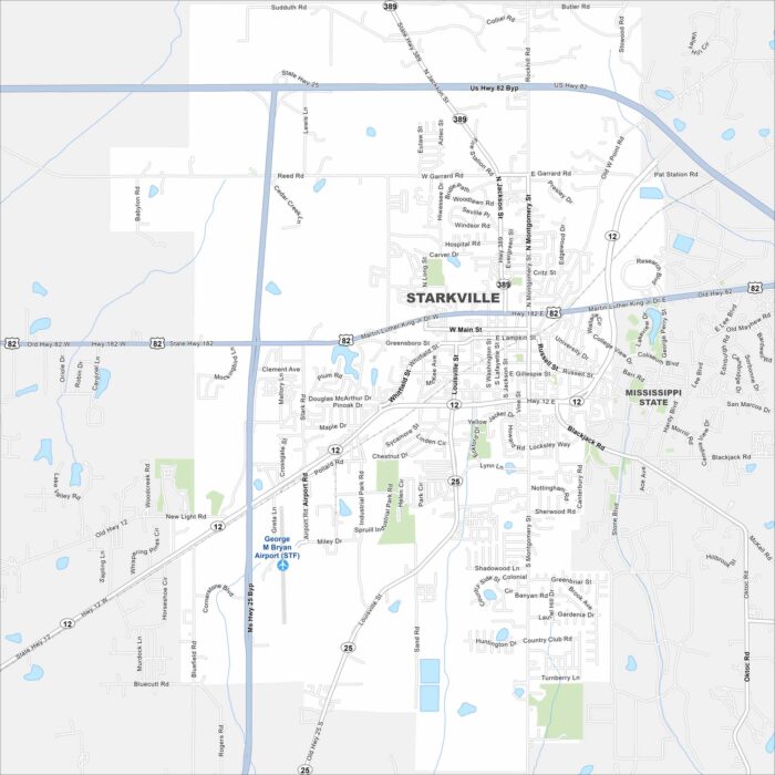
Our map of Starkville shows the home of Mississippi State University. College life shapes the restaurants, sports, and culture here.
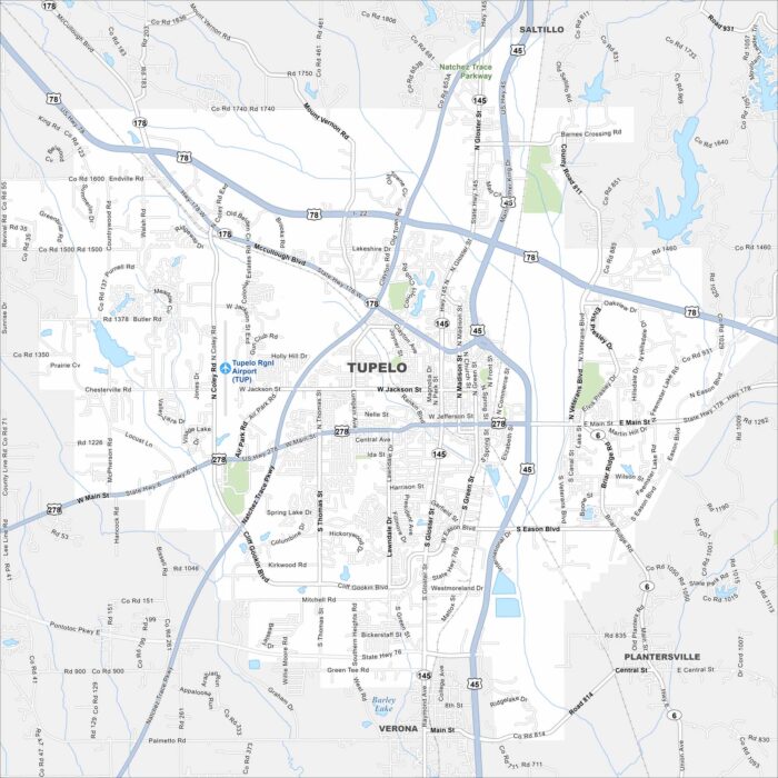
Our map of Tupelo shows you around Elvis Presley’s birthplace. The city is a North Mississippi hub with music history and a small-town feel.
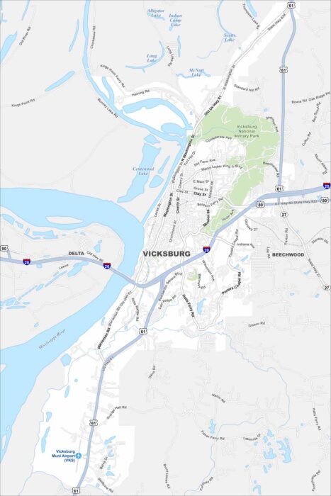
Vicksburg is a Mississippi River city with Civil War history. Our map shows its airport, highways/roads, riverfront, and local neighborhoods.