Michigan Physical Map
Michigan is two peninsulas surrounded by Great Lakes. The Upper Peninsula is rugged. But the Lower Peninsula is flatter with rolling hills.
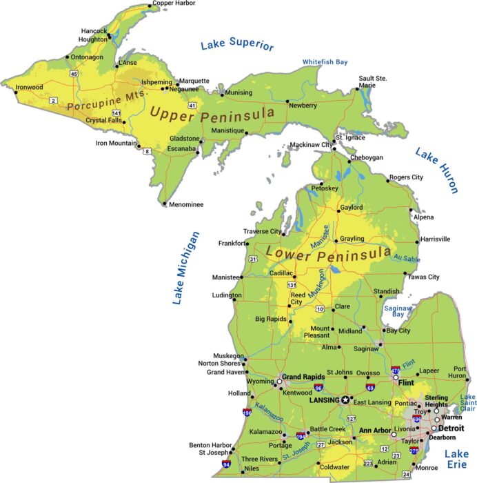
Michigan is two peninsulas surrounded by Great Lakes. The Upper Peninsula is rugged. But the Lower Peninsula is flatter with rolling hills.
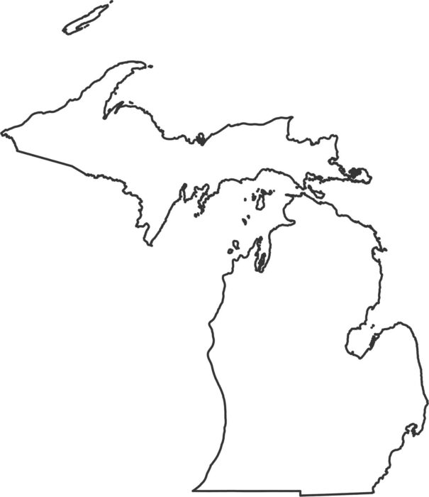
Our Michigan outline map shows two separate peninsulas surrounded by the Great Lakes. Only the southern border is a straight land boundary.
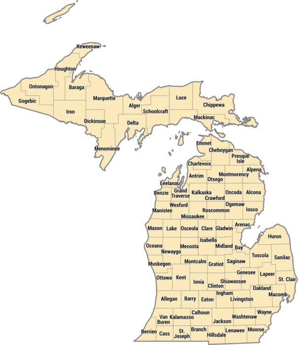
Michigan’s 83 counties span two separate peninsulas divided by the Great Lakes. Wayne County has Detroit and the metro area.
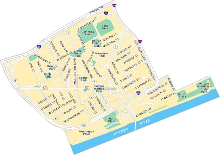
Our map of Downtown Detroit shows the streets along the river and around Campus Martius Park. The Detroit River forms the southern edge.
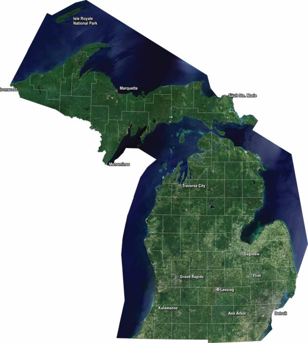
Our satellite map of Michigan shows this state that stretches between two Great Lakes. Highways cross the mitten shape in many directions.
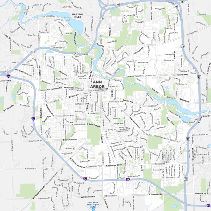
Get to know Ann Arbor with our road map. The Huron River winds through with residential development along its banks.
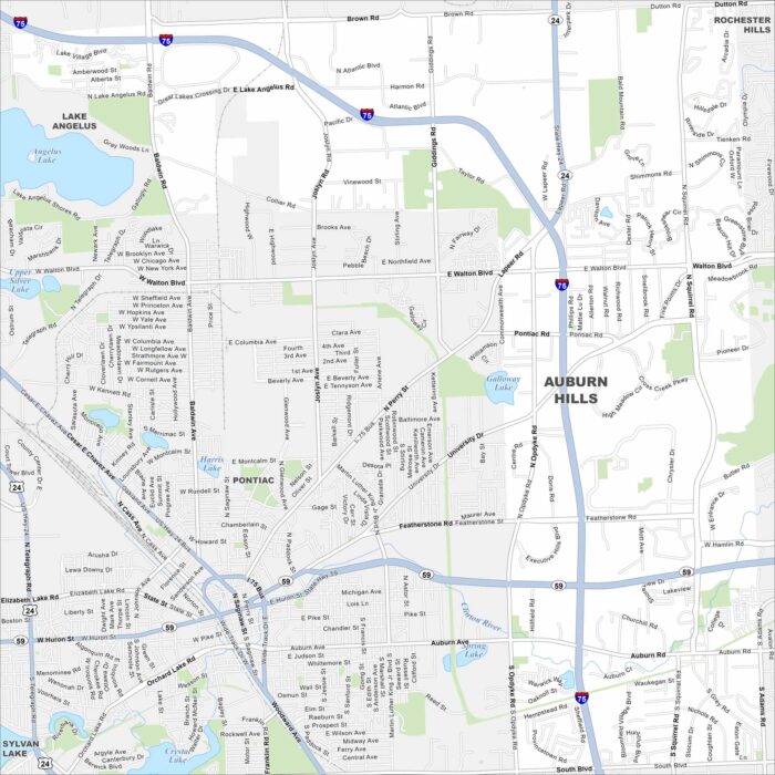
Our map of Auburn Hills shows the highways, streets, and open park spaces. Roads stretch toward the Detroit area.
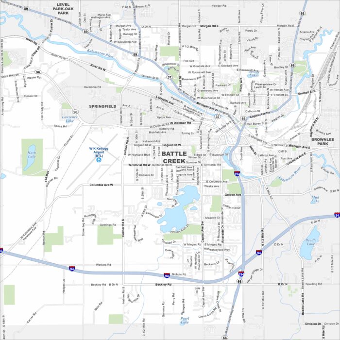
Get a snapshot of Battle Creek with our map. Battle Creek is in southwest Michigan where rivers and rail lines meet.
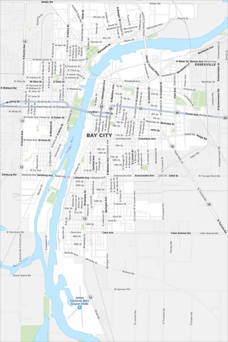
See the streets of Bay City, located on Lake Huron’s Saginaw Bay. Explore its waterfront and historic districts.
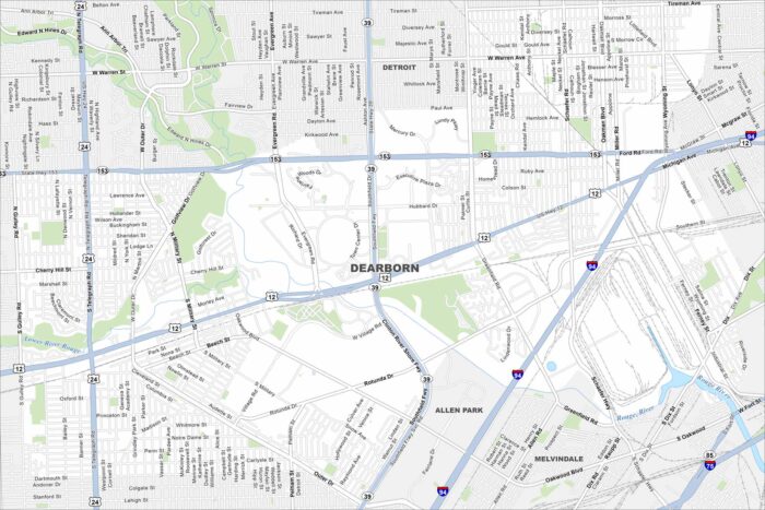
Home to the Ford Motor Company, Dearborn lies just west of Detroit. The Rouge River flows through its neighborhoods.
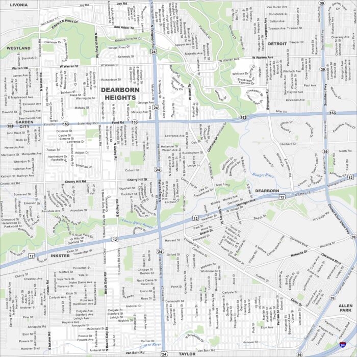
Our Dearborn Heights map shows this community part of the Detroit suburbs. Residential neighborhoods dominate the landscape.
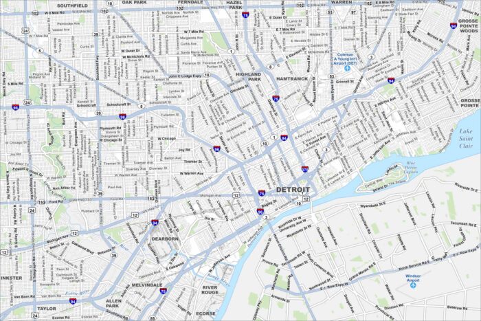
Detroit is located along the Detroit River on the border with Canada. Our map highlights its downtown grid, riverfront, and major roadways.
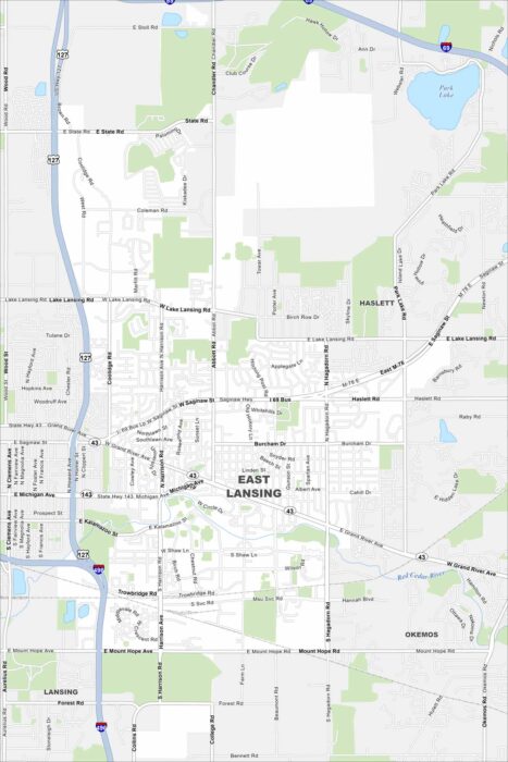
Our map of East Lansing shows the Red Cedar River running through the city. Green spaces and parks stretch along its banks.
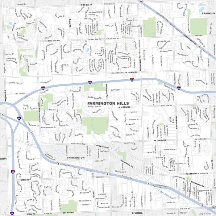
Our map of Farmington Hills shows it northwest of Detroit. Suburban neighborhoods fill in between I-696 and State Highway 5.
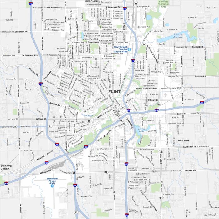
Flint sits along the Flint River in eastern Michigan. Its streets stretch out from the downtown core into wide neighborhoods.