Map of Bay City, Michigan
See the streets of Bay City, located on Lake Huron’s Saginaw Bay. Explore its waterfront and historic districts.
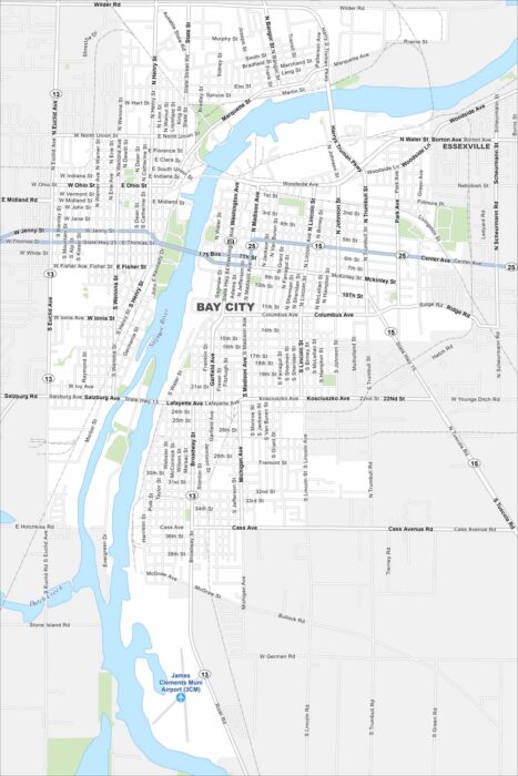
See the streets of Bay City, located on Lake Huron’s Saginaw Bay. Explore its waterfront and historic districts.
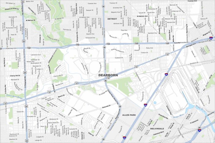
Home to the Ford Motor Company, Dearborn lies just west of Detroit. The Rouge River flows through its neighborhoods.
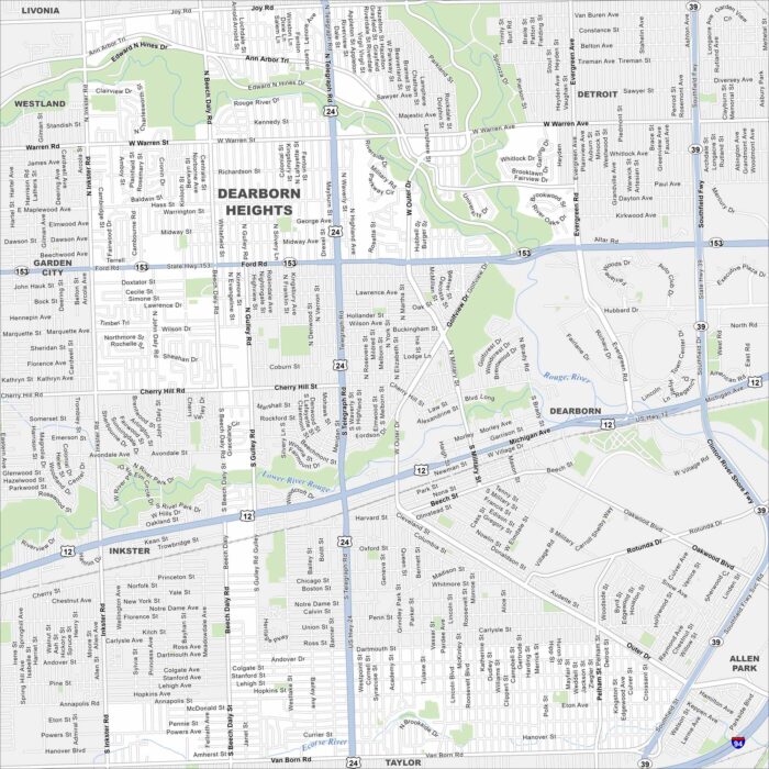
Our Dearborn Heights map shows this community part of the Detroit suburbs. Residential neighborhoods dominate the landscape.
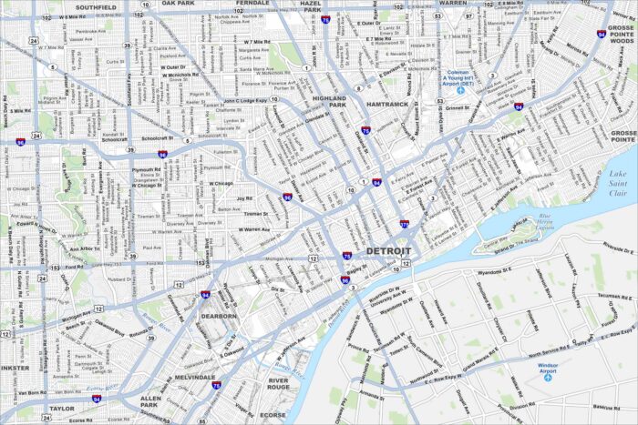
Detroit is located along the Detroit River on the border with Canada. Our map highlights its downtown grid, riverfront, and major roadways.
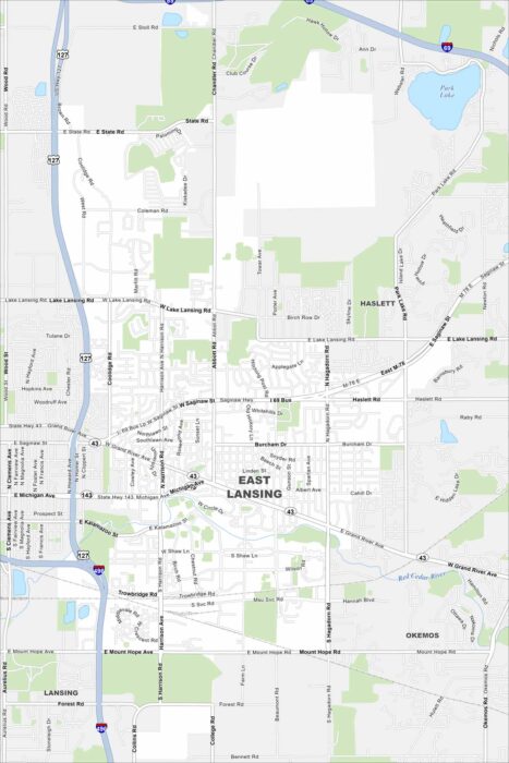
Our map of East Lansing shows the Red Cedar River running through the city. Green spaces and parks stretch along its banks.
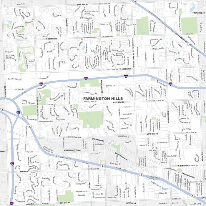
Our map of Farmington Hills shows it northwest of Detroit. Suburban neighborhoods fill in between I-696 and State Highway 5.
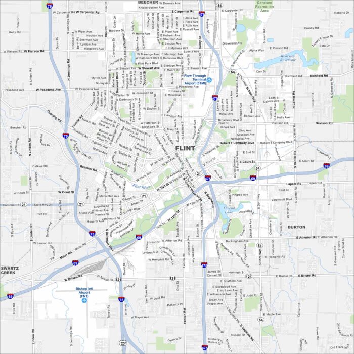
Flint sits along the Flint River in eastern Michigan. Its streets stretch out from the downtown core into wide neighborhoods.
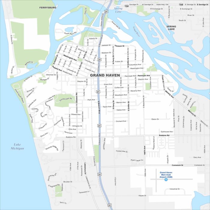
Check out our map of Grand Haven on Lake Michigan’s eastern shore. You’ll see the Grand River flowing into the lake, along with marina areas.
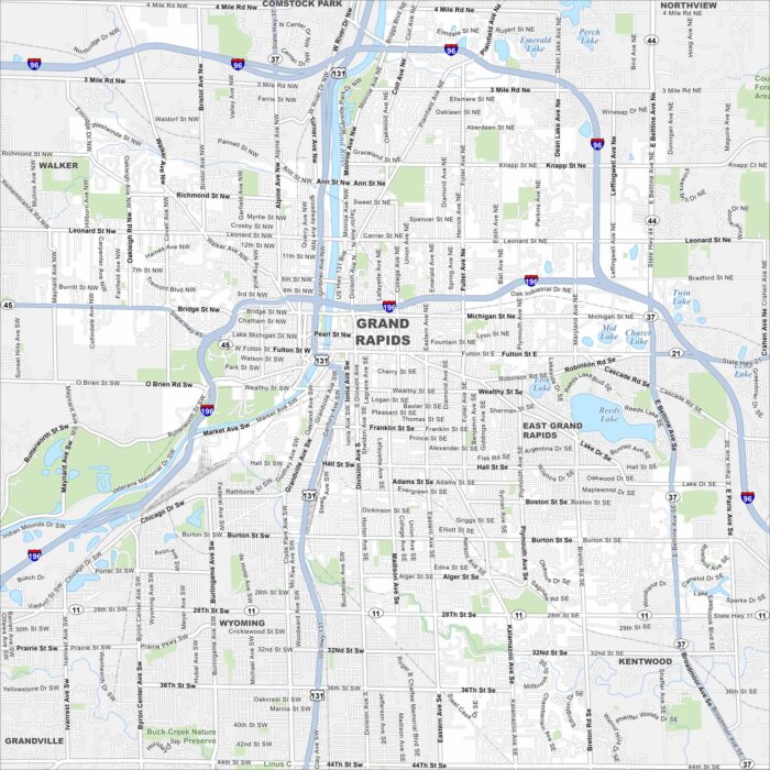
Our map of Grand Rapids follows the Grand River winding through downtown. Highways, parks, and neighborhoods stretch on both sides.
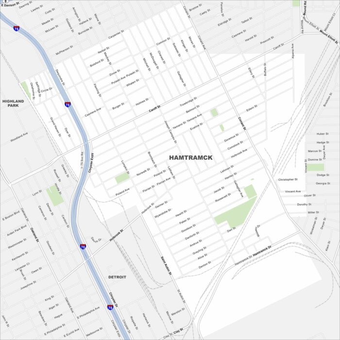
Hamtramck is a small city enclosed entirely by Detroit. On our map, it’s easy to see how tightly packed its streets are.
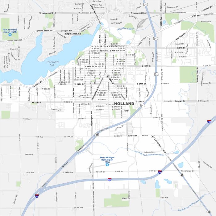
Holland sits on Lake Macatawa, which connects to Lake Michigan. It’s famous for its Dutch heritage and annual tulip festival.
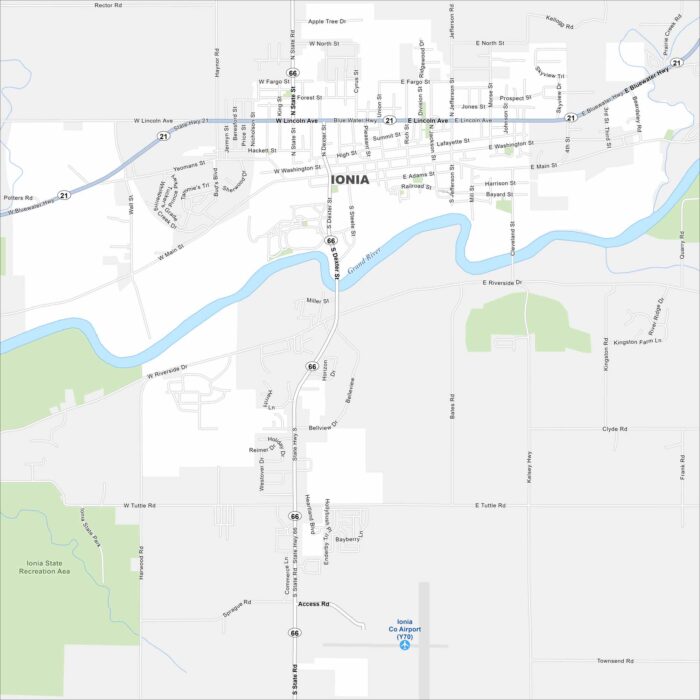
Ionia, Michigan sits along the Grand River on the northern edge. Our map shows its downtown area with highways linking it to cities nearby.
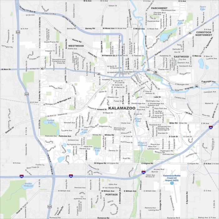
Our map of Kalamazoo shows a downtown split by the Kalamazoo River. Highways link the city to Lake Michigan and Detroit.
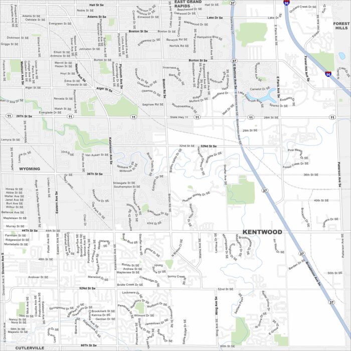
Kentwood borders Grand Rapids. This map shows residential areas and busy commercial corridors. Major highways frame the city’s edges.
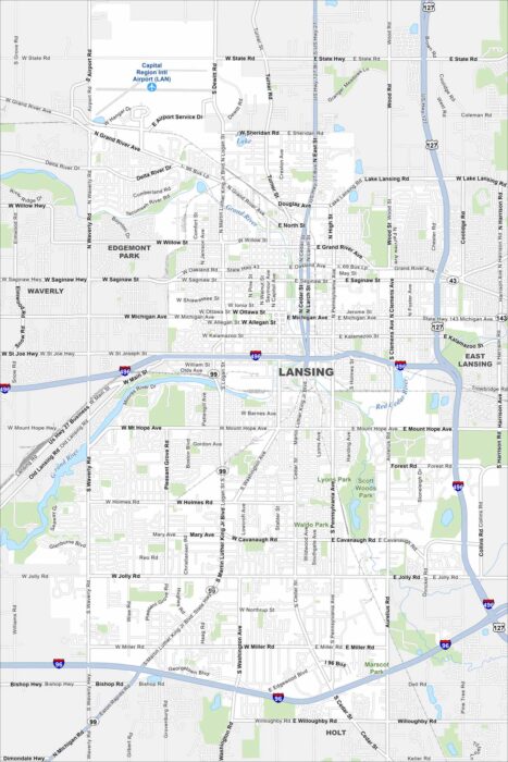
Our map of Lansing shows the Grand River winding through the central region. The State Capitol dominates downtown.