Kansas Physical Map
No matter what you’ve heard, Kansas isn’t completely flat. It really just slopes. The land rises gradually from east to west.
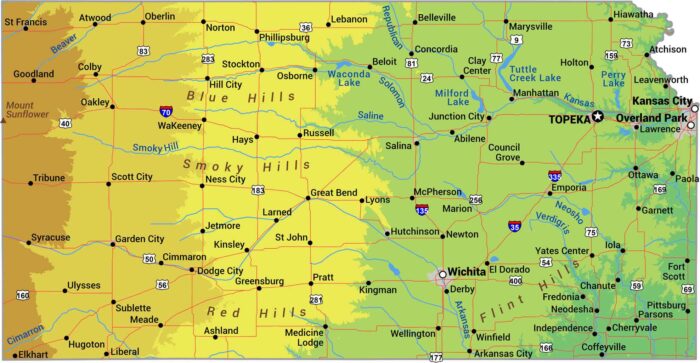
No matter what you’ve heard, Kansas isn’t completely flat. It really just slopes. The land rises gradually from east to west.
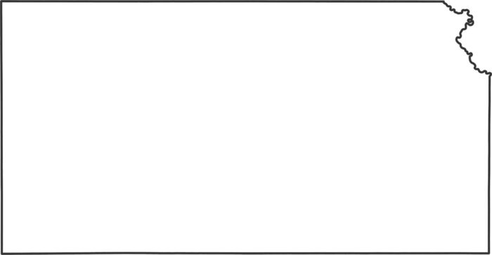
Check out our Kansas outline map. You can see how every single border is a perfect rectangle, except for the Missouri River in the northeast.
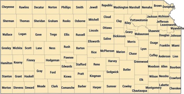
Kansas keeps it organized with 105 counties in tidy rectangles across the plains. This grid is from land surveying across the Great Plains.
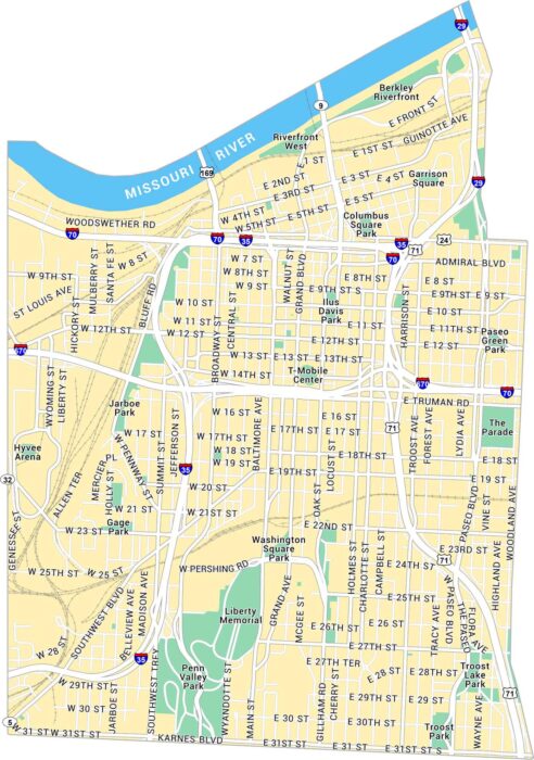
Our map of Downtown Kansas City shows this neighborhood set along the Missouri River. You’ll see parks, highways, and local routes.
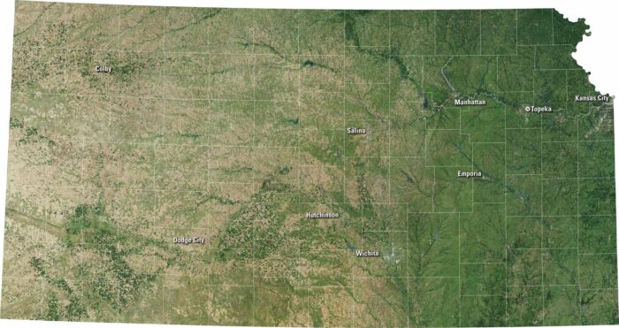
Kansas has a rectangular shape with quiet beauty. From Wichita to Topeka, you’ll spot towns framed by golden fields and long, straight roads.
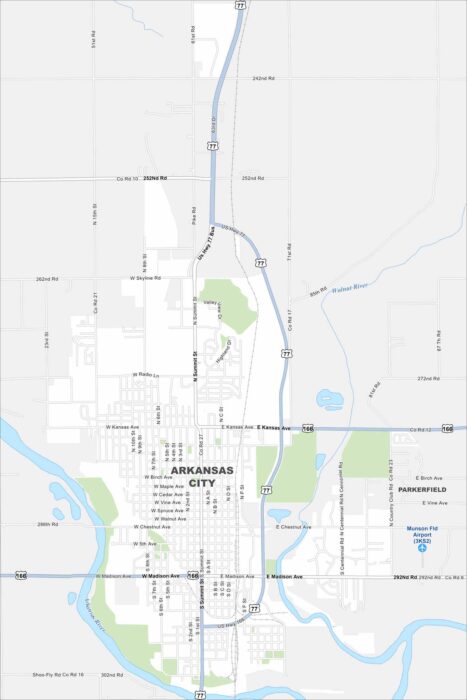
Not to be confused with the state of Arkansas. But Arkansas City sits at the meeting of the Arkansas and Walnut Rivers in Kansas.
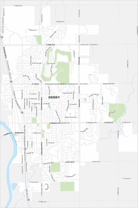
Our map of Derby shows a suburban community south of Wichita. You’ll see the Arkansas River cutting through the area.
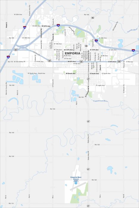
Emporia sits between Topeka and Wichita on the Kansas prairie. Both U.S. 50 and I-35 cross right by the city.
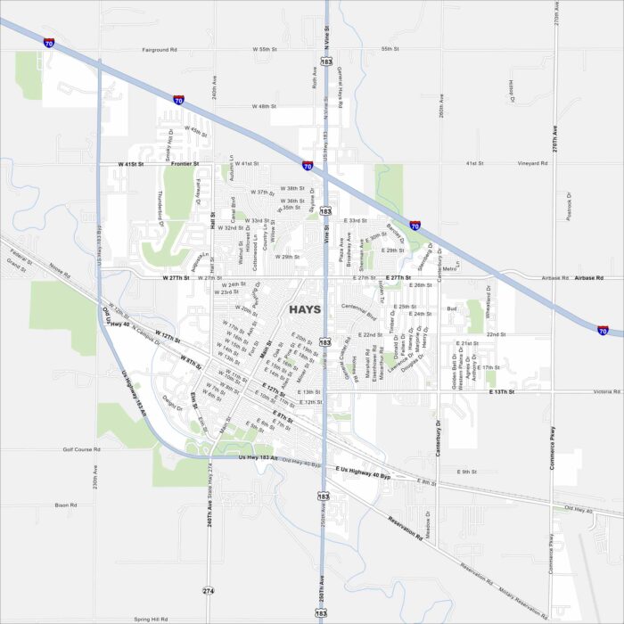
Hays is in western Kansas along Interstate 70. It’s surrounded by open prairie land. Our map of Hays shows its rivers, lakes and roads.
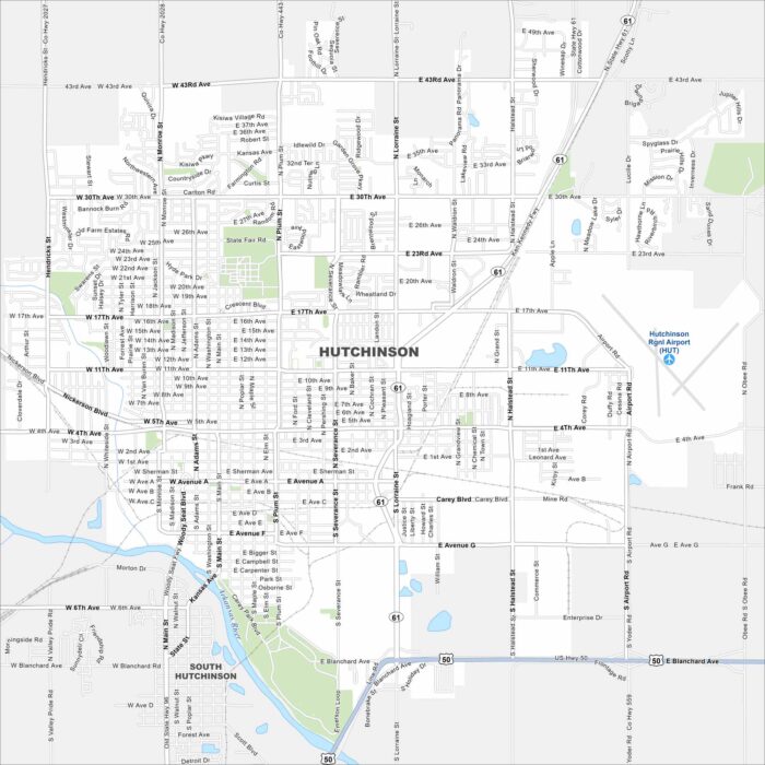
Our map of Hutchinson shows it along the Arkansas River Valley. Highways connect farmland directly to the city grid.
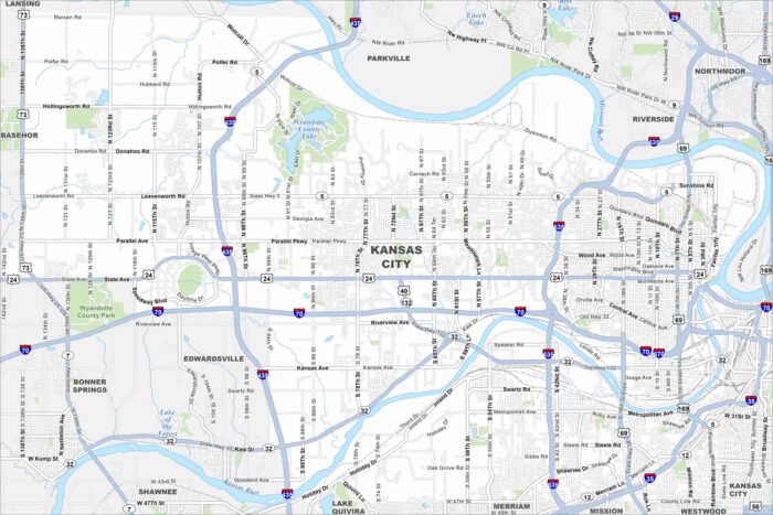
Our map shows Kansas City sitting at the junction of the Kansas and Missouri Rivers. Highways cross in every direction.
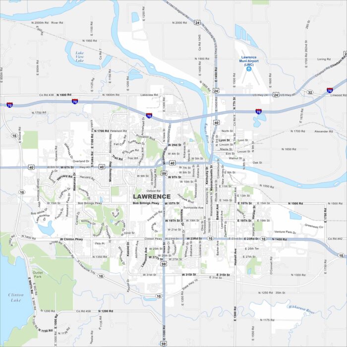
Our map of Lawrence shows the Kansas River running through downtown. The University of Kansas dominates the west side.
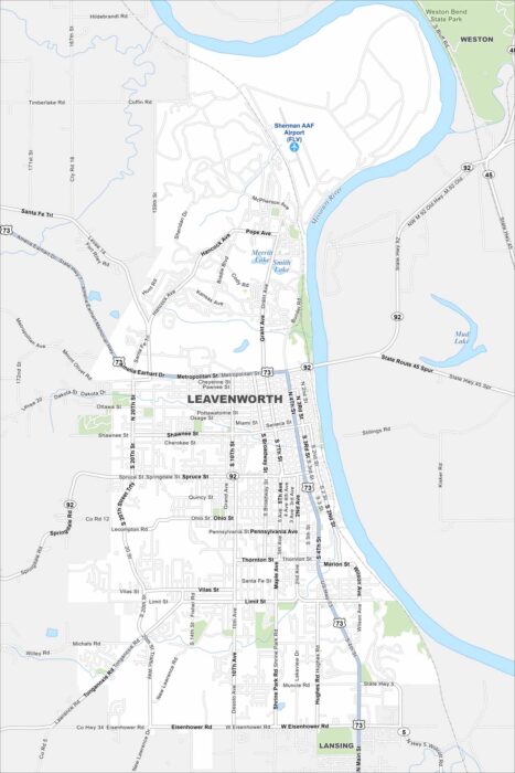
Check out Leavenworth on the Missouri River. Its historic downtown and Weston Bend State Park both stand out. Surrounding it is farmland.
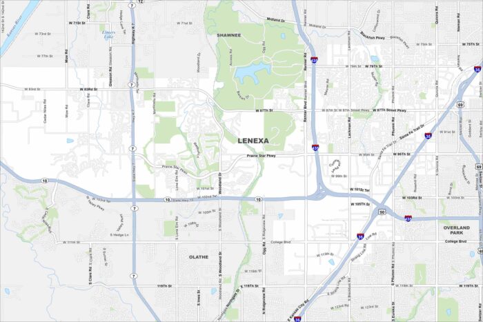
Lenexa is in suburban Johnson County. The map shows a mix of neighborhoods, parks, and lakes. It blends directly into the Kansas City metro.
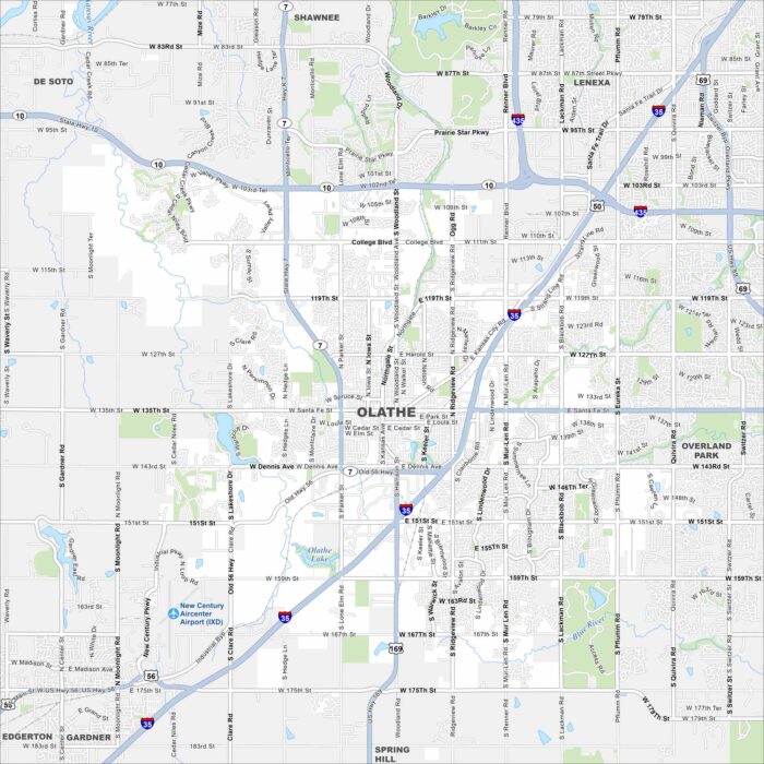
Olathe lies southwest of Kansas City spreading across rolling prairie. Our map highlights highways, lakes, rivers and greenbelts.