Iowa Zip Code Map
Iowa zip codes cover a lot of ground, spanning 500XX to 528XX. Our Iowa zip code map shows wide postal areas between towns.
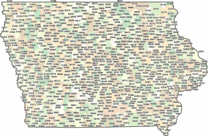
Iowa zip codes cover a lot of ground, spanning 500XX to 528XX. Our Iowa zip code map shows wide postal areas between towns.
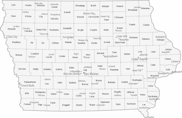
Iowa’s map is an orderly grid of 99 counties. Des Moines is the capital and central business hub near the center of the state.
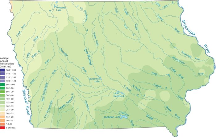
Our precipitation map of Iowa shows that the southeast corner is the wettest. The northwest is a bit drier closer to the Great Plains.
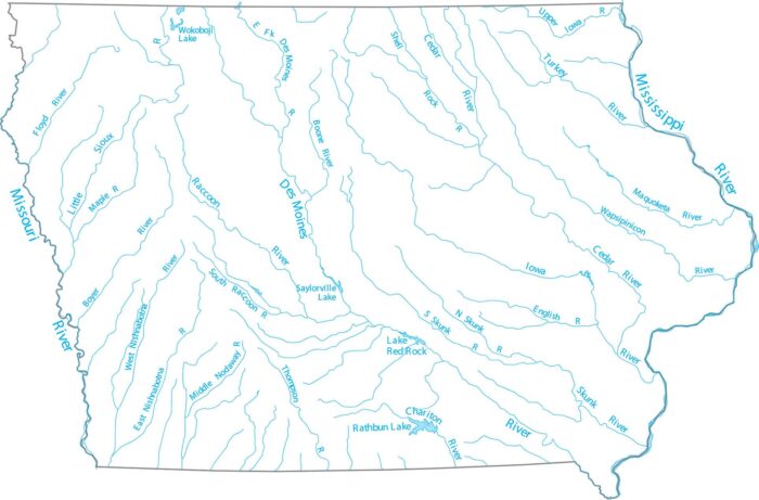
Our map of Iowa lakes and rivers highlights the Des Moines, Mississippi and Missouri Rivers that flow through the state.
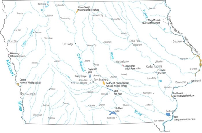
Federal land barely registers at first glance in Iowa. Our map shows only small refuges near waterways with mostly farming.
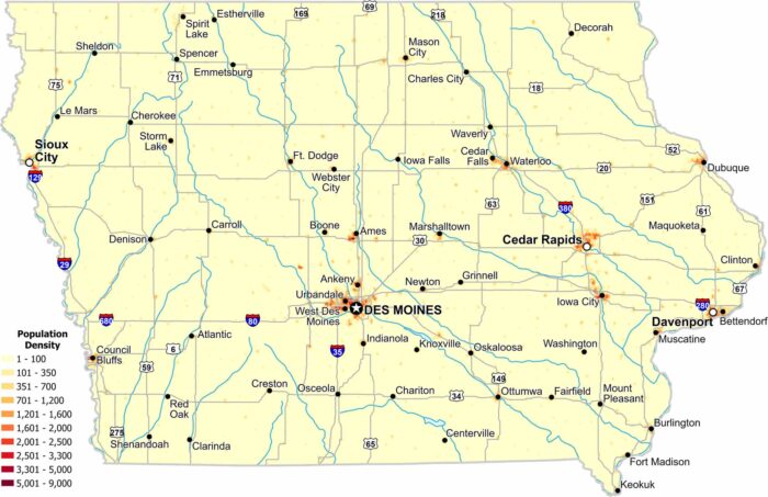
Population density remains moderate across much of Iowa. Des Moines, Davenport and Cedar Rapids have the highest population density.
Let’s be honest. Iowa is flat farmland from border to border. It’s sandwiched by the Mississippi on the east and the Missouri on the west.
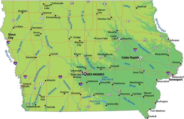
Two major rivers define this state’s shape of Iowa. The Mississippi River forms the east border. The Missouri River is on the west side.
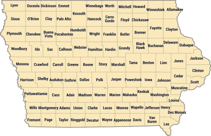
Neat and tidy. That’s one way to describe our county map of Iowa. Iowa’s 99 counties create an almost perfect checkerboard across the state.
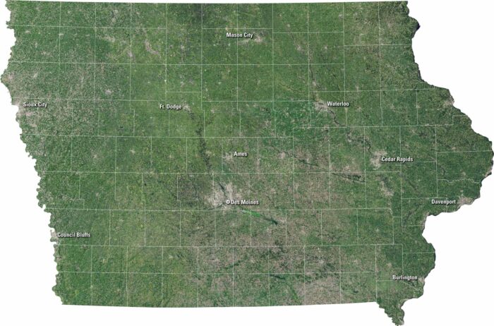
Iowa unfolds in our satellite map with green fields and flowing rivers. It shows gentle hills, scattered lakes, and neat towns.
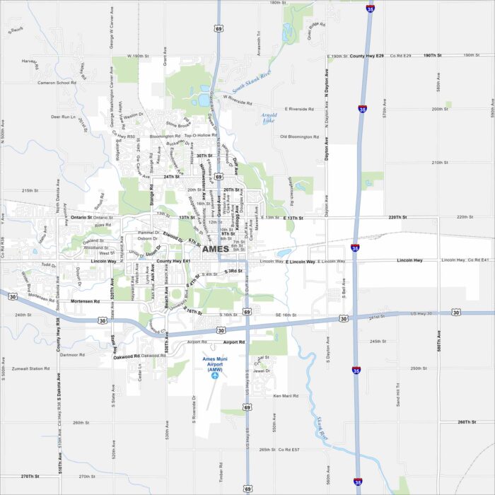
Home to Iowa State University, Ames is both a college town and a research hub. Roads wrap around the campus, as shown on our map.
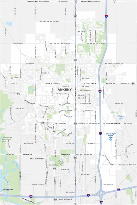
Our map of Ankeny shows the Des Moines River flowing on the west side. It includes highways like I-35 and park spaces.
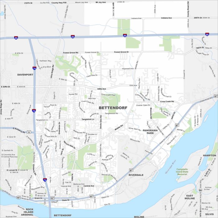
See Bettendorf on our map along the Mississippi River. Parks, winding roads, and riverfront trails are a big part of the city.
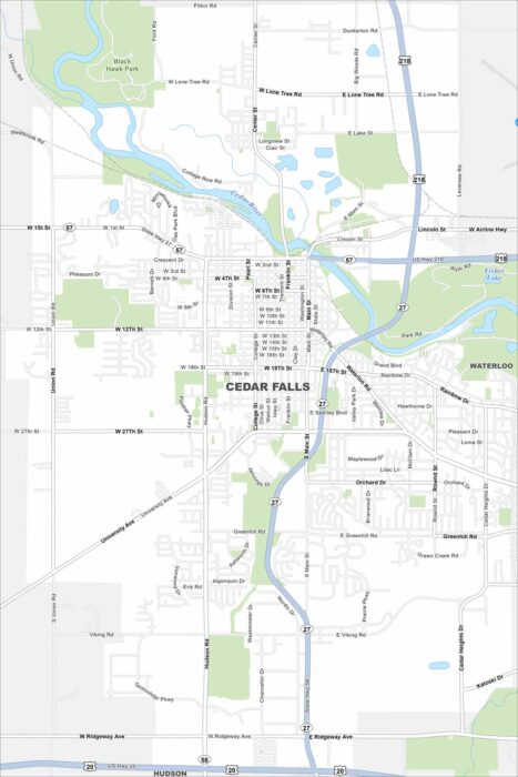
Take a look at Cedar Falls on our map. This is where the Cedar River flows through the city. Neighborhoods and parks line the riverbanks.
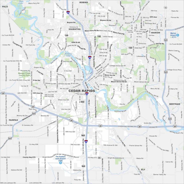
See Cedar Rapids on our map. Parks and neighborhoods stretch along the water, with Cedar River splitting the city in two.