Map of Fort Wayne, Indiana
Fort Wayne sits in northeastern Indiana where the St. Marys and St. Joseph Rivers meet. Our map of the city shows I-69 running across.
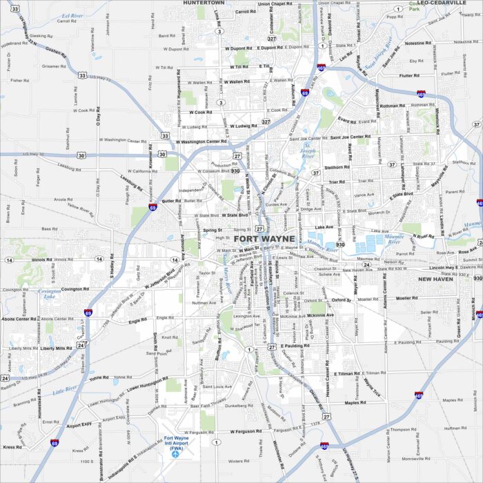
Fort Wayne sits in northeastern Indiana where the St. Marys and St. Joseph Rivers meet. Our map of the city shows I-69 running across.
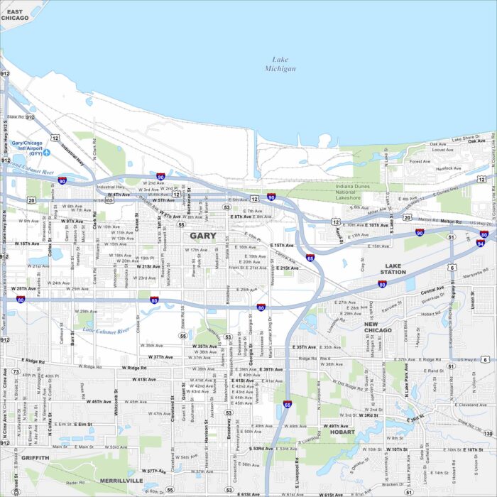
Get to know the major highways, city streets, and green areas. Our map of Gary shows its layout next to Lake Michigan.
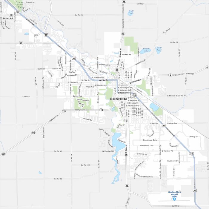
Our map of Goshen highlights it in northern Indiana near the Elkhart River. The river curves through downtown and neighborhoods.
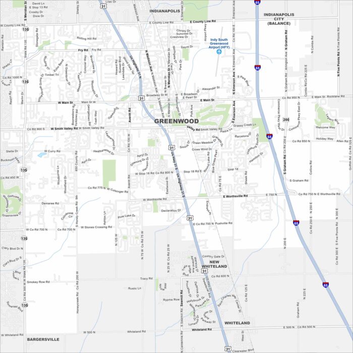
Greenwood is just south of Indianapolis in central Indiana. On the map, you’ll see dense suburban neighborhoods.
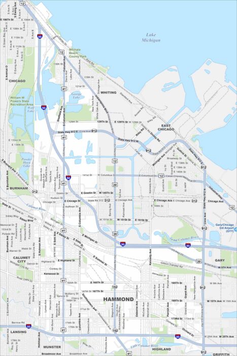
Hammond lies in northwest Indiana along Lake Michigan’s southern edge. You’ll see the lakefront, rail lines, and industry on our map.
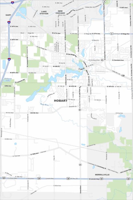
Our map of Hobart shows the downtown built around Lake George. Highways connect the city to nearby Gary and Chicago.
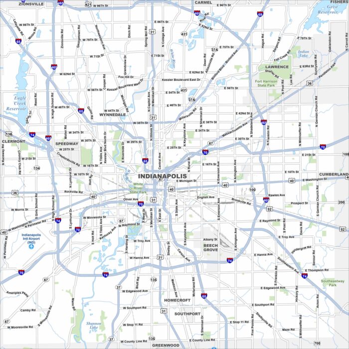
Check out our map of Indianapolis with its famous “Mile Square” downtown. Interstates form a ring around the city with the White River.
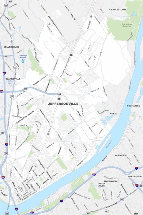
Jeffersonville sits right across the Ohio River from Louisville. Our map shows bridges linking the two cities.
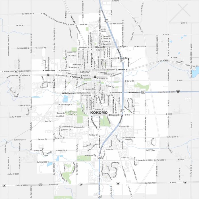
Our map of Kokomo shows a compact city grid with parks and small lakes. The city sits in north-central Indiana.
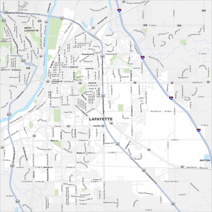
Our map of Lafayette shows the Wabash River cutting through downtown. Streets form a neat grid around the city.
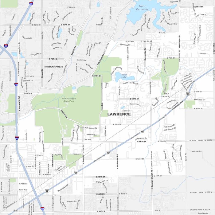
Lawrence appears on the map northeast of Indianapolis. Fort Harrison State Park takes up a large section of the city.
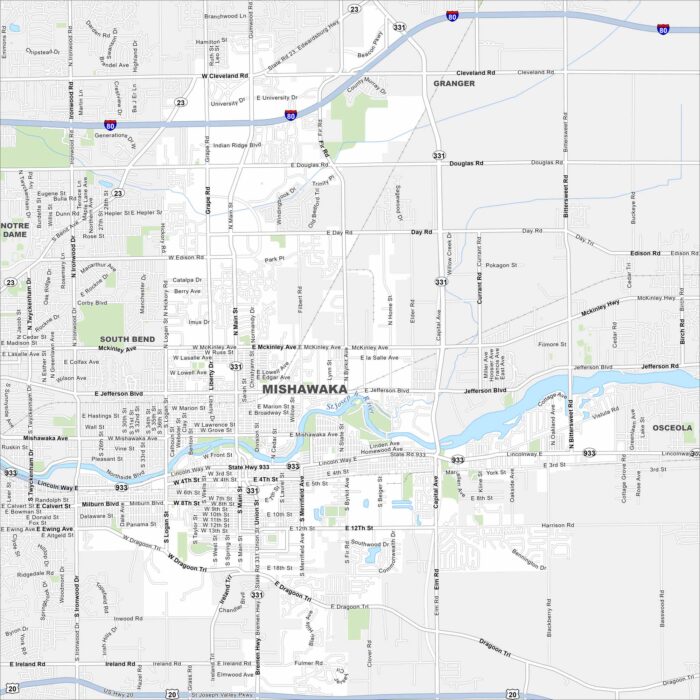
Get to know Mishawaka with our map. This city is located along the St. Joseph River. Downtown streets and parks cluster near the water.
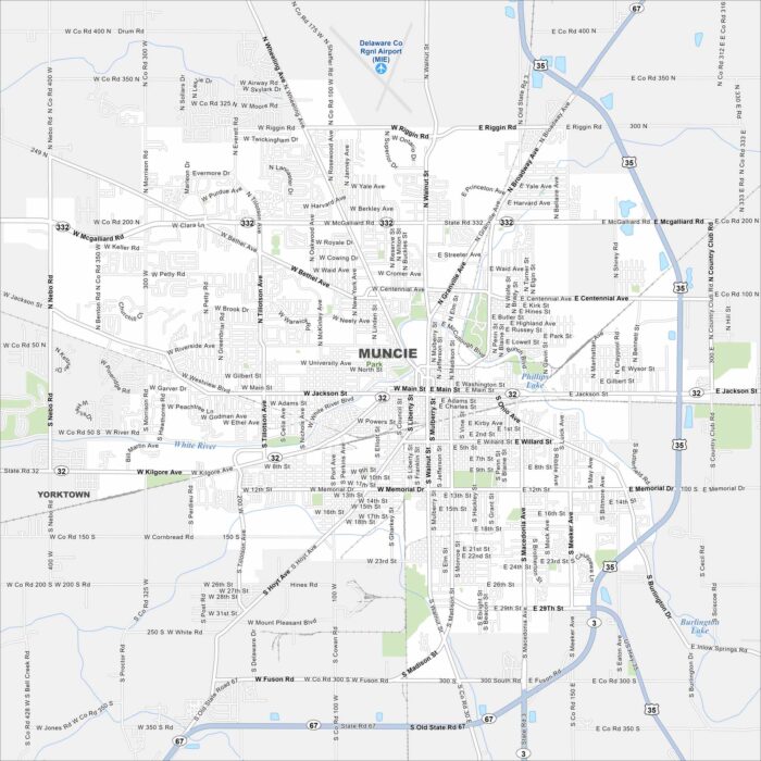
Muncie is mapped out with Ball State University at its center. Surrounding it are neighborhoods, parks, and industry.
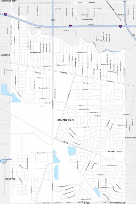
Our map of Munster shows this suburb situated in northwest Indiana. Chicago’s influence just to the west. It’s part of the Calumet Region.
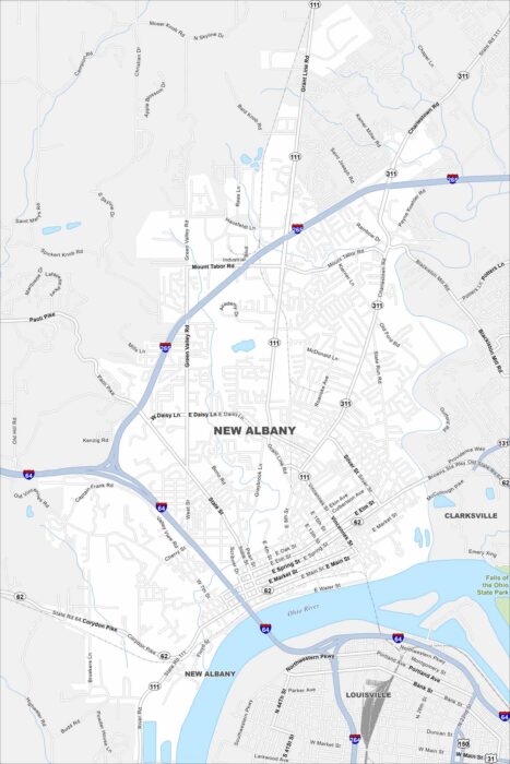
Our map of New Albany shows this city on the Ohio River. Downtown sits by the riverfront, with neighborhoods rising into the hills.