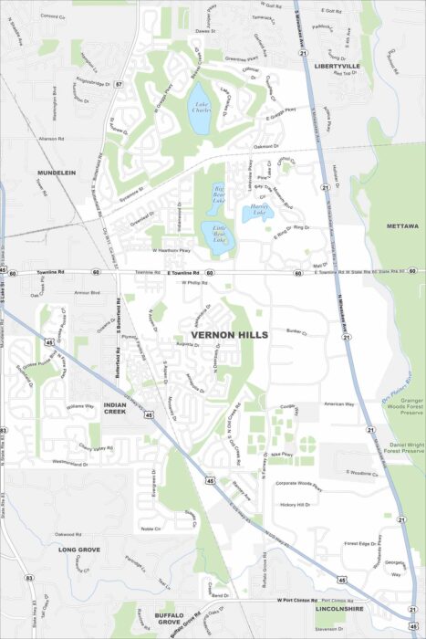
Map of Vernon Hills, Illinois
Our Vernon Hills map helps you explore this Chicago suburb. The area is packed with shopping, parks, and growing neighborhoods.
Our Vernon Hills map helps you explore this Chicago suburb. The area is packed with shopping, parks, and growing neighborhoods.
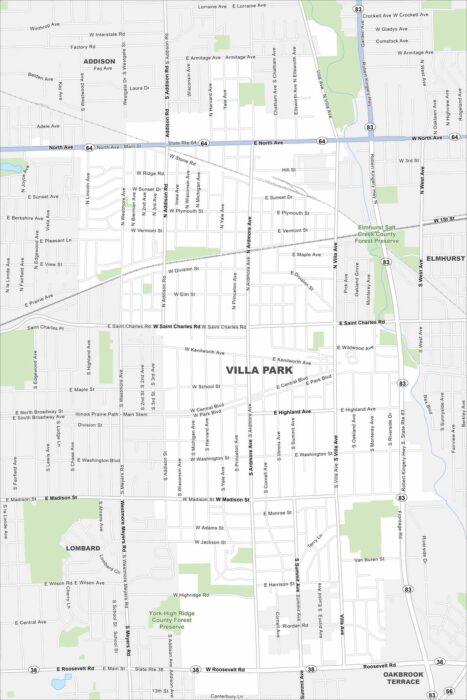
Familiarize yourself with Villa Park, a small DuPage County suburb. The map shows quiet neighborhoods, parks, and easy rail access.
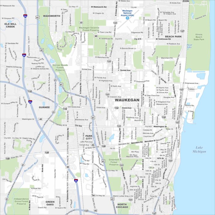
Here’s a simple map of Waukegan located along Lake Michigan. It’s a historic city with a working port and lakefront parks.
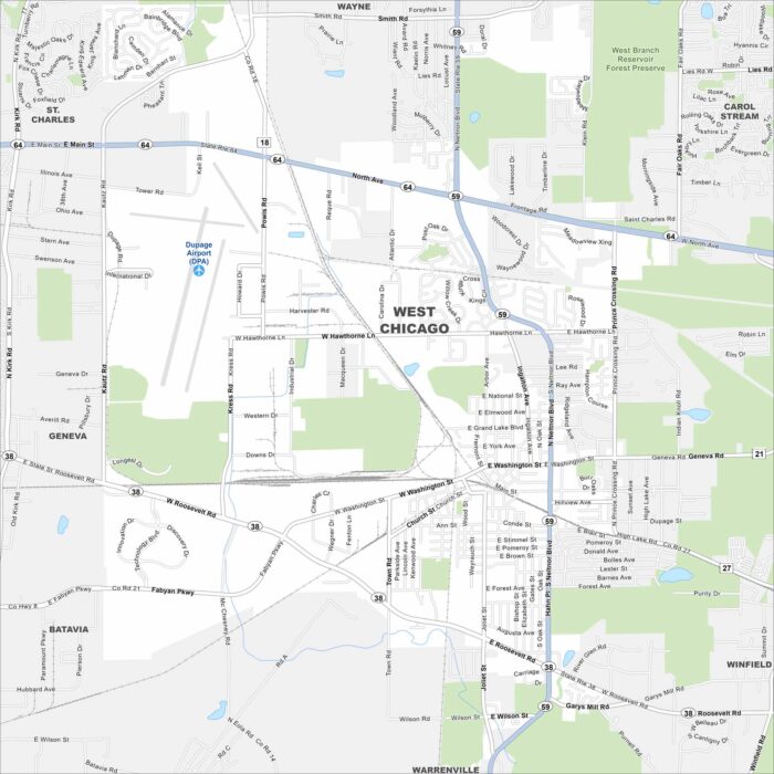
Here’s our map of West Chicago in DuPage County. Railroads, parks, and diverse neighborhoods shape the city’s layout.
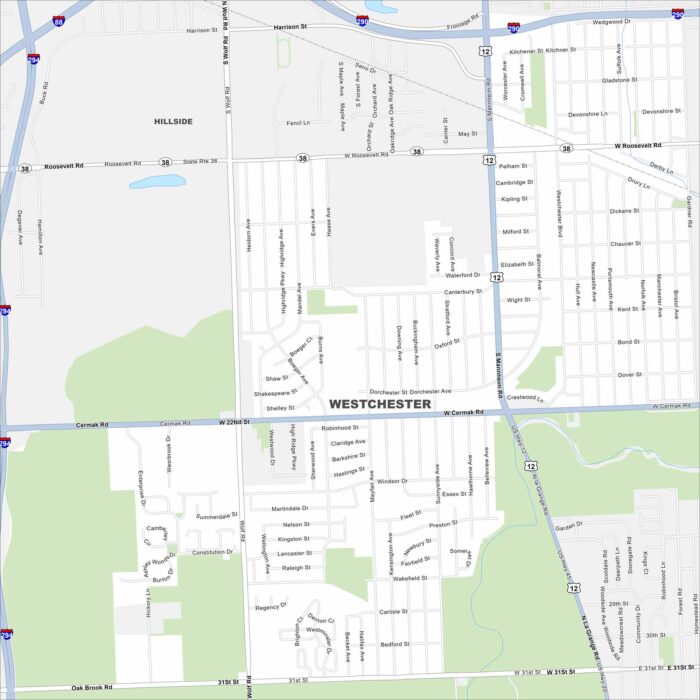
Get around Westchester, a suburban community west of Chicago. Parks and quiet residential streets fill the map.
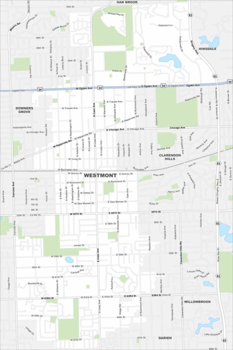
Here’s our map of Westmont, Illinois in DuPage County. The community blends suburban neighborhoods with a historic downtown.
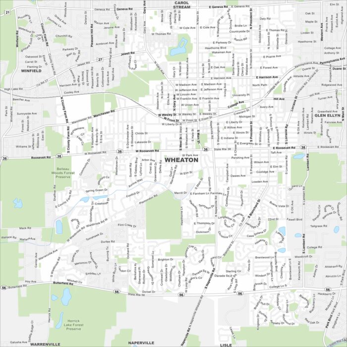
Our map of Wheaton shows this college town west of Chicago. Its historic downtown and forest preserves stand out the most.
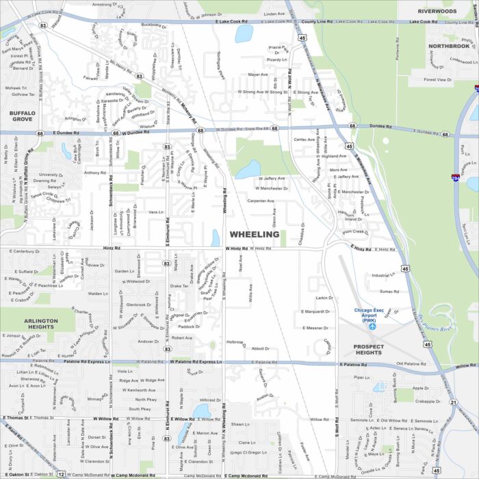
Here’s a map of Wheeling, a diverse suburb in Chicago’s North Shore area. The Des Plaines River runs through the community.
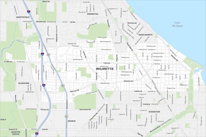
Here’s our map of Wilmette, a North Shore suburb of Chicago. Lake Michigan stands out in the northeast corner, as well as I-94 to the west.
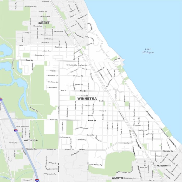
See it here on our map of Winnetka. Village streets are laid out clearly. You’ll also notice its location right along Lake Michigan.
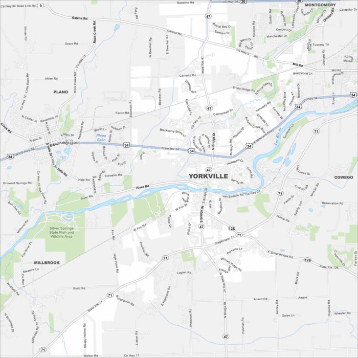
Looking for a map of Yorkville? You’ll find this city along the Fox River, which cuts through east to west.
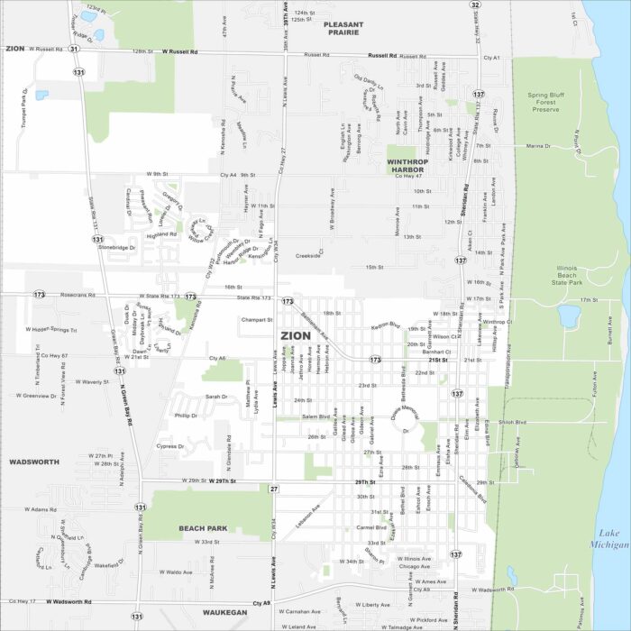
Looking for a map of Zion? This Lake Michigan community has green parks, a fine downtown grid, and lakefront access.