Colorado Zip Code Map
Our Colorado zip code map runs from 80000 to 81699. It includes Denver, Boulder, and the mountain towns in between.
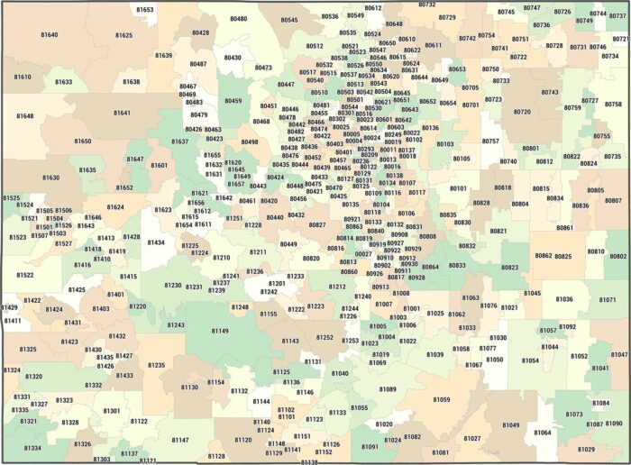
Our Colorado zip code map runs from 80000 to 81699. It includes Denver, Boulder, and the mountain towns in between.
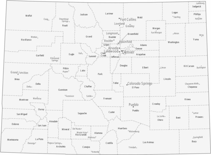
Colorado counties have irregular shapes in the mountains. Cities line up along the Front Range in counties like Denver, Boulder, and El Paso.
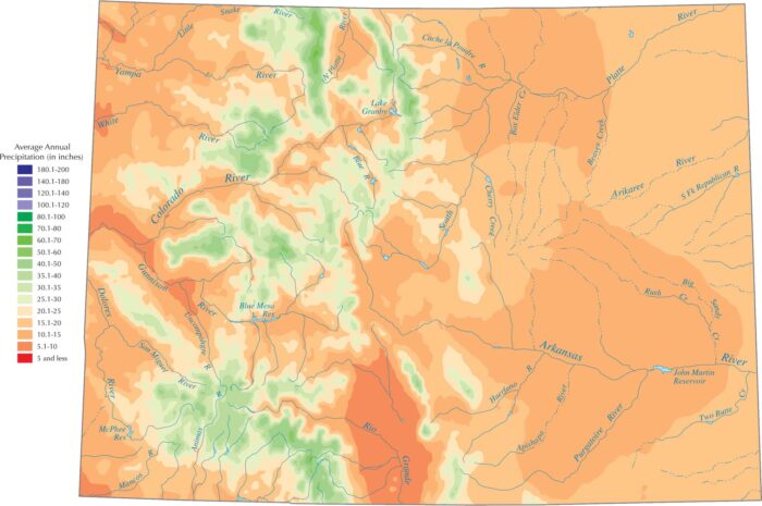
Colorado is drier overall because it sits far from oceans. Our precipitation map of Colorado shows that the highest peaks get the most water.
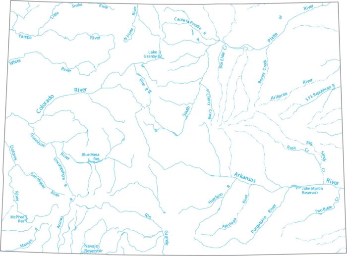
Our Colorado map shows the starting point for the Rio Grande and the Colorado River, both of which begin high in the Rockies.
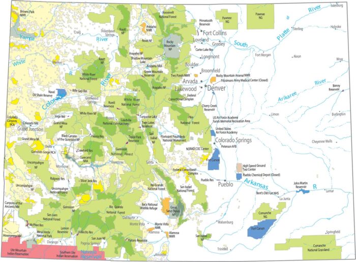
Everything clusters around height with Rocky Mountain National Park as the centerpiece. Forests stretch along the Rockies in long bands.
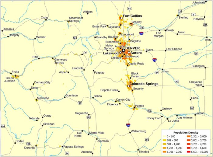
Most residents in Colorado live along the eastern edge of the Rockies. The Front Range forms a clear north–south corridor.

Our map shows where Arizona, Utah, Colorado, and New Mexico meet. You’ll see Highway 160 and trails leading to Four Corners Monument.
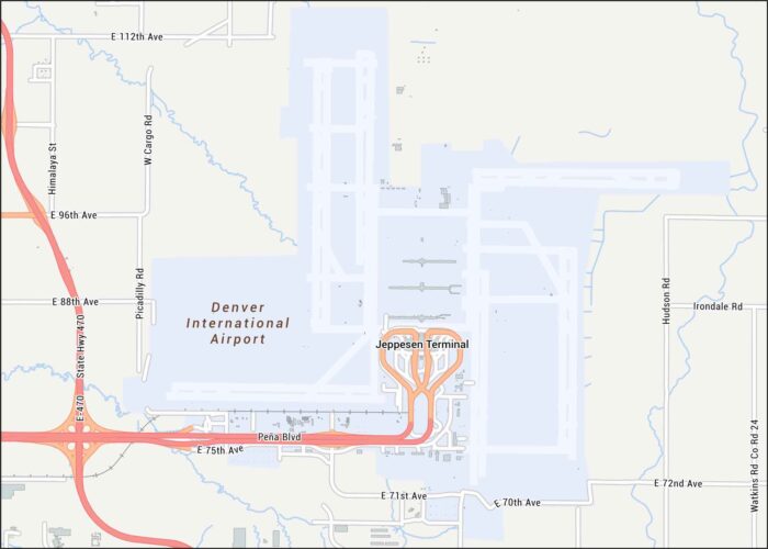
Here’s our Denver International Airport map, which sits northeast of Denver. Our map shows runways, nearby highways, and local streets.
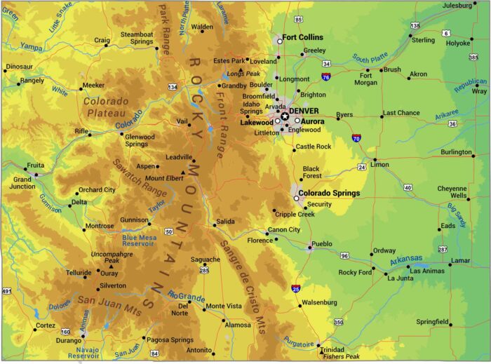
Here’s our physical map of Colorado. The Rockies dominate, running north to south through the center with over 50 summits above 14,000 feet.

Our Colorado outline map shows one of three states with only straight-line borders forming an almost perfect rectangle.

The Rockies split Colorado’s 64 counties down the middle. Eastern counties are flat prairie, western counties are mountains and ski towns.
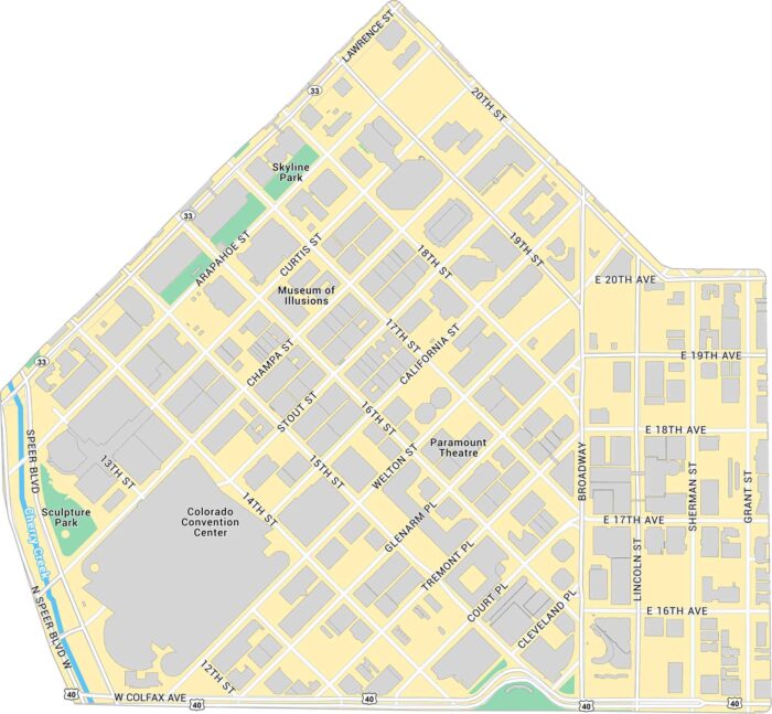
Here’s our map of Downtown Denver with a view of the city’s core. We’ve marked buildings, parks, major roads, and highways.

Union Station in Denver is the heart of the city’s transit and history. Our map highlights the station itself, surrounded by its roads.
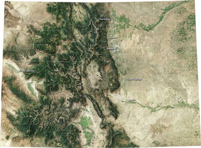
Colorado bursts with variety. Our satellite map shows the capital of Denver, the Rocky Mountains to the west, and wide plains to the east.
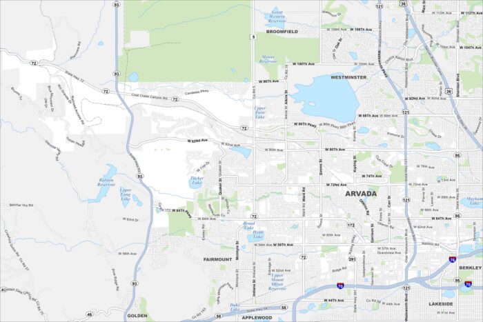
Arvada is located northwest of Denver. Our map of Arvada shows the roads, waterways, and park spaces. Streets connect to Denver.