Colorado Physical Map
Here’s our physical map of Colorado. The Rockies dominate, running north to south through the center with over 50 summits above 14,000 feet.
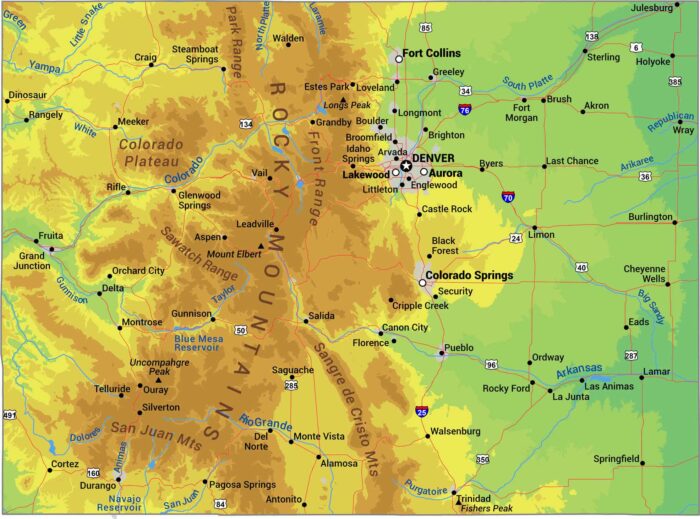
Here’s our physical map of Colorado. The Rockies dominate, running north to south through the center with over 50 summits above 14,000 feet.

Our Colorado outline map shows one of three states with only straight-line borders forming an almost perfect rectangle.

The Rockies split Colorado’s 64 counties down the middle. Eastern counties are flat prairie, western counties are mountains and ski towns.
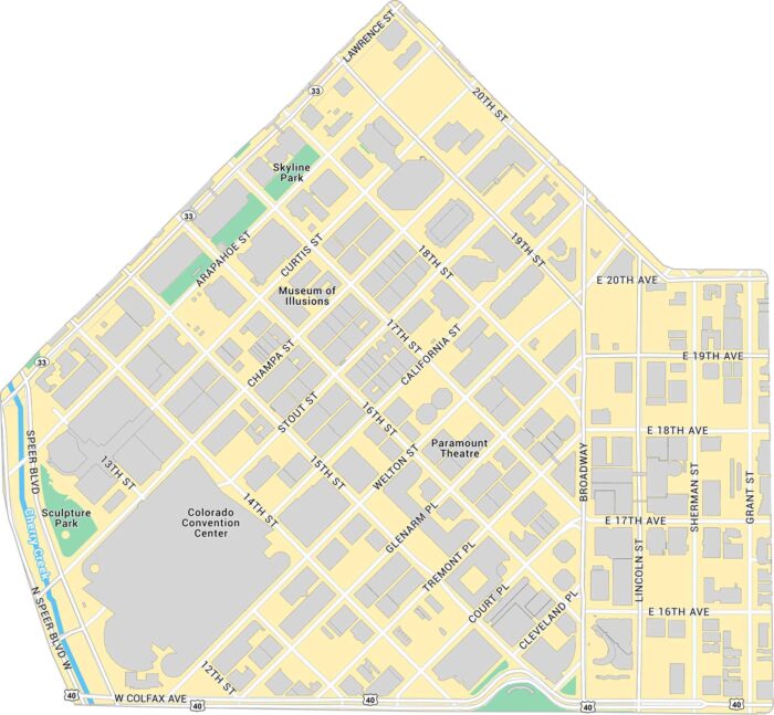
Here’s our map of Downtown Denver with a view of the city’s core. We’ve marked buildings, parks, major roads, and highways.

Union Station in Denver is the heart of the city’s transit and history. Our map highlights the station itself, surrounded by its roads.
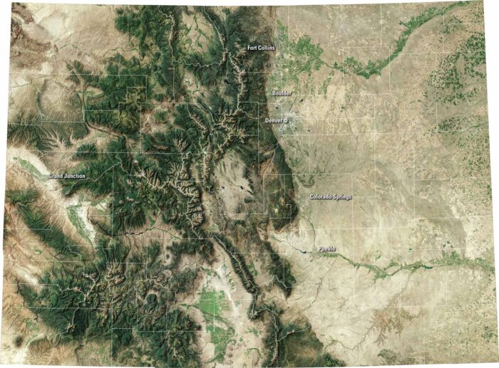
Colorado bursts with variety. Our satellite map shows the capital of Denver, the Rocky Mountains to the west, and wide plains to the east.
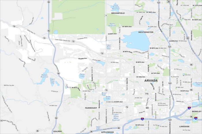
Arvada is located northwest of Denver. Our map of Arvada shows the roads, waterways, and park spaces. Streets connect to Denver.
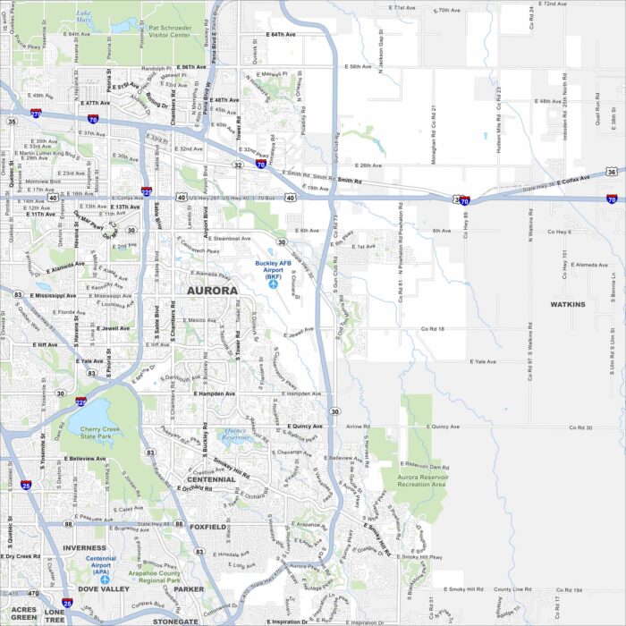
Our map of Aurora highlights the highways, streets, and parkland. It connects to Denver but still covers a wide area.
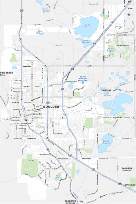
Boulder sits at the foot of the Rocky Mountains. Our map shows open space, trails, and streets. It’s known for outdoor living.
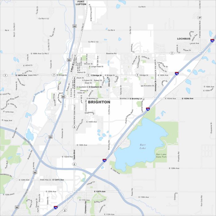
Take a look at Brighton, Colorado on our map. You can find it northeast of Denver. Barr Lake is a major waterbody here.
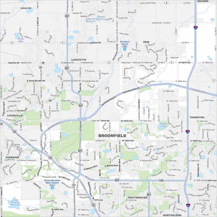
See Broomfield on our map, spread between Denver and Boulder. Highways pass through, but open space and trails are easy to spot.
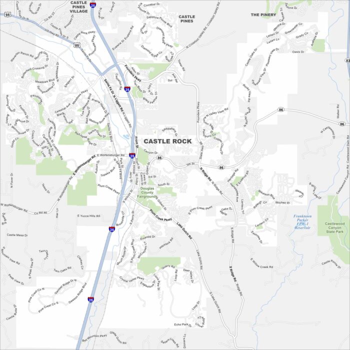
Explore Castle Rock with our map, set between Denver and Colorado Springs. The city is defined by its namesake butte and rolling hills.
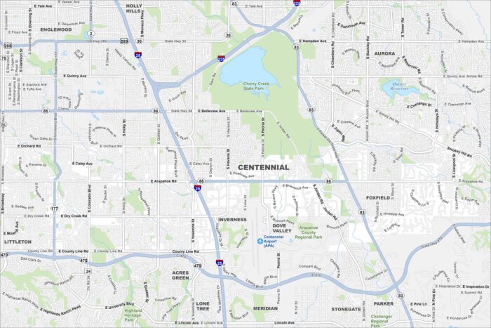
Centennial is a suburban city in the Denver metro. Our map highlights winding streets, open parks, and major roadways.
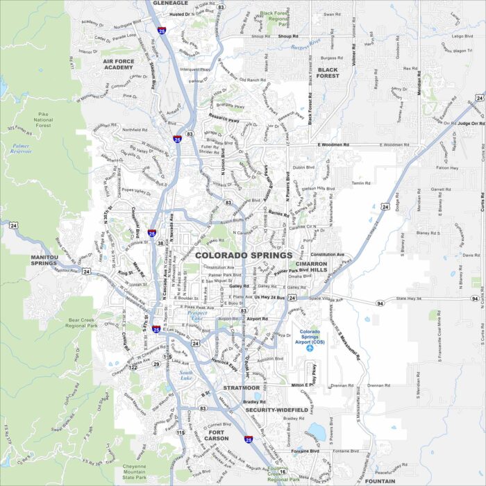
Colorado Springs is situated at the foot of Pikes Peak so the city is surrounded by nice scenery. The Garden of the Gods is west of downtown.
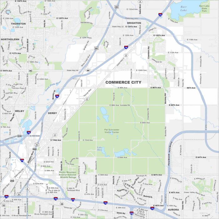
Our map of Commerce City follows I-270 and the South Platte River as they cut through industrial and residential areas.