Map of Commerce City, Colorado
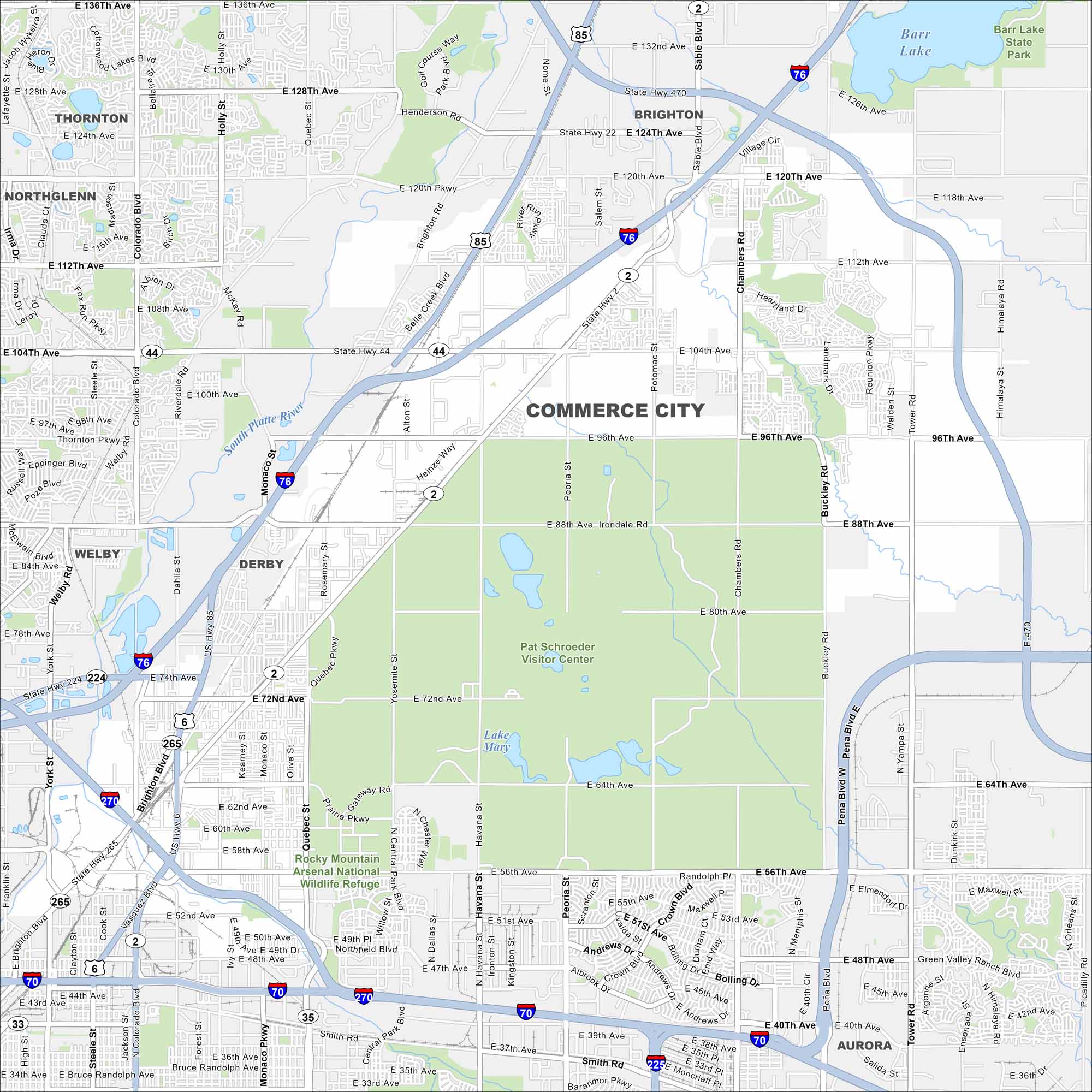
Our map of Commerce City follows I-270 and the South Platte River as they cut through industrial and residential areas. The Rocky Mountain Arsenal Wildlife Refuge covers a good portion of the city.
Colorado State Maps
Browse Colorado with our detailed state maps


Map Information
On the Map
Interstates/Highways: I-76, I-270, I-70, US Hwy 85, US Hwy 6, State Rte 44, State Rte 224, State Rte 2, State Rte 470 Major Roads: 120th Ave, 104th Ave, 96th Ave, 88th Ave, 72nd Ave, 56th Ave, 112th Ave, 128th Ave, 136th Ave, Tower Rd, Chambers Rd, Buckley Rd, Peoria St, Brighton Rd, Quebec St, Monaco Pkwy, Colorado Blvd, Vasquez Blvd, Dahlia St, Holly St Lakes and Reservoirs: Barr Lake, Lake Mary, Thomas Reservoir Major Rivers: South Platte River Parks and Preserves: Barr Lake State Park, Rocky Mountain Arsenal National Wildlife Refuge Nearby Communities: Thornton, Brighton, Northglenn, Derby, Welby, AuroraColorado City Maps
Here are maps of Colorado’s urban areas


