Map of Merced, California
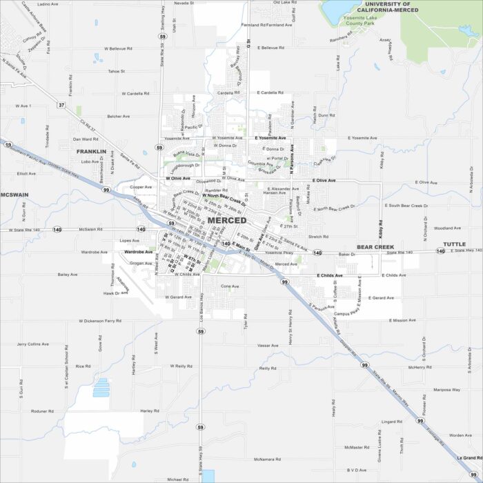
Here’s our map of Merced in California’s Central Valley. Our map shows its road network, nearby farmland, and UC Merced campus.
Here’s our map of Merced in California’s Central Valley. Our map shows its road network, nearby farmland, and UC Merced campus.
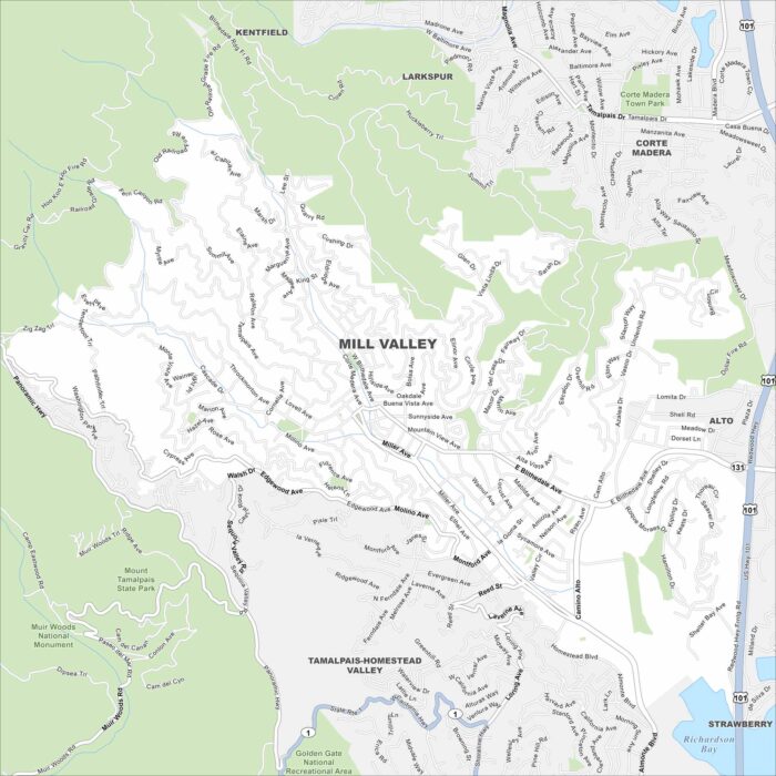
Discover Mill Valley using our road map. It sits at the base of Mount Tamalpais, surrounded by redwoods with easy access to San Francisco.
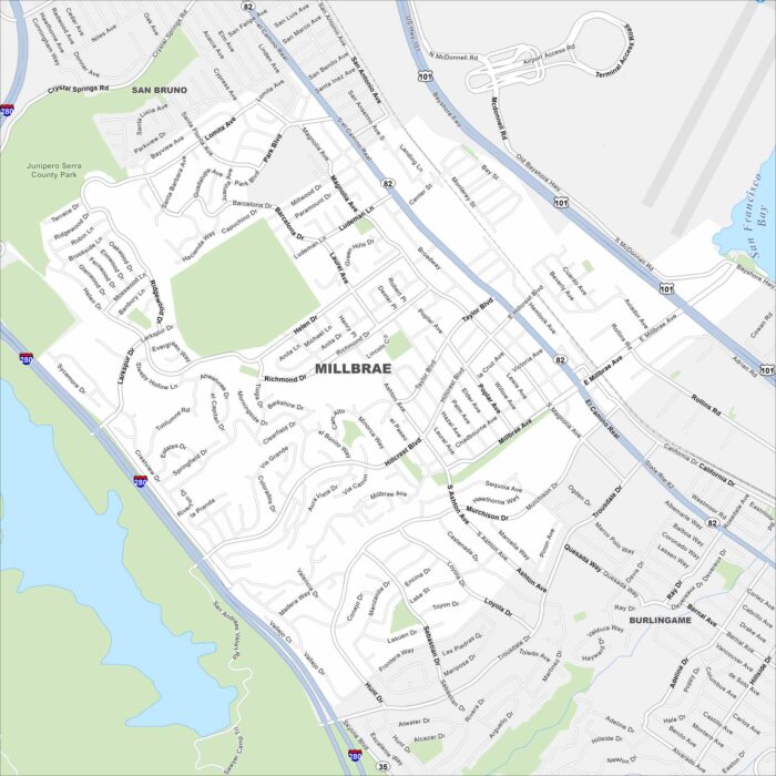
Our map of Millbrae highlights its location along San Francisco Bay. You often see residential neighborhoods rise into the nearby hills.
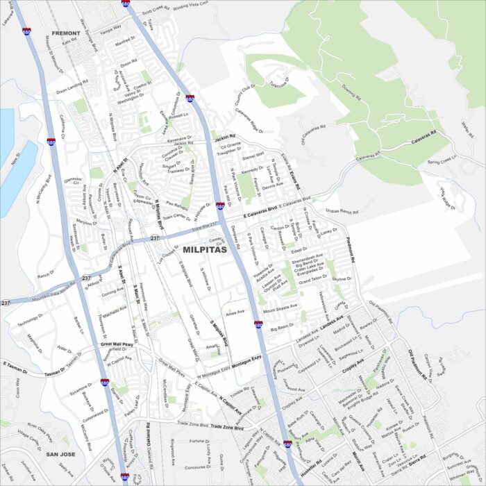
Milpitas sits at the north end of Silicon Valley. Our map shows its mix of residential areas mixed with its highways, roads and parks.
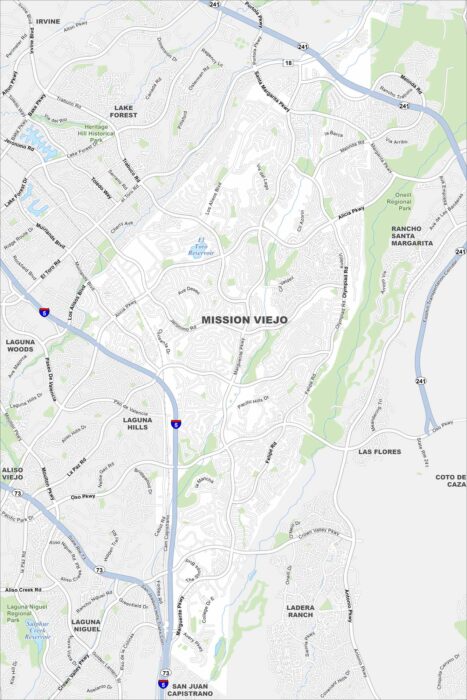
Get to know Mission Viejo using our road map. The planned neighborhoods surround a central lake, with hills on the edge of the city.
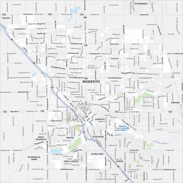
Our map of Modesto shows a city at the heart of the Central Valley. Streets spread across farmland, with the Tuolumne River flowing south.
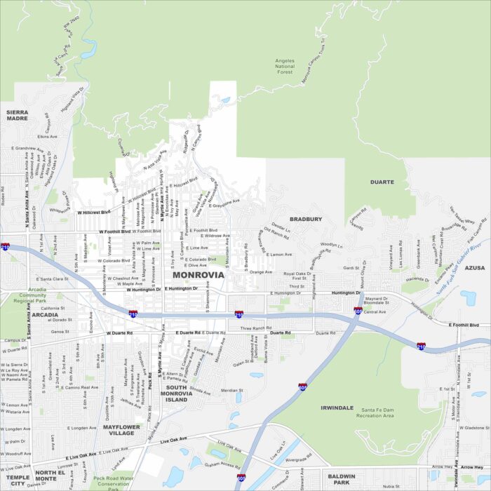
Take a look at our map of Monrovia in Los Angeles County. This city sits right against the San Gabriel Mountains.
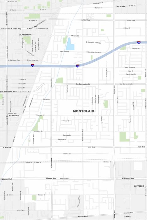
We’ve mapped out Montclair, which is located within the Inland Empire. Our map shows its transportation network and highways at its core.
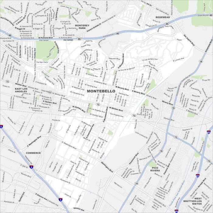
Our map of Montebello highlights a dense suburban layout east of Los Angeles. Freeways, neighborhoods, and parks fill the area.
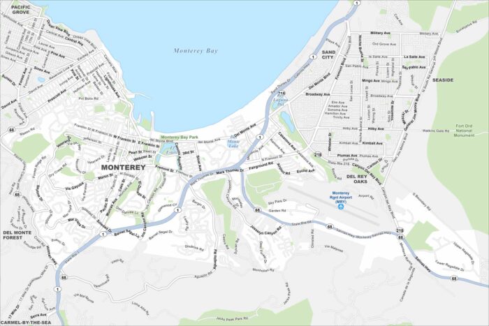
Monterey sits on the Pacific coast. Our map shows Cannery Row, the waterfront, and coastal parks. Tourism and marine life define the city.
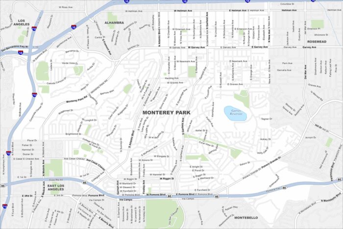
Explore Monterey Park with our road map. Located in the San Gabriel Valley, it’s well known for its strong Asian-American community.
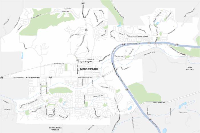
Take a look at Moorpark with our map. Suburban streets spread through valleys and hills, with agriculture still surrounding the edges.
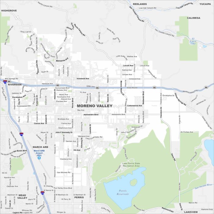
Our map of Moreno Valley shows wide residential areas backed by rugged hills. Highways connect it across the Inland Empire.
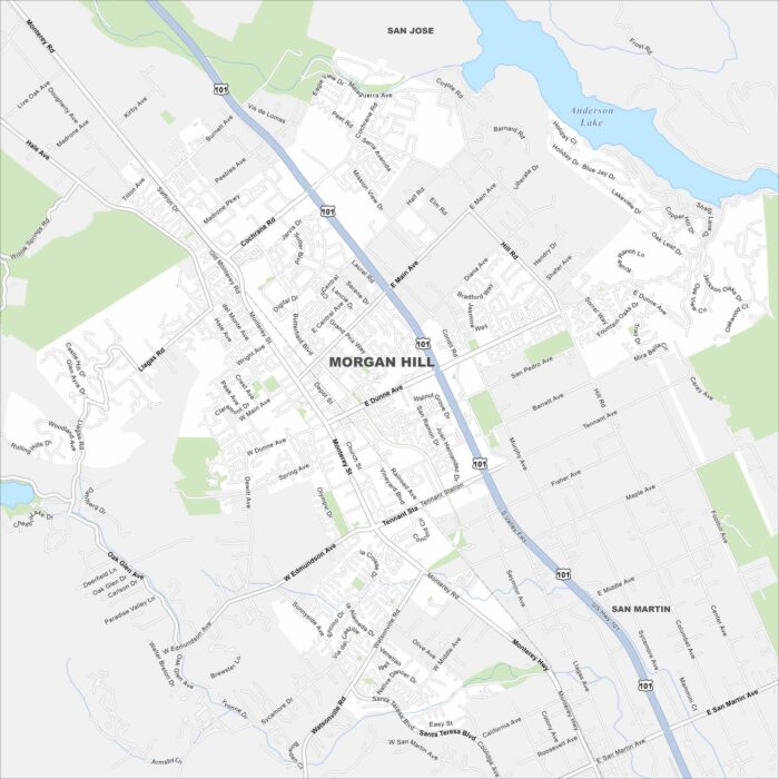
Check out our Morgan Hill map. The city is part of of Santa Clara County with vineyards nearby. It’s a quieter spot south of Silicon Valley.
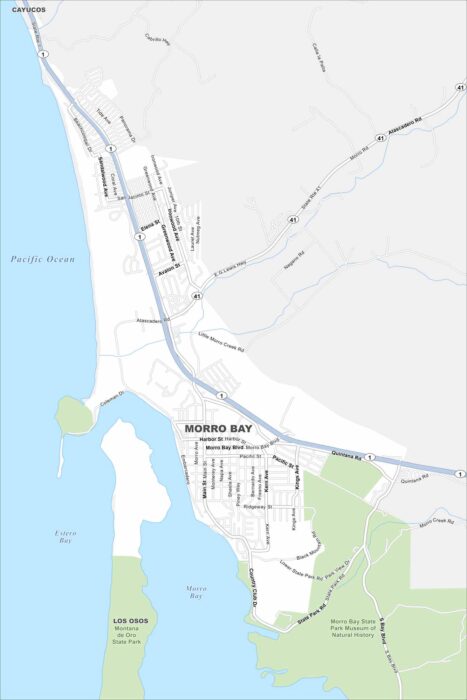
Explore Morro Bay with our map. Located in the Central Coast, the harbor and Morro Rock are unmistakable landmarks.