Map of Long Beach, California
Long Beach sits on the Pacific coast south of Los Angeles. Our map shows its port and shoreline. Freeways tie the city to Southern California.
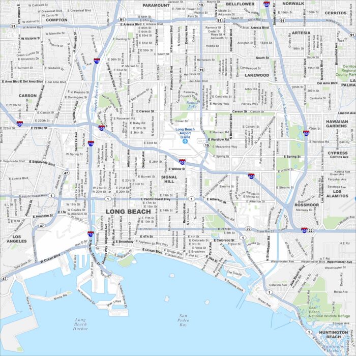
Long Beach sits on the Pacific coast south of Los Angeles. Our map shows its port and shoreline. Freeways tie the city to Southern California.
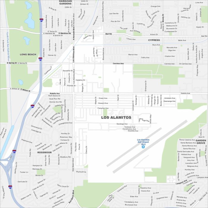
Check out Los Alamitos in northwest Orange County. Freeways and surface streets cross through the area. Our map highlights its location.
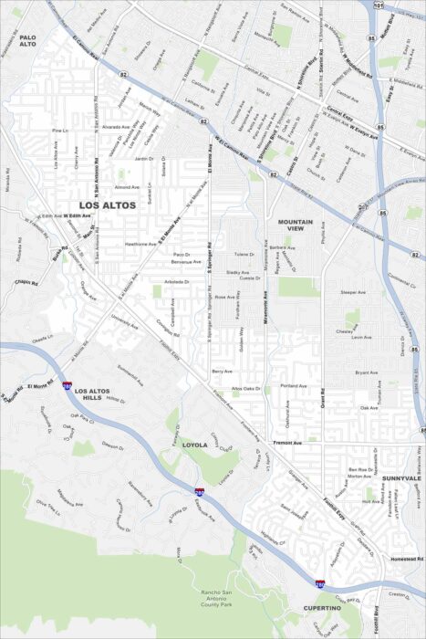
Los Altos rests at the edge of the Santa Cruz Mountains. Our map shows its neighborhoods blending into Silicon Valley.
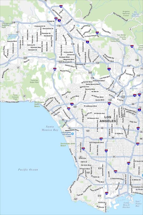
Our map of Los Angeles stretches from the Pacific coast to the San Gabriel Mountains. Freeways form a road network across the city.
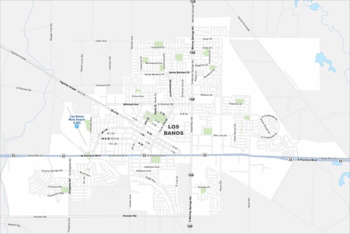
Los Banos sits in the San Joaquin Valley near wetlands and farmland. Our map shows Highway 33 cutting east-west through town.
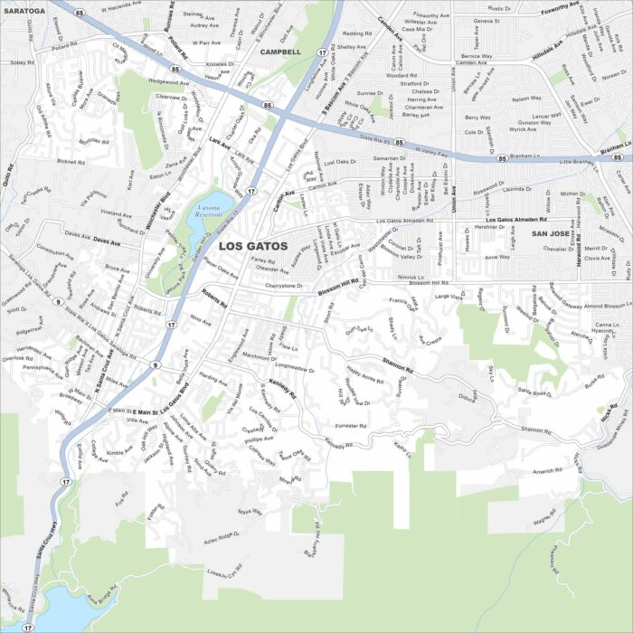
Explore Los Gatos at the foothills of the Santa Cruz Mountains. Our map shows winding streets heading into the hills.
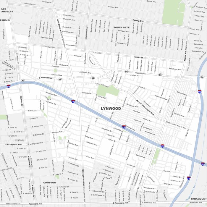
Lynwood sits in Los Angeles County near the 105 and 710 freeways. Our map shows a compact grid of streets.
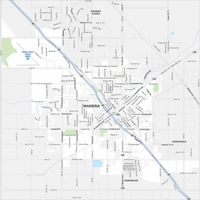
Our map of Madera shows its location in the San Joaquin Valley. Highways link it north to Merced and south to Fresno.
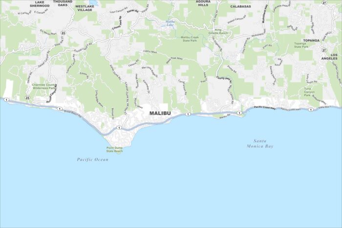
Check out Malibu stretched along the Pacific Coast Highway. Our map shows beaches lining the ocean side and mountains rising inland.
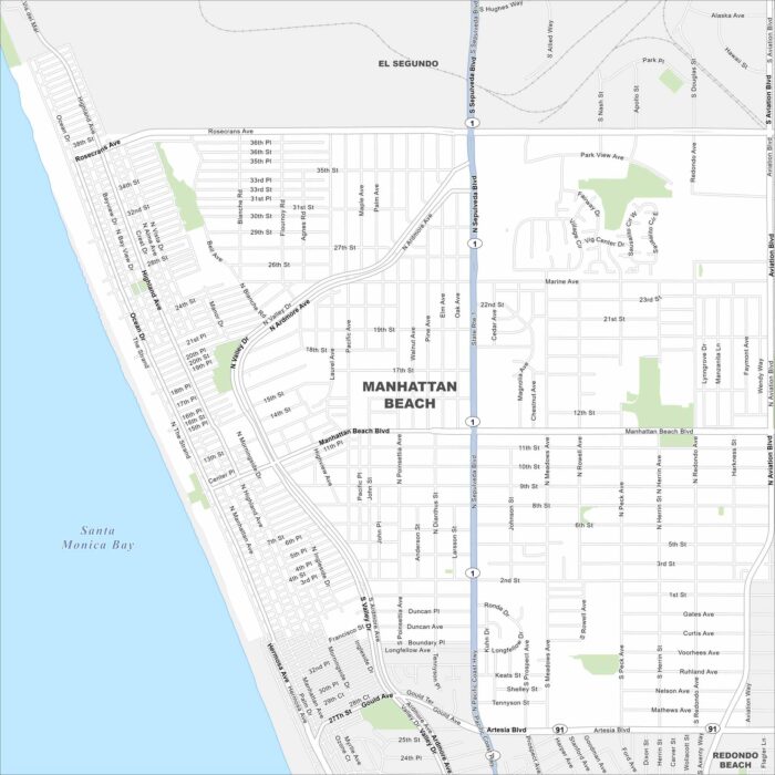
Our map of Manhattan Beach follows the shoreline south of Los Angeles. A grid of neighborhoods leads straight to the sand.
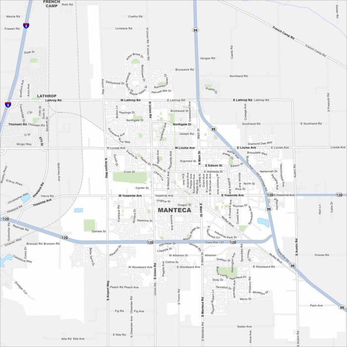
Our road map of Manteca highlights its crossroads of Highway 99 and 120. Rail lines run through its center.
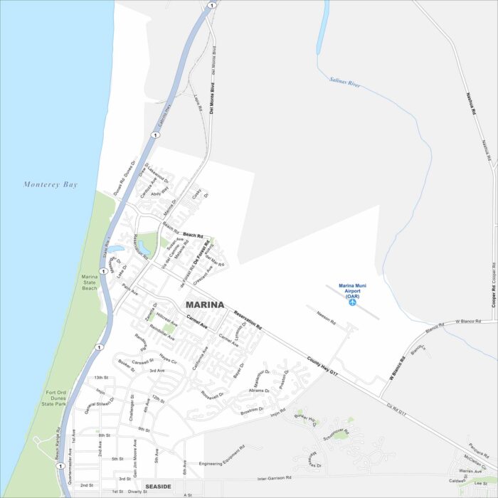
Our map of Marina shows its streets set against the Pacific coastline. The city borders Monterey Bay and Fort Ord Dunes.
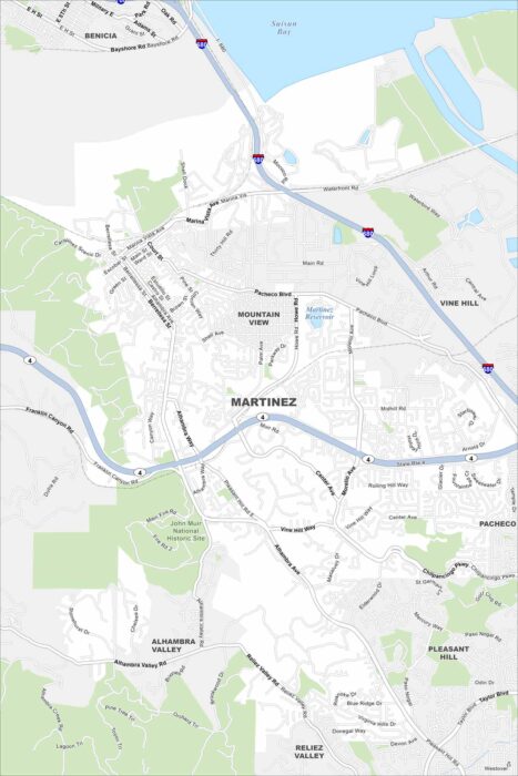
Explore Martinez with our map. Located on the southern shore of the Carquinez Strait, historic downtown streets define the core.
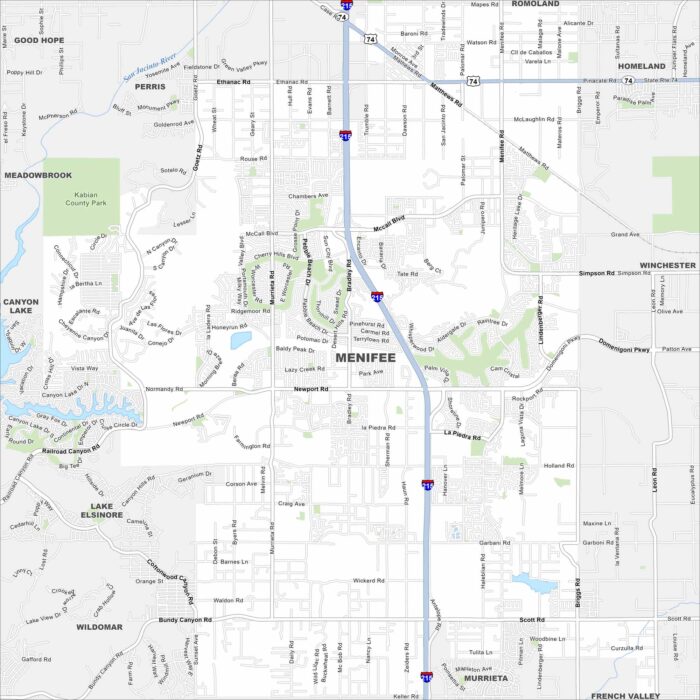
Explore Menifee with our road map. Suburban growth fills the valleys, with hills on the edges. It’s situated in the Inland Empire.
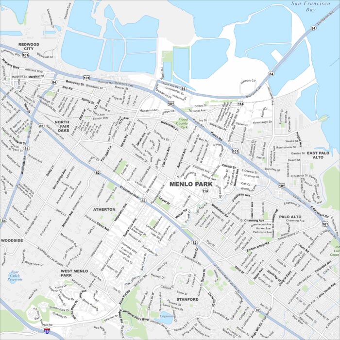
Menlo Park sits at the edge of San Francisco Bay and is central to Silicon Valley. Our map shows its reservoirs, streets, and green spaces.