Map of Sugar Land, Texas
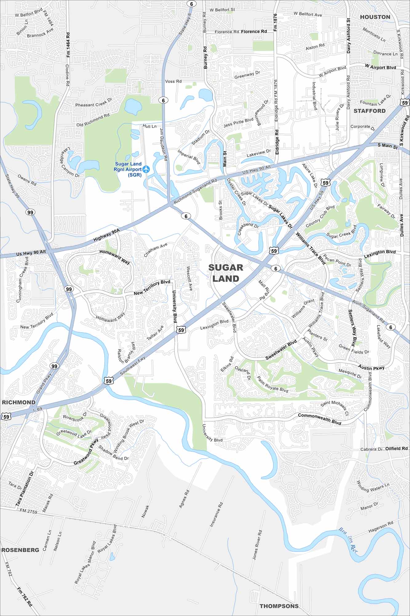
Our map of Sugar Land highlights master-planned neighborhoods and shopping districts. It’s one of the fastest-growing suburbs in the Houston area.
Map Information
On the Map
Interstates/Highways: US Hwy 59, US Hwy 90 Alt, State Rte 6, State Rte 99 Major Roads: Southwest Fwy, Grand Pkwy, Highway 90A, University Blvd, Lexington Blvd, Williams Trace Blvd, Sweetwater Blvd, Commonwealth Blvd, Austin Pkwy, Palm Royale Blvd, Elkins Rd, Settlers Way Blvd, Voss Rd, Burney Rd, Eldridge Rd, Dairy Ashford Rd, Corporate Dr, Main St, Brooks St, Oilfield Rd Airports: Sugar Land Rgnl Airport (SGR) Major Rivers: Brazos River Nearby Communities: Houston, Stafford, Richmond, Rosenberg, ThompsonsTexas State Maps
Scan our maps of the massive southern state of Texas.


City Maps of Texas
Explore our map collection of Texas cities.


