Map of St. Paul, Minnesota
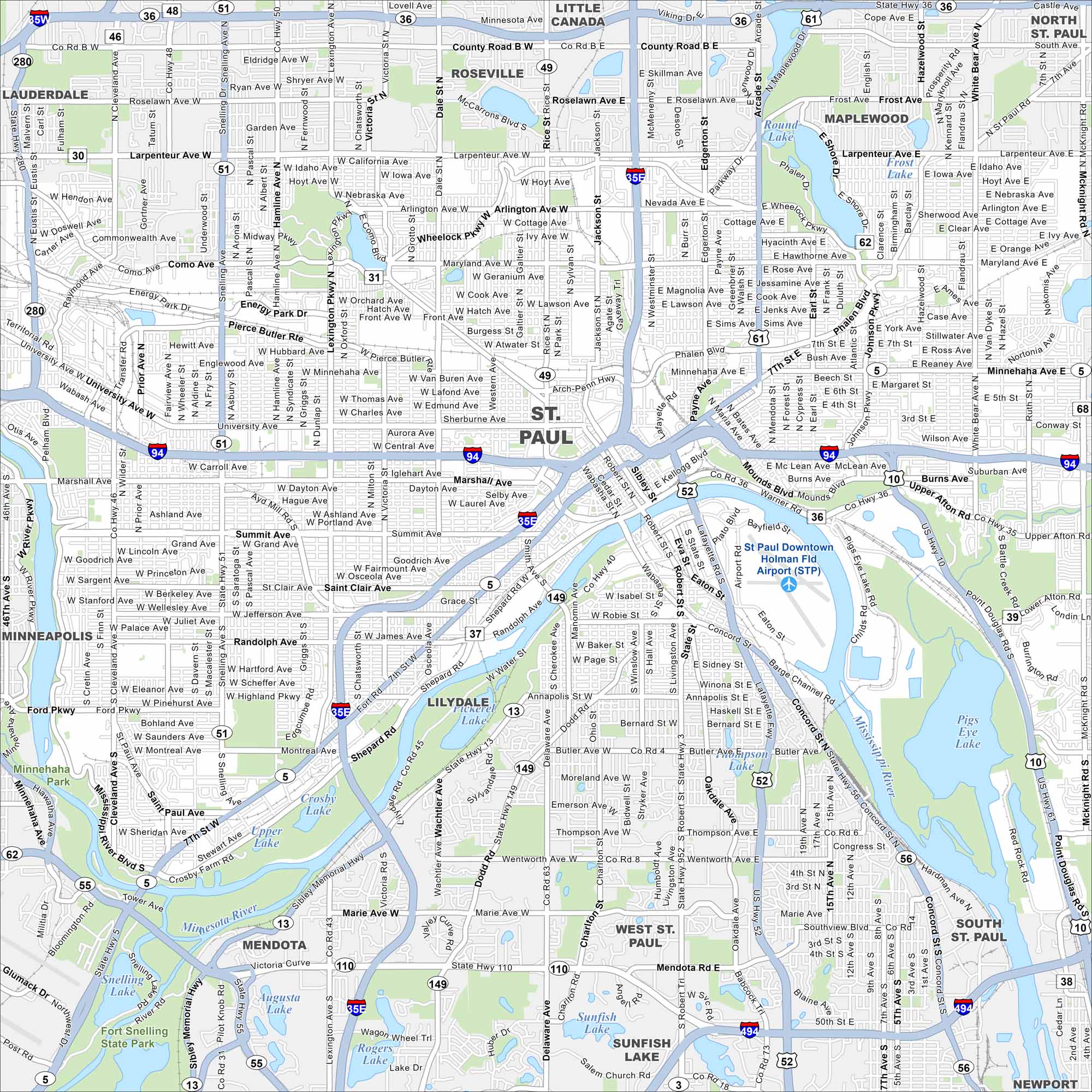
Our map of St. Paul highlights the state capital’s riverfront and historic neighborhoods. It’s a city filled with culture, government, history, and lively festivals. The “S” shape bend of the Mississippi River really stands out on our map.
Map Information
On the Map
Interstates/Highways: I-94, I-35E, I-494, I-35W, US Hwy 52, State Rte 5, State Rte 51, State Rte 36, State Rte 62, State Rte 13, State Rte 149 Major Roads: University Ave, Marshall Ave, Summit Ave, Randolph Ave, W 7th St, Robert St, Concord St, Kellogg Blvd, Mounds Blvd, Burns Ave, Minnehaha Ave, Larpenteur Ave, Maryland Ave, Wheelock Pkwy, Como Ave, Grand Ave, Shepard Rd, Warner Rd, Upper Afton Rd, Hudson Rd Airports: St Paul Downtown Holman Fld Airport (STP) Lakes and Reservoirs: Round Lake, Phalen Lake, Frost Lake, Rogers Lake, Sunfish Lake, Augusta Lake, Pickerel Lake, Pigs Eye Lake Major Rivers: Mississippi River, Minnesota River Parks and Preserves: Fort Snelling State Park, Minnehaha Park Nearby Communities: Lauderdale, Roseville, Little Canada, Maplewood, North St Paul, Lilydale, Mendota, West St Paul, South St Paul, NewportMinnesota State Maps
Explore every lake in our state maps of Minnesota


Minnesota City Maps
Browse through our city maps of Minnesota


