Map of Sioux City, Iowa
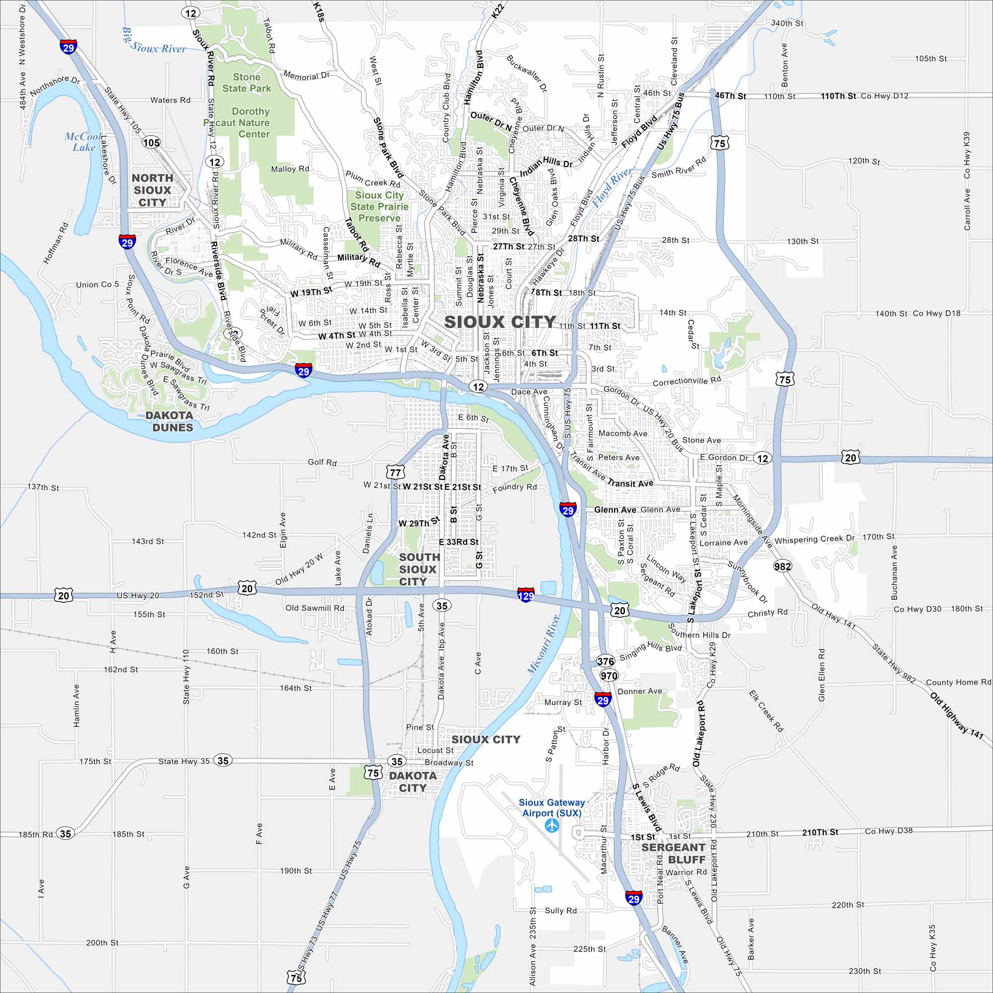
This street map of Sioux City highlights its location on the Missouri River. The city is a regional hub with parks, culture, and Native American history.


Map Information
On the Map
Interstates/Highways: I-29, I-129, US Hwy 75, US Hwy 20, US Hwy 77, State Rte 12, State Rte 35, State Rte 105, State Rte 376, State Rte 970, State Rte 982, State Rte 141 Major Roads: Hamilton Blvd, Floyd Blvd, Gordon Dr, Transit Ave, Lakeport Rd, Military Rd, Riverside Blvd, Stone Park Blvd, Outer Dr, 27th St, 28th St, 18th St, 11th St, 6th St, Dace Ave, Correctionville Rd, Lewis Blvd, Singing Hills Blvd, Harbor Dr, Glenn Ave Airports: Sioux Gateway Airport (SUX) Major Rivers: Missouri River, Sioux River, Floyd River Parks and Preserves: Stone State Park, Dorothy Pecaut Nature Center, Sioux City State Prairie Preserve Nearby Communities: South Sioux City, Dakota City, Sergeant Bluff, Dakota Dunes, North Sioux CityIowa City Maps
Browse city maps in the state of Iowa


