Map of Shakopee, Minnesota
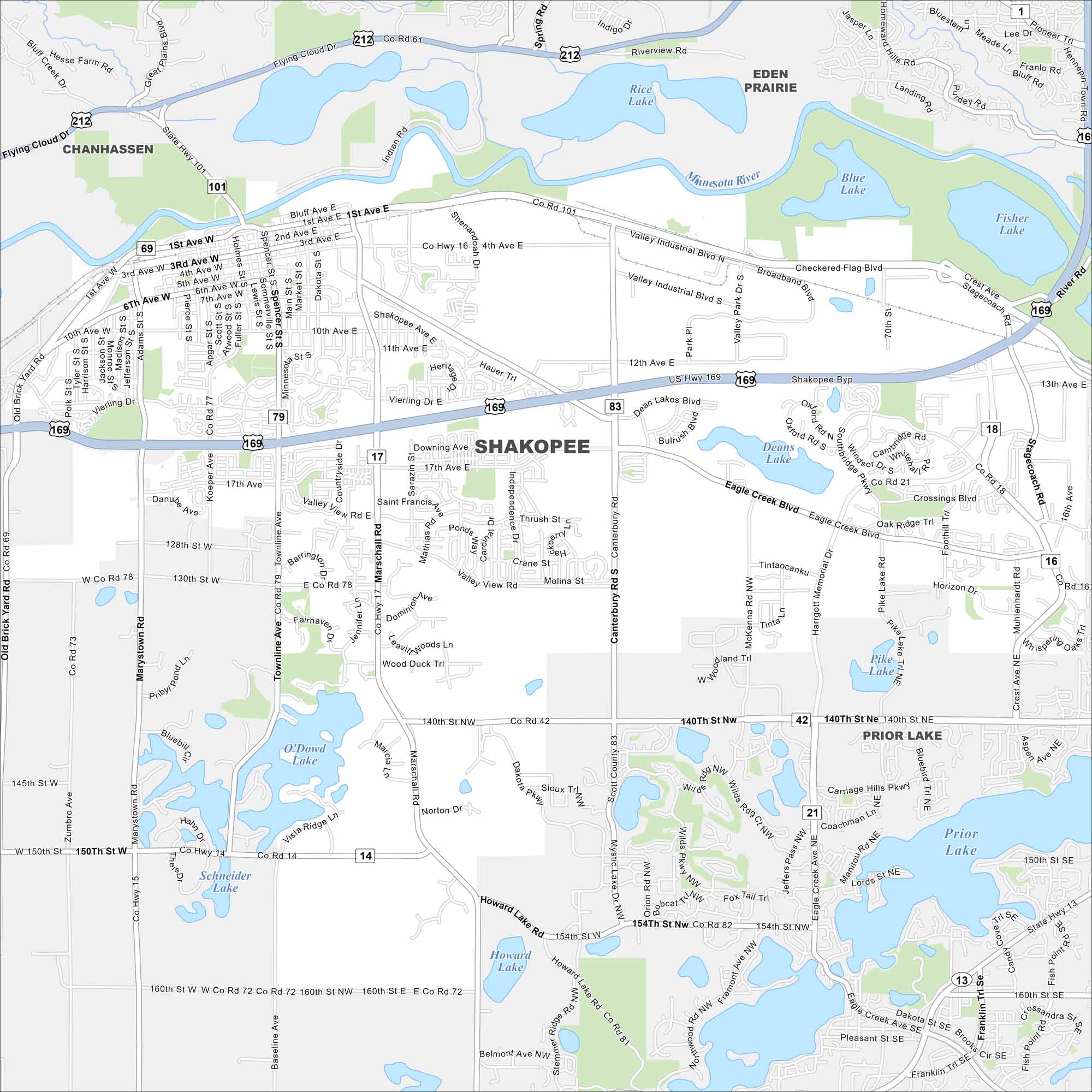
Our map of Shakopee helps you find your way. It’s home to Valleyfair amusement park, Canterbury Park racetrack, and a growing mix of neighborhoods.
Map Information
On the Map
Interstates/Highways: I-494, US Hwy 169, State Rte 101, State Rte 13, State Rte 21 Major Roads: 17th Ave, Co Rd 42, Co Rd 101, Co Rd 83, Marshall Rd, Canterbury Rd, Valley View Rd, Eagle Creek Blvd, 4th Ave, Shakopee Ave, Vierling Dr, Old Brick Yard Rd, 10th Ave, Marystown Rd, Townline Ave, Mystic Lake Dr, Howard Lake Rd, Pike Lake Rd, 140th St, 154th St Lakes and Reservoirs: Rice Lake, Blue Lake, Fisher Lake, Deans Lake, Pike Lake, O’Dowd Lake, Schneider Lake, Howard Lake, Prior Lake Major Rivers: Minnesota River Nearby Communities: Chanhassen, Eden Prairie, Prior LakeMinnesota State Maps
Explore every lake in our state maps of Minnesota


Minnesota City Maps
Browse through our city maps of Minnesota


