Map of Seattle, Washington
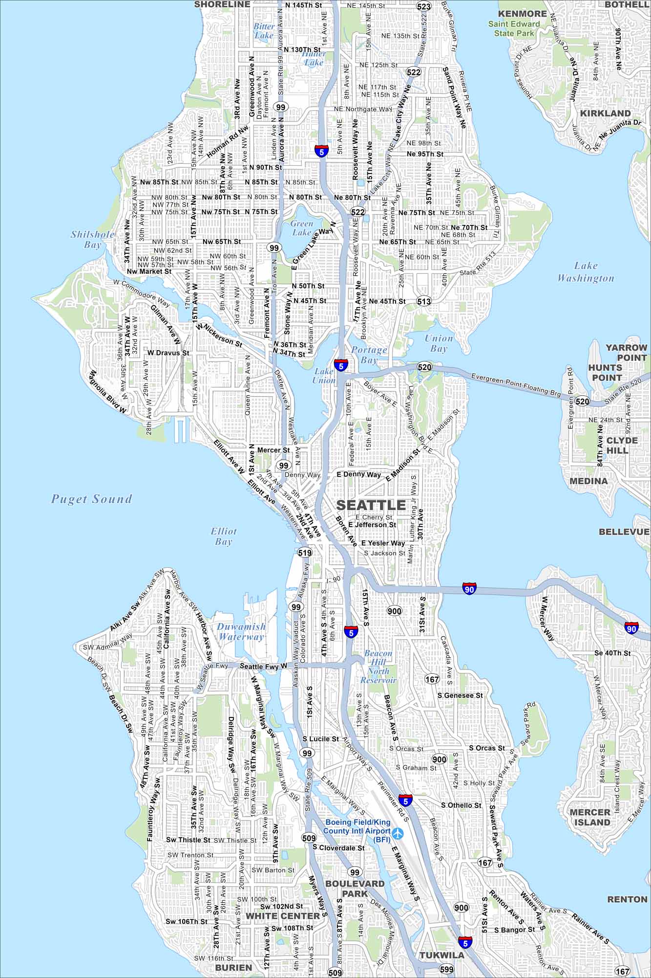
Our Seattle map helps you get around the Emerald City. From Pike Place Market to the Space Needle and waterfront, it highlights the major highways and roads.
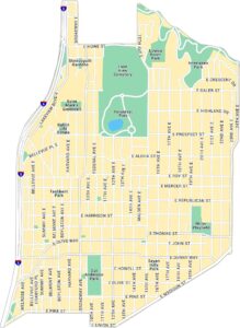
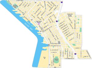
Seattle Neighborhood Maps
See our neighborhood maps for a closer look of the city.
Map Information
On the Map
Interstates/Highways: I-5, I-90, State Rte 523, State Rte 522, State Rte 513, State Rte 520, State Rte 99, State Rte 509, State Rte 519, State Rte 518 Major Roads: Aurora Ave, Mercer St, Denny Way, Madison St, Yesler Way, Jackson St, Cherry St, Jefferson St, Rainier Ave, Market St, Holman Rd, Sand Point Way, Roosevelt Way, Elliott Ave, Admiral Way, Fauntleroy Way, 15th Ave, 35th Ave, 4th Ave, 1st Ave Airports: Boeing Field/King County Intl Airport Lakes and Reservoirs: Puget Sound, Lake Washington, Elliott Bay, Lake Union, Green Lake, Union Bay, Shilshole Bay, Bitter Lake, Portage Bay, Beacon Hill North Reservoir Major Rivers: Duwamish Waterway Parks and Preserves: Saint Edward State Park Nearby Communities: Shoreline, Kenmore, Bothell, Kirkland, Yarrow Point, Hunts Point, Clyde Hill, Medina, Bellevue, Mercer Island, Renton, Tukwila, Boulevard Park, White Center, BurienWashington State Maps
Move through the Evergreen State with our map collection.


City Maps of Washington
Check out our city maps of Washington


