Map of Round Rock, Texas
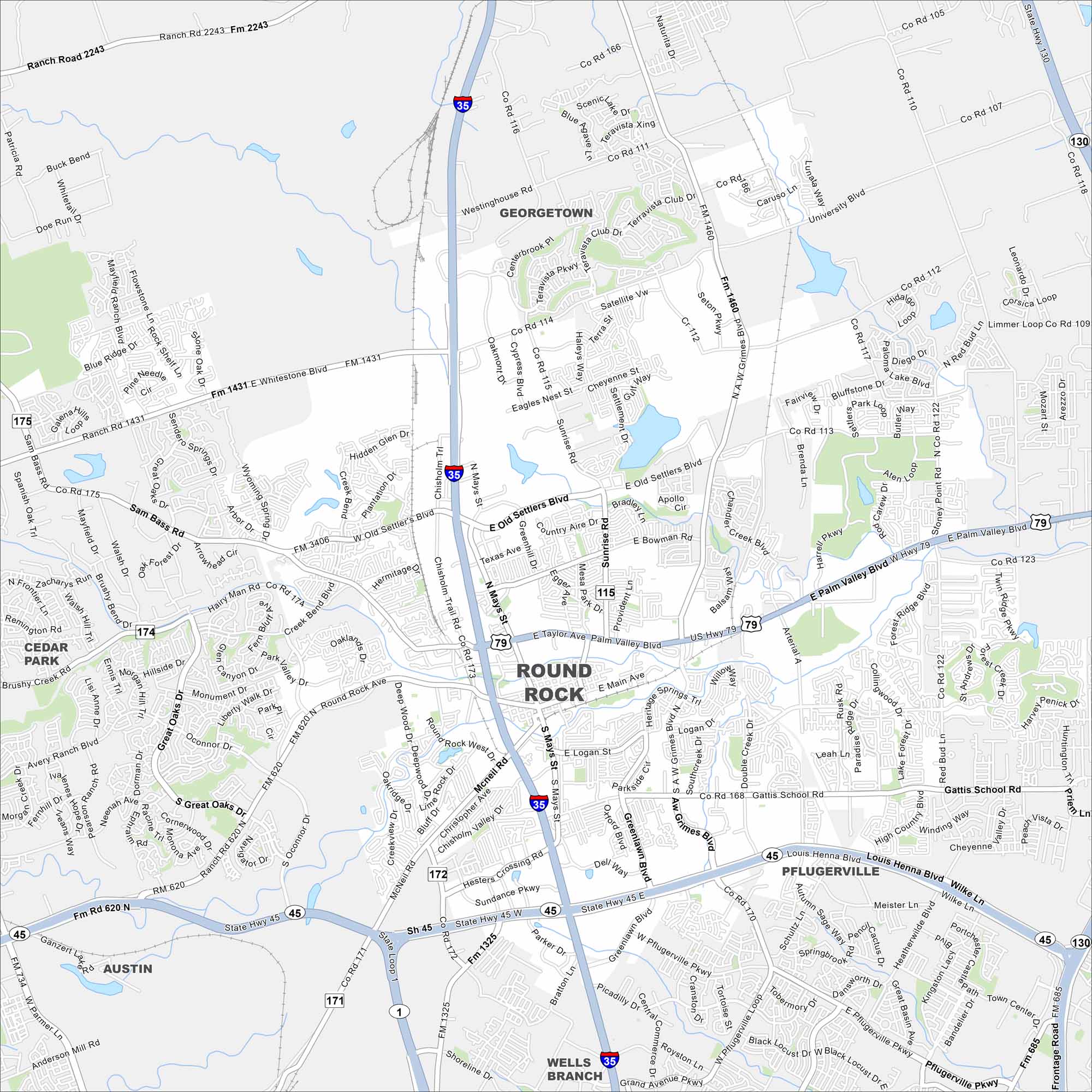
We’ve mapped out every major road in Round Rock. From Dell’s campus to local parks, it’s easy to see what’s nearby. Use it to explore this fast-growing Texas city.
Map Information
On the Map
Interstates/Highways: I-35, US Hwy 79, State Hwy 45, State Hwy 130 Major Roads: Main Ave, Palm Valley Blvd, Old Settlers Blvd, Gattis School Rd, Louis Henna Blvd, Round Rock Ave, Mays St, Sunrise Rd, University Blvd, Georgetown St, AW Grimes Blvd, Double Creek Dr, McNeil Rd, Chisholm Trail Rd, Sam Bass Rd, RM 620, Wyoming Spring Dr, Hairy Man Rd, Creek Bend Blvd, Great Oaks Dr Nearby Communities: Georgetown, Pflugerville, Wells Branch, Austin, Cedar ParkTexas State Maps
Scan our maps of the massive southern state of Texas.


City Maps of Texas
Explore our map collection of Texas cities.


