Map of Rosenberg, Texas
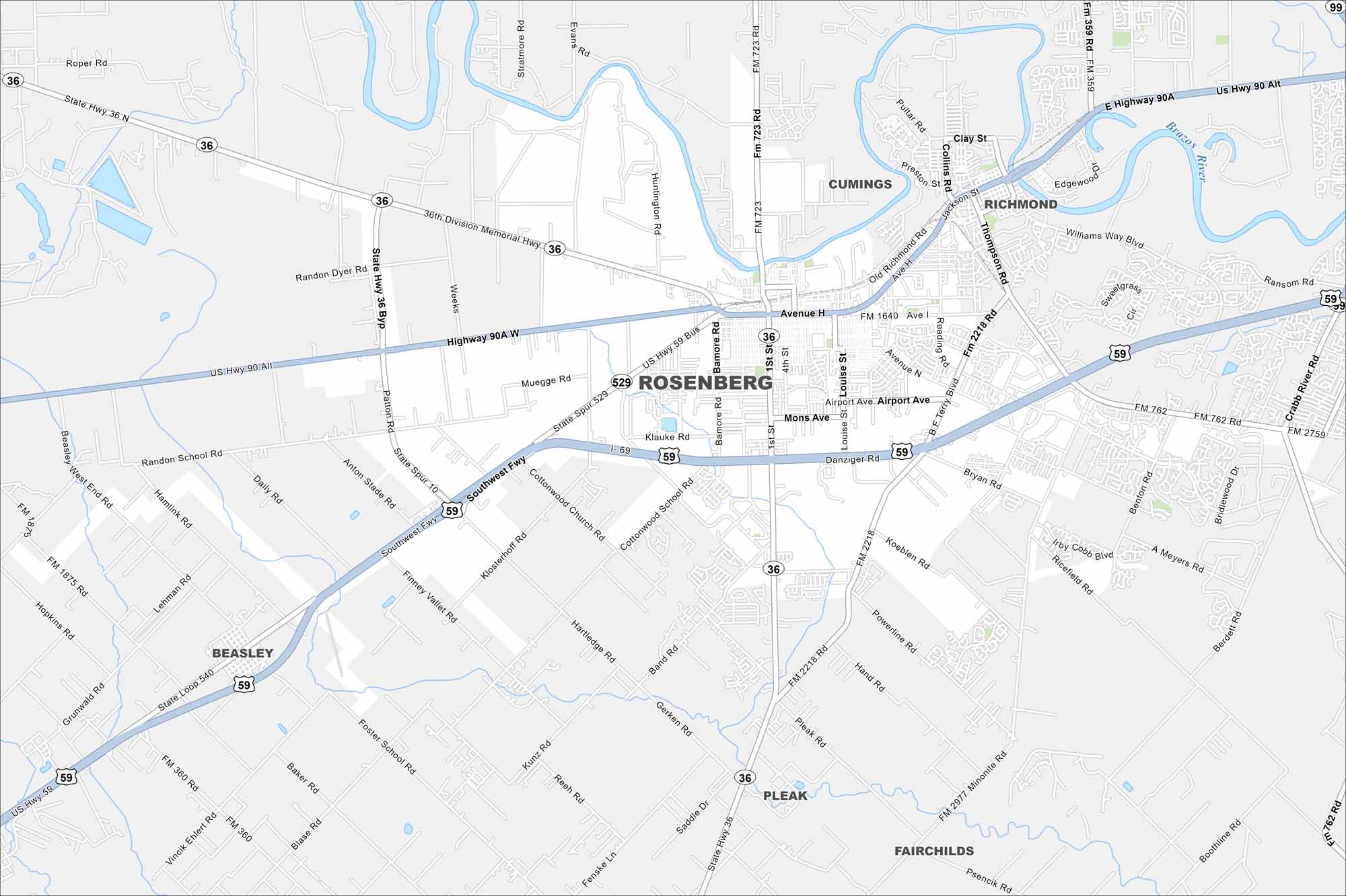
Here’s our map of Rosenberg to help you get around. Downtown, highways, and neighborhoods are all laid out. Use it to see how the city connects to greater Houston.
Map Information
On the Map
Interstates/Highways: I-69, US Hwy 59, US Hwy 90 Alt, State Hwy 36 Major Roads: Avenue H, Avenue I, Reading Rd, Airport Ave, Mons Ave, Danziger Rd, Bamore Rd, 1st St, 4th St, Louise St, Powerline Rd, Band Rd, Gerken Rd, Hartledge Rd, Cottonwood School Rd, Randon Dyer Rd, Randon School Rd, Daily Rd, Finney Valley Rd, Klosterhoff Rd Major Rivers: Brazos River Nearby Communities: Cumings, Richmond, Beasley, Pleak, FairchildsTexas State Maps
Scan our maps of the massive southern state of Texas.


City Maps of Texas
Explore our map collection of Texas cities.


