Map of Ramsey, Minnesota
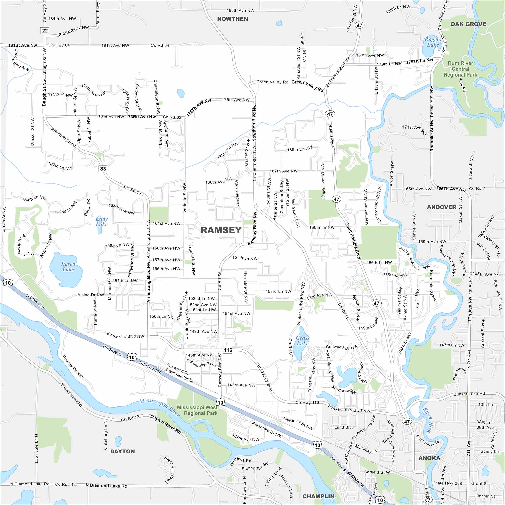
Set along the Mississippi River, our map of Ramsey shows its suburbs and open land. Residents enjoy easy access to the Twin Cities while keeping a small-town feel.
Map Information
On the Map
Interstates/Highways: US Hwy 10, US Hwy 169, State Rte 47 Major Roads: Ramsey Blvd, Armstrong Blvd, Bunker Lake Blvd, Sunfish Lake Blvd, Nowthen Blvd, Saint Francis Blvd, 181st Ave, 173rd Ave, 167th Ave, 160th Ave, 153rd Ave, 142nd Ave, 185th Ave, Main St, Riverdale Dr, Jasper St, Garnet Blvd, Tungsten St, Potassium St, Helium St Lakes and Reservoirs: Itasca Lake, Eddy Lake, Grass Lake, Rogers Lake Major Rivers: Mississippi River, Rum River, Dayton River Parks and Preserves: Rum River Central Regional Park, Mississippi West Regional Park Nearby Communities: Nowthen, Oak Grove, Andover, Anoka, Champlin, DaytonMinnesota State Maps
Explore every lake in our state maps of Minnesota


Minnesota City Maps
Browse through our city maps of Minnesota


