Map of Pueblo, Colorado
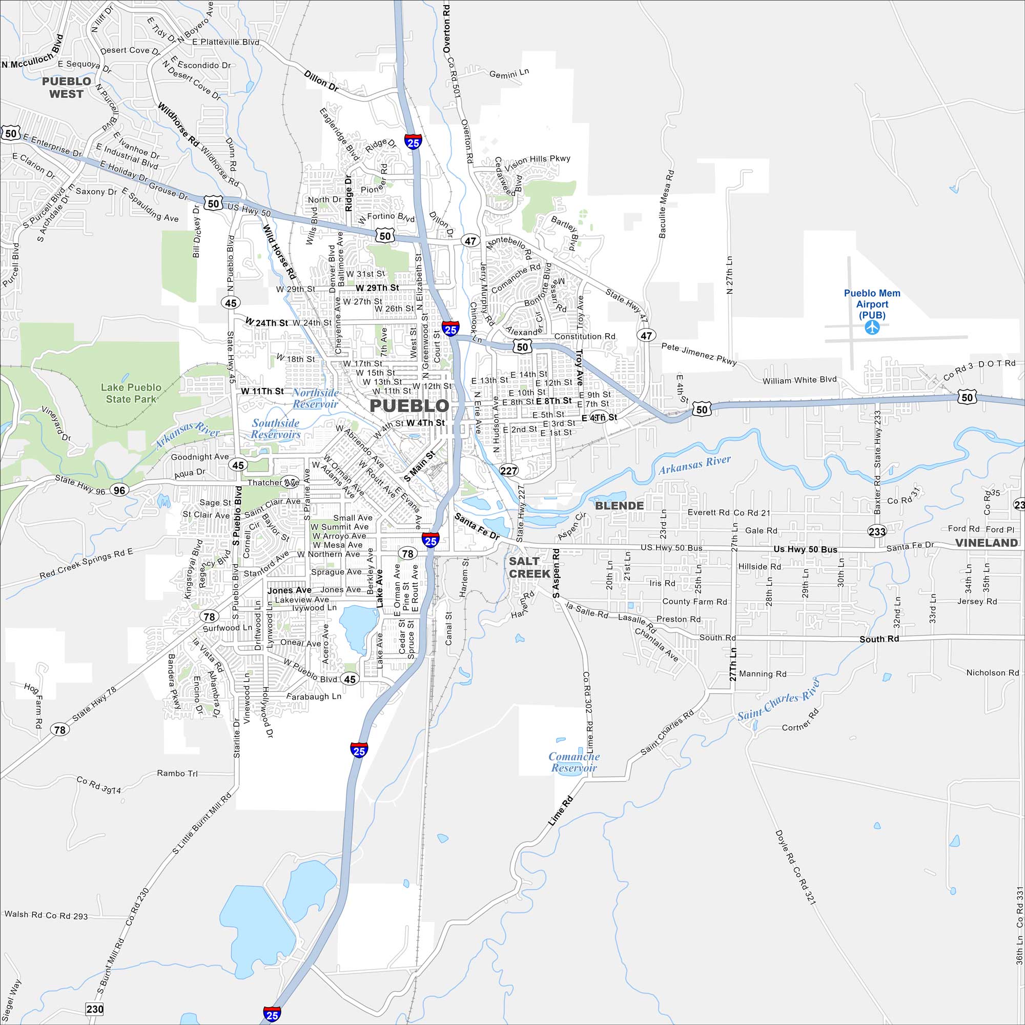
Pueblo sits where the Arkansas River meets the plains of southern Colorado. Our map shows the grid of downtown and the roads leading into steel country. The city is also known for its famous green chiles.
Colorado State Maps
Browse Colorado with our detailed state maps


Map Information
On the Map
Interstates/Highways: I-25, US Hwy 50, State Hwy 45, State Hwy 47, State Hwy 78, State Hwy 96, State Hwy 227, State Hwy 233 Major Roads: Pueblo Blvd, Santa Fe Dr, Northern Ave, Thatcher Ave, 4th St, 29th St, 24th St, Elizabeth St, Main St, Abriendo Ave, Prairie Ave, Ivywild Ln, Goodnight Ave, Hollywood Dr, 8th St, 11th St, Wills Blvd, Troy Ave, Baxter Rd, 36th Ln Airports: Pueblo Mem Airport (PUB) Lakes and Reservoirs: Northside Reservoir, Southside Reservoirs, Lake Ave, Comanche Reservoir Major Rivers: Arkansas River, St Charles River Parks and Preserves: Lake Pueblo State Park Nearby Communities: Pueblo West, Blende, Salt Creek, VinelandColorado City Maps
Here are maps of Colorado’s urban areas


